Related Plugins and Tags

QGIS Planet

GRASS GIS 8.3.0 released

What’s new in a nutshell The GRASS GIS 8.3.0 release provides more than 360 changes compared to the 8.2 branch. This new minor release brings in many fixes and improvements in GRASS GIS modules and the graphical user interface (GUI) which now has the single window layout by default. Some of the most relevant changes […]

The post GRASS GIS 8.3.0 released appeared first on Markus Neteler Consulting.

GRASS GIS 8.2.0 released

The 8.2.0 release of GRASS GIS is now available with results from the GSoC 2021 and many other additions. A new grass.jupyter package is now included for interacting with Jupyter notebooks. Single window graphical user interface is available in GUI settings. r.series and three other modules are newly parallelized. Additionally, the release includes a series […]

The post GRASS GIS 8.2.0 released appeared first on Markus Neteler Consulting.

GRASS GIS 8.0.0 released! Finally…

Overview of changes After more than 3 year of development the first stable release GRASS GIS 8.0.0 is available. Efforts have concentrated on making the user experience even better, providing many new useful additional functionalities to modules and further improving the graphical user interface. Breaking news: new graphical user interface with entirely rewritten startup sequence! […]

The post GRASS GIS 8.0.0 released! Finally… appeared first on Markus Neteler Consulting.

GRASS GIS 8.0.0RC2 released

Overview of changes

After more than 3 year of development the first stable release GRASS GIS 8.0.0 is available. Efforts have concentrated on making the user experience even better, providing many new useful additional functionalities to modules and further improving the graphical user interface.

Breaking news: new graphical user interface with entirely rewritten startup sequence!

This re-establishes user experience compatibility with QGIS and other connected software packages.

The GRASS GIS 8.0.0 release provides more than 1,300 fixes and improvements with respect to the release 7.8.6.

With the introduction of the semantic label raster metadata class, the temporal database was modified to version 3. Hence, to be able to read and process GRASS 7.x space-time datasets, users will be prompted to run t.upgrade. If users want to read newly created space-time datasets back in GRASS 7.x, they can run t.downgrade.

Launching the software

The user experience of the graphical user interface has been completely rewritten: no more clumsy selection screens – just enter the menu system directly!

And on command line, GRASS GIS now starts versionless, i.e. as grass.

Download and detailed list of changes

See https://github.com/OSGeo/grass/releases/tag/8.0.0RC2

Thanks to all contributors!

GRASS GIS 8.0.0RC2 contributors

The post GRASS GIS 8.0.0RC2 released appeared first on Markus Neteler Consulting.

GRASS GIS 7.8.5 released

What’s new in a nutshell Zanzibar Mapping Initiative data processed in OpenDroneMap and interpolated respecting building footprints using v.surf.icw

As a follow-up to the previous GRASS GIS 7.8.4 we have published the new release GRASS GIS 7.8.5 with more than 80 improvements. This minor release offers new wxGUI fixes across the tree. Also the addon extension manager received various stability fixes. VRT raster map with tiled raster maps can now be properly exported and imported in the native GRASS GIS raster format.

The overview of new features in the 7.8 release series is available at new features in GRASS GIS 7.8. See also our detailed announcement with the full list of changes and bugs fixed at https://trac.osgeo.org/grass/wiki/Release/7.8.5-News.

Binaries/Installer download:

Source code download:

First time users may explore the first steps tutorial after installation.

About GRASS GIS

The Geographic Resources Analysis Support System (https://grass.osgeo.org/), commonly referred to as GRASS GIS, is an Open Source Geographic Information System providing powerful raster, vector and geospatial processing capabilities. It can be used either as a stand-alone application or as backend for other software packages such as QGIS and R geostatistics or in the cloud. It is distributed freely under the terms of the GNU General Public License (GPL). GRASS GIS is a founding member of the Open Source Geospatial Foundation (OSGeo).

The GRASS Development Team, Dec 2020

The post GRASS GIS 7.8.5 released appeared first on Markus Neteler Consulting.

GRASS GIS 7.8.4 released

1. What’s new in a nutshell

Processed LiDAR data in GRASS GIS (screenshot by @neteler)As a follow-up to the previous GRASS GIS 7.8.3 we have published the new release GRASS GIS 7.8.4 with more than 170 improvements. This minor release again focuses on wxGUI fixes, especially in the animation export, the layer management, 3D visualization and the data catalogue. Many display modules received fixes as well, and the vector digitizer now works as expected.

The overview of new features in the 7.8 release series is available at new features in GRASS GIS 7.8. See also our detailed announcement with the full list of changes and bugs fixed at https://trac.osgeo.org/grass/wiki/Release/7.8.4-News.

Binaries/Installer download:

Source code download:

First time users may explore the first steps tutorial after installation.

About GRASS GIS

The Geographic Resources Analysis Support System (https://grass.osgeo.org/), commonly referred to as GRASS GIS, is an Open Source Geographic Information System providing powerful raster, vector and geospatial processing capabilities. It can be used either as a stand-alone application or as backend for other software packages such as QGIS and R geostatistics or in the cloud. It is distributed freely under the terms of the GNU General Public License (GPL). GRASS GIS is a founding member of the Open Source Geospatial Foundation (OSGeo).

The GRASS Development Team, Oct 2020

The post GRASS GIS 7.8.4 released appeared first on GFOSS Blog | GRASS GIS and OSGeo News.

Happy birthday OSGeo!

On February 4, 2006 OSGeo held its first meeting in Chicago, with 25 participants representing 18 groups and over 20 different Open Source GIS projects, and 39 others participating via Internet Relay Chat. During the meeting, participants made important decisions in the formation and organization of the foundation, including the name, structure and purpose. The consensus reached in Chicago opened the way for the establishment of a productive and representative foundation.

Today we are happy to announce that the we have meanwhile over 32,800 unique subscribers in the huge list of over 290 OSGeo mailing lists!

And: check out the web site of the OSGeo foundation.

1. More to come this year!

… see here for the growing list of events

The post Happy birthday OSGeo! appeared first on GFOSS Blog | GRASS GIS and OSGeo News.

GRASS GIS 7.4.2 released

We are pleased to announce the GRASS GIS 7.4.2 release

What’s new in a nutshell

After a bit more than four months of development the new update release GRASS GIS 7.4.2 is available. It provides more than 50 stability fixes and improvements compared to the previous stable version 7.4.1. An overview of the new features in the 7.4 release series is available at New Features in GRASS GIS 7.4.

Efforts have concentrated on making the user experience even better, providing many small, but useful additional functionalities to modules and further improving the graphical user interface. Segmentation now support extremely large raster maps. Dockerfile and Windows support received updates. Also the manual was improved. For a detailed overview, see the list of new features. As a stable release series, 7.4.x enjoys long-term support.

Binaries/Installer download:

Source code download:

More details:

See also our detailed announcement:

About GRASS GIS

The Geographic Resources Analysis Support System (https://grass.osgeo.org/), commonly referred to as GRASS GIS, is an Open Source Geographic Information System providing powerful raster, vector and geospatial processing capabilities in a single integrated software suite. GRASS GIS includes tools for spatial modeling, visualization of raster and vector data, management and analysis of geospatial data, and the processing of satellite and aerial imagery. It also provides the capability to produce sophisticated presentation graphics and hardcopy maps. GRASS GIS has been translated into about twenty languages and supports a huge array of data formats. It can be used either as a stand-alone application or as backend for other software packages such as QGIS and R geostatistics. It is distributed freely under the terms of the GNU General Public License (GPL). GRASS GIS is a founding member of the Open Source Geospatial Foundation (OSGeo).

The GRASS Development Team, October 2018

The post GRASS GIS 7.4.2 released appeared first on GFOSS Blog | GRASS GIS and OSGeo News.

Celebrating 35 years of GRASS GIS!

Today marks 35 years of GRASS GIS development – with frequent releases the project keeps pushing the limits in terms of geospatial data processing quality and performance.

GRASS (Geographic Resources Analysis Support System) is a free and open source Geographic Information System (GIS) software suite used for geospatial data management and analysis, image processing, graphics and map production, spatial modeling, and 3D visualization. Since the major GRASS GIS 7 version, it also comes with a feature rich engine for space-time cubes useful for time series processing of Landsat and Copernicus Sentinel satellite data and more. GRASS GIS can be either used as a desktop application or as a backend for other software packages such as QGIS and R. Furthermore, it is frequently used on HPC and cloud infrastructures for massive parallelized data processing.

Brief history
In 1982, under the direction of Bill Goran at the U.S. Army Corps of Engineers Construction Engineering Research Laboratory (CERL), two GIS development efforts were undertaken. First, Lloyd Van Warren, a University of Illinois engineering student, began development on a new computer program that allowed analysis of mapped data.  Second, Jim Westervelt (CERL) developed a GIS package called “LAGRID – the Landscape Architecture Gridcell analysis system” as his master’s thesis. Thirty five years ago, on 29 July 1983, the user manual for this new system titled “GIS Version 1 Reference Manual” was first published by J. Westervelt and M. O’Shea. With the technical guidance of Michael Shapiro (CERL), the software continued its development at the U.S. Army Corps of Engineers Construction Engineering Research Laboratory (USA/CERL) in Champaign, Illinois; and after further expansion version 1.0 was released in 1985 under the name Geographic Resources Analysis Support System (GRASS). The GRASS GIS community was established the same year with the first annual user meeting and the launch of GRASSnet, one of the internet’s early mailing lists. The user community expanded to a larger audience in 1991 with the “Grasshopper” mailing list and the introduction of the World Wide Web. The users’ and programmers’ mailing lists archives for these early years are still available online.
In the mid 1990s the development transferred from USA/CERL to The Open GRASS Consortium (a group who would later generalize to become today’s Open Geospatial Consortium — the OGC). The project coordination eventually shifted to the international development team made up of governmental and academic researchers and university scientists. Reflecting this shift to a project run by the users, for the users, in 1999 GRASS GIS was released under the terms of the GNU General Public License (GPL). A detailed history of GRASS GIS can be found at https://grass.osgeo.org/history/.

Where to next?
The development on GRASS GIS continues with more energy and interest than ever. Parallel to the long-term maintenance of the GRASS 7.4 stable series, effort is well underway on the new upcoming cutting-edge 7.6 release, which will bring many new features, enhancements, and cleanups. As in the past, the GRASS GIS community is open to any contribution, be it in the form of programming, documentation, testing, and financial sponsorship. Please contact us!

About GRASS GIS

The Geographic Resources Analysis Support System (https://grass.osgeo.org/), commonly referred to as GRASS GIS, is an Open Source Geographic Information System providing powerful raster, vector and geospatial processing capabilities in a single integrated software suite. GRASS GIS includes tools for spatial modeling, visualization of raster and vector data, management and analysis of geospatial data, and the processing of satellite and aerial imagery. It also provides the capability to produce sophisticated presentation graphics and hardcopy maps. GRASS GIS has been translated into about twenty languages and supports a huge array of data formats. It can be used either as a stand-alone application or as backend for other software packages such as QGIS and R geostatistics. It is distributed freely under the terms of the GNU General Public License (GPL). GRASS GIS is a founding member of the Open Source Geospatial Foundation (OSGeo).

The GRASS Development Team, July 2018

The post Celebrating 35 years of GRASS GIS! appeared first on GFOSS Blog | GRASS GIS and OSGeo News.

PDAL 1.6.0 packaged for Fedora including vertical datums and grids

Cologne city shown as colorized 3D point cloud (data source: openNRW Germany)In order to simplify the installation of the latest PDAL release (Point Data Abstraction Library, http://www.pdal.io/, version 1.6.0) on Fedora, I have created an updated set of RPM packages now including vertical datums and grids (.gtx files from here).

The installation is as simple as this (the repository is located at Fedora’s COPR):

# enable extra repos to satisfy dependencies
sudo dnf copr enable neteler/pdal-hexer
sudo dnf copr enable neteler/points2grid

# install dependencies
sudo dnf install hexer
sudo dnf install points2grid

# enable and install PDAL
sudo dnf copr enable neteler/pdal
sudo dnf install PDAL PDAL-devel PDAL-vdatums

# run PDAL:
pdal-config --version
pdal --help

Enjoy!

The post PDAL 1.6.0 packaged for Fedora including vertical datums and grids appeared first on GFOSS Blog | GRASS GIS Courses.

GRASS GIS 7.2.1 released

We are pleased to announce the update release GRASS GIS 7.2.1

GRASS GIS 7.2.1 in actionWhat’s new in a nutshell

After four months of development the new update release GRASS GIS 7.2.1 is available. It provides more than 150 stability fixes and manual improvements compared to the first stable release version 7.2.0. An overview of new features in this release series is available at New Features in GRASS GIS 7.2.

About GRASS GIS 7: Its graphical user interface supports the user to make complex GIS operations as simple as possible. The updated Python interface to the C library permits users to create new GRASS GIS-Python modules in a simple way while yet obtaining powerful and fast modules. Furthermore, the libraries were again significantly improved for speed and efficiency, along with support for huge files. A lot of effort has been invested to standardize parameter and flag names. Finally, GRASS GIS 7 comes with a series of new modules to analyse raster and vector data, along with a full temporal framework. For a detailed overview, see the list of new features. As a stable release series, 7.2.x enjoys long-term support.

Binaries/Installer download:

Source code download:

More details:

See also our detailed announcement:

https://trac.osgeo.org/grass/wiki/Grass7/NewFeatures72 (overview of new 7.2 stable release series)

https://grass.osgeo.org/grass72/manuals/addons/ (list of available addons)

First time users may explore the first steps tutorial after installation.

About GRASS GIS

The Geographic Resources Analysis Support System (https://grass.osgeo.org/), commonly referred to as GRASS GIS, is an Open Source Geographic Information System providing powerful raster, vector and geospatial processing capabilities in a single integrated software suite. GRASS GIS includes tools for spatial modeling, visualization of raster and vector data, management and analysis of geospatial data, and the processing of satellite and aerial imagery. It also provides the capability to produce sophisticated presentation graphics and hardcopy maps. GRASS GIS has been translated into about twenty languages and supports a huge array of data formats. It can be used either as a stand-alone application or as backend for other software packages such as QGIS and R geostatistics. It is distributed freely under the terms of the GNU General Public License (GPL). GRASS GIS is a founding member of the Open Source Geospatial Foundation (OSGeo).

The GRASS Development Team, May 2017

The post GRASS GIS 7.2.1 released appeared first on GFOSS Blog | GRASS GIS Courses.

QGIS workshops at FOSSGIS

We are looking forward to a hot geo summer here in Central Europe with both the German FOSSGIS (this year in conjunction with the annual AGIT conference) and the international FOSS4G just a few weeks away. It’s going to be exciting, and I still have a lot of talks (and a keynote) to prep for both events ;-)

If you speak German and want to enhance your geo skills, the FOSSGIS program offers some great opportunities and there is still the chance to sign up for a couple of great FOSSGIS workshops:

Of course the program also features many non-QGIS workshops. If I’d have to pick one of them, it would most certainly be Marc Jansen’s and Andreas Hocevar’s OpenLayers 3 workshop because it’s always great to get the latest information first hand, directly from the developers.

Online registration closes on June 25th.


Videos and slides from FOSSGIS & AGIT OSGeo Day

Last week I had the pleasure to attend the combined FOSSGIS, AGIT and GI_Forum conferences in Salzburg. It was a great joint event bringing together GIS user and developers from industry and academia, working with both open source and commercial GIS.

I was particularly impressed by the great FOSSGIS video team. Their tireless work makes it possible to re-watch all FOSSGIS talks (in German).

I also had the pleasure to give a few presentations. Most of all, it was an honor to give the AGIT opening keynote, which I dedicated to Open Source, Open Data & Open Science.

In addition, I also gave one talk related to an ongoing research project on pedestrian routing. It was really interesting to see that other people – in particular from the OSM community – also talked about this problem during FOSSGIS:

(For more details, please see the full paper (OA).)

To wrap up this great week, Astrid Emde, Andreas Hocevar, and myself took the chance to celebrate the 10th anniversary of OSGeo during AGIT2016 OSGeo Day.

And last but not least, I presented an update from the QGIS project with news about the 3.0 plans and a list of (highly subjective) top new features:


New stable release of GRASS GIS 7.0.0!

The GRASS GIS Development team has announced the release of the new major version GRASS GIS 7.0.0. This version provides many new functionalities including spatio-temporal database support, image segmentation, estimation of evapotranspiration and emissivity from satellite imagery, automatic line vertex densification during reprojection, more LIDAR support and a strongly improved graphical user interface experience. GRASS GIS 7.0.0 also offers significantly improved performance for many raster and vector modules: “Many processes that would take hours now take less than a minute, even on my small laptop!” explains Markus Neteler, the coordinator of the development team composed of academics and GIS professionals from around the world. The software is available for Linux, MS-Windows, Mac OSX and other operating systems.

Detailed announcement and software download:
http://grass.osgeo.org/news/42/15/GRASS-GIS-7-0-0/

About GRASS GIS
The Geographic Resources Analysis Support System (http://grass.osgeo.org/), commonly referred to as GRASS GIS, is an open source Geographic Information System providing powerful raster, vector and geospatial processing capabilities in a single integrated software suite. GRASS GIS includes tools for spatial modeling, visualization of raster and vector data, management and analysis of geospatial data, and the processing of satellite and aerial imagery. It also provides the capability to produce sophisticated presentation graphics and hardcopy maps. GRASS GIS has been translated into about twenty languages and supports a huge array of data formats. It can be used either as a stand-alone application or as backend for other software packages such as QGIS and R geostatistics. It is distributed freely under the terms of the GNU General Public License (GPL). GRASS GIS is a founding member of the Open Source Geospatial Foundation (OSGeo).

The post New stable release of GRASS GIS 7.0.0! appeared first on GFOSS Blog | GRASS GIS Courses.

QGIS 2.6 ‘Brighton’ released

In the new release of QGIS 2.6.0 a series of new features have been added concerning

  • General: new features and bugfixes,
  • DXF export (improvements),
  • Map Composer (enhancements),
  • Processing (including a new modeler implementation),
  • QGIS Server (improvements),
  • Symbology (including user interface improvements),
  • User Interface with improvements.

A visual changelog is available for more details with lots of screenshots.

Congratulations to all QGIS developers! Looking forward to see the Fedora RPM available…

You can download QGIS 2.6 at http://qgis.org/en/site/forusers/download.html

The post QGIS 2.6 ‘Brighton’ released appeared first on GFOSS Blog | GRASS GIS Courses.

FOSSGIS 2014 slides

Neues in QGIS 2.2

Nach dem lange erwarteten Release von QGIS 2.0 im September 2013, sind ab diesem Jahr neue Versionen im Viermonatszyklus geplant. Es werden die neuen Funktionen in QGIS 2.2, wie z.B. DB-Relationen mit verschachtelten Formularen, die erweiterten Methoden zur Transformierung geographischer Koordinatensysteme, zahlreiche Verbesserungen im Print Composer und ein komplett überarbeiteter DXF Export vorgestellt. Zusätzlich wird eine Vorschau auf das multithreaded Rendering gegeben und die neuen Mitglieder im Project Steering Committee vorgestellt

Links:

Mobile Kartenviewer mit Openlayers 3

Mit OpenLayers 3 steht eine komplette Neuentwicklung der funktionsreichen OpenLayers-Bibliothek zur Verfügung. Die verbesserte Unterstützung mobiler Geräte war ein primäres Ziel der neuen Version. Dieser Vortrag stellt den JQuery Mobile basierten OL3 Mobile Viewer vor, der erweiterte Funktionen wie automatische Kartenausrichtung oder Positionsnachführung bietet. Es wird auch ein Vergleich mit anderen Viewern, wie der auf Bootstrap und AngularJS aufbauenden Neuentwicklung von Swisstopo angestellt.

Links:

50th ICA-OSGeo Lab established at Fondazione Edmund Mach (FEM)

We are pleased to announce that the 50th ICA-OSGeo Lab has been established at the GIS and Remote Sensing Unit (Piattaforma GIS & Remote Sensing, PGIS), Research and Innovation Centre (CRI), Fondazione Edmund Mach (FEM), Italy. CRI is a multifaceted research organization established in 2008 under the umbrella of FEM, a private research foundation funded by the government of Autonomous Province of Trento. CRI focuses on studies and innovations in the fields of agriculture, nutrition, and environment, with the aim to generate new sharing knowledge and to contribute to economic growth, social development and the overall improvement of quality of life.

The mission of the PGIS unit is to develop and provide multi-scale approaches for the description of 2-, 3- and 4-dimensional biological systems and processes. Core activities of the unit include acquisition, processing and validation of geo-physical, ecological and spatial datasets collected within various research projects and monitoring activities, along with advanced scientific analysis and data management. These studies involve multi-decadal change analysis of various ecological and physical parameters from continental to landscape level using satellite imagery and other climatic layers. The lab focuses on the geostatistical analysis of such information layers, the creation and processing of indicators, and the production of ecological, landscape genetics, eco-epidemiological and physiological models. The team pursues actively the development of innovative methods and their implementation in a GIS framework including the time series analysis of proximal and remote sensing data.

The GIS and Remote Sensing Unit (PGIS) members strongly support the peer reviewed approach of Free and Open Source software development which is perfectly in line with academic research. PGIS contributes extensively to the open source software development in geospatial (main contributors to GRASS GIS), often collaborating with various other developers and researchers around the globe. In the new ICA-OSGeo lab at FEM international PhD students, university students and trainees are present.

PGIS is focused on knowledge dissemination of open source tools through a series of courses designed for specific user requirement (schools, universities, research institutes), blogs, workshops and conferences. Their recent publication in Trends in Ecology and Evolution underlines the need on using Free and Open Source Software (FOSS) for completely open science. Dr. Markus Neteler, who is leading the group since its formation, has two decades of experience in developing and promoting open source GIS software. Being founding member of the Open Source Geospatial Foundation (OSGeo.org, USA), he served on its board of directors from 2006-2011. Luca Delucchi, focal point and responsible person for the new ICA-OSGeo Lab is member of the board of directors of the Associazione Italiana per l’Informazione Geografica Libera (GFOSS.it, the Italian Local Chapter of OSGeo). He contributes to several Free and Open Source software and open data projects as developer and trainer.

Details about the GIS and Remote Sensing Unit at http://gis.cri.fmach.it/

Open Source Geospatial Foundation (OSGeo) is a not-for-profit organisation founded in 2006 whose mission is to support and promote the collaborative development of open source geospatial technologies and data.

International Cartographic Association (ICA) is the world authoritative body for cartography and GIScience. See also the new ICA-OSGeo Labs website.

Call for Papers FOSSGIS 2014 in Berlin

(reposting from here, Note to English speakers below)FOSSGIS Konferenz 2014 Berlin 19. - 21. März 2014

Sie forschen, Sie entwickeln, Sie beschäftigen sich mit Open-Source-Geo-Software oder freien Geodaten? Sie haben neue Ideen in diesem Themenbereich oder sind bereits dabei, freie Software und freie Geodaten zu nutzen oder zu entwickeln? Dann sind Sie auf unserer Konferenz – der FOSSGIS-Konferenz 2014 - genau richtig.

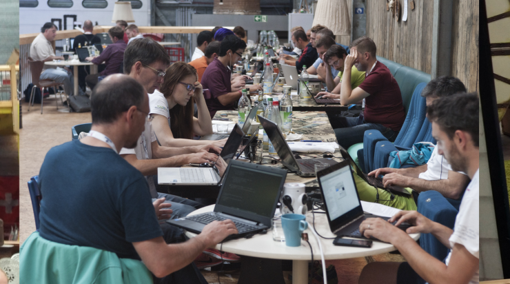
WIR BIETEN: Eine Plattform für Ihre Idee, Ihr Projekt, Ihren Erfahrungsbericht auf der größten deutschsprachigen Anwenderkonferenz für freie Geoinformationssysteme und freie Geodaten. Im Jahr 2014 findet die FOSSGIS vom 19. bis 21. März auf dem Gelände der Beuth Hochschule für Technik in Berlin statt. Wir rechnen mit über 400 Teilnehmern. An der Konferenz 2013 in Rapperswil (Schweiz) nahmen über ca. 350 Besucher teil.

WIR SUCHEN: Ihre Idee. Ihr Projekt. Ihren Erfahrungsbericht. Ihr Thema. Genauer gesagt, suchen wir Vorträge für Einsteiger und Fortgeschrittene, um spannende Themen zu behandeln, Diskussionen zu entwickeln, praxisorientierte Workshops* runden unser Programm ab. Vorträge zum Thema freie Geodaten, zum Beispiel OpenStreetMap, Open Data sind ebenso möglich wie Beiträge zu beispielsweise Softwarelösungen aus dem Bereich WebGIS, Desktop GIS, Geodatenbanken oder Location-Based-Services. Bewerben Sie sich jetzt mit einem Vortrag, Lightning Talk oder Workshop* beim Call for Papers.

ABSTRACT: Die Einreichung eines Abstracts für die FOSSGIS 2014 ist ab sofort bis zum 15. November 2013 über unsere Konferenzsoftware Pentabarf möglich. Beitrags-Einreichungen ohne Abstract müssen leider abgelehnt werden, da sich das Programm-Komitee anhand des Abstracts ein Bild von Inhalt und Relevanz des Beitrags macht. Der Abstract sollte ca. 1500 Zeichen umfassen. Ob die Einreichung angenommen wurde, wird im Dezember 2013 bekanntgegeben. Es besteht die Möglichkeit einen Lightning Talk einzureichen. Ein Lightning Talk ist eine kurze, knackige Auseinandersetzung mit einem Thema, welches in 5 Minuten, gern humorvoll, Anregung zur Diskussion bietet. Weiterhin können Poster eingereicht werden.

*Workshops: Bitte berücksichtigen Sie bei der Planung, dass für die Workshops nur 90 Minuten vorgesehen sind und die Teilnehmer ein Mix aus Theorie und vor allem Praxis erwarten. Die Beschreibung des Workshops soll erreichbare Lernziele und die notwendigen Vorkenntnisse der Teilnehmer enthalten. Ein Workshop findet ab einer Teilnehmerzahl von 5 statt.

WER WIR SIND: Veranstaltet wird die Konferenz vom FOSSGIS e.V., von der OSGeo Foundation und der Beuth Hochschule für Technik Berlin.

Unsere Konferenz lebt von Ihren Beiträgen und Ihrem Besuch. Werden Sie Teil der Konferenz – wir freuen uns auf Sie!

Noch Fragen? Wir haben versucht, in unseren FAQs alle wichtigen Fragen zu beantworten. Falls weitere Fragen bestehen, zögern Sie nicht uns eine E-Mail zu schreiben.

Note to English speakers

The FOSSGIS-conference is the largest German-language conference for Free and Open Source Software for GIS and Free Geodata hosting about 400 participants.

Today, the Conference Committee announced the “Call for papers” for 2014. Because the conference-language is German, the CfP is either.

The program committee will, however, also consider applications for talks or workshops held in English if they are deeemed to add to the quality of the conference. So if you don’t speak German, but are a FOSS/Open Data celebrity, or have a story that only you can tell, please do submit your talk. We are unlikely to be able to provide interpreters, but we’ll make sure you don’t get lost in Berlin. Please be aware that you can submit paper until November, 15. 2013. You can submit your abstract using our Conference Software.

We are looking forward to see you in Berlin March 19-21, 2014!
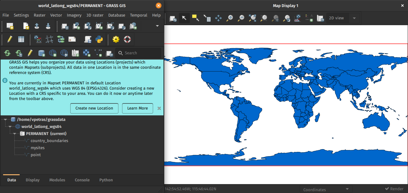
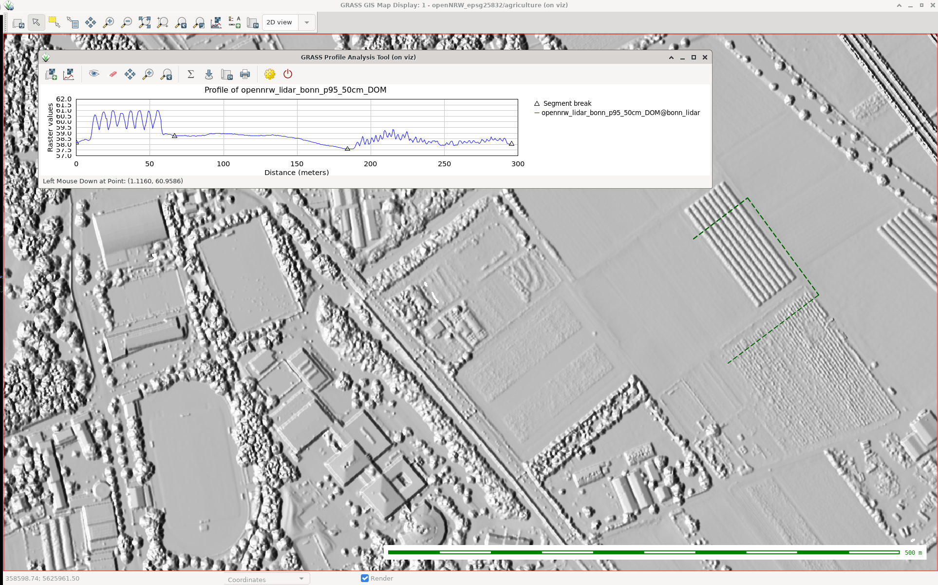
User history added to osm-reporter app

This weekend I implemented a new feature for my 'just for fun' project osm-reporter. The feature implements timeline reporting for Open Street Map contributors. Its probably easiest to explain with a screenshot:

OSM-Reporter with timelines

Here is another one showing a few charts together:

OSM-Reporter with timelines

I added the feature because I wanted to see how many person days were involved in data gathering for a particular area and feature type. It does have some limitations - it ignores deletion and ownership transfer of features. It does however provide a nice quick overview of effort. Try it on your own neighbourhood and see how much work went into the OSM coverage for your area!

I've also had some really awesome contributions from Yohan Bonifiace (added leaflet support, feature type switching, extent urls) and Sun Ning (added heatmap support). Its really great making a small, simple and limited scope project and seeing it grow with random hacks of kindness from strangers! Here is a little screenshot of the heatmap feature:

Heatmaps

I hope you all enjoy the new version, and look forward to more improvements and suggestions from the community. Its all freely available from my github repository. You can test out the current version of the software by visiting http://osm.linfiniti.com.

  • Page 1 of 4 ( 72 posts )
  • >>
  • fossgis

Back to Top

Sustaining Members