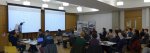
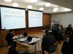
6th Scottish QGIS UK user group meeting
Informatics Forum, University of Edinburgh, Edinburgh
3rd November 2016
A full house with all tickets sold. Our biggest event yet. A last minute decision to video the talks. A first ever raffle to raise funds for the QGIS project. More than half the attendees were at a QGIS user group for the first time. All sectors represented and a range of talks from accessible introductions to QGIS functionality to wonderful technical geekery to varied FOSS4G use cases.
Slides
Video: https://youtu.be/kHDZmmzKU4U
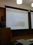
How deep is your loch?
Phil Taylor (@scienceandmaps) from CEH opened up the day with a detailed explanation of how he lovingly captured the plumbed depths of four Scottish lochs and turned them into interactive 3D visualisations. You can see his results at http://contours.org.uk/bathymetry
Slides
Video: https://youtu.be/-q021mocJdI
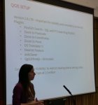
QGIS Server: the good, not-so-good and the ugly
Fiona Hemsley-Flint showed us the exploratory work she and her team have done with QGIS Server as a possible replacement for MapServer and Cadcorp GeognoSIS. QGIS server is capable and can render complex styles and labels well but was generally 5 to 10 times slower than GeognoSIS in rendering the maps.
Slides
Video: https://youtu.be/TPoOOkurtlA
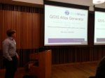
Installing QGIS on a Network
Tom Armitage (@MapNav_Tom) from the University of Edinburgh gave a quick run through of the requirements for installing QGIS 2.14.3 across 3000 computers.
Slides
Video: https://youtu.be/fv3fgI-u084
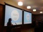
Mapping narrative: QGIS in the Digital Humanities
Anouk Lang (@e_a_lang) from the University of Edinburgh explained how mapping and visualisation were used to engage students and explore literature in a different way.
Slides
Video: https://youtu.be/XlADXIrC9PE
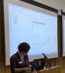
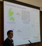
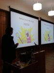
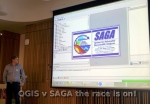
QGIS Plug-in for Parallel Processing in Terrain Analysis
Art Lembo (@artlembo) from Salisbury University, Maryland, USA got everyone excited about advances in personal computing power and how graphics cards can be harnessed to speed up spatial processing. The trouble with geographic data is that it is usually a large chunk of data with relatively little processing required. Parallel processing likes small chunks of data that need huge amounts of processing. The plugin hits the limit of the ability of Python to pass through more data. That’s how fast the graphics cards are.
Slides
Video: https://youtu.be/mkDMFiVLdkg
Viewshed analysis and how to find the heart of Scotland
Neil Benny (@bennymapper) from thinkWhere gave a very useful overview of how to use the different tools in QGIS to generate viewsheds which a lot people at the event could see a use for in their workflows. See https://blog.thinkwhere.com/2016/08/25/viewsheds-and-visibility-analysis-in-qgis/ for more information.
Slides
Video: https://youtu.be/LOPuw2-oaPA
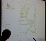
qgis2web: geocrustin’
Tom Chadwin (@tomchadwin) from NNPA gave an entertaining talk on how and why he developed the qgis2web plugin. He showed us how to use it and you can see why it is such a popular extension to QGIS.
Video: https://youtu.be/4gyW1aeoTvU
QGIS 3.0, WMTS previews and XYZ support in QGIS 2.18
Pete Wells (@lutraconsulting) from Lutra Consulting gave a more technical talk on some behind the scenes work that they have been doing to make using QGIS 3.0 even better for the user. No more waiting for the base map to load as the WMS server thinks about the request – tiled services quickly and seamlessly fill the screen. For more information see http://www.lutraconsulting.co.uk/blog/2016/10/26/qgis-xyz-tile-wmts-preview/
Video: https://youtu.be/Q83W0XJ2Y3g
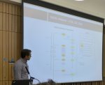
Decision Support Systems in Forestry
Stephen Bathgate (@Forestry_Research) from the Forestry Commission gave a real world example of how a GIS, and then an open source GIS infrastructure, delivered improved workflows, better efficiencies and made a smaller workforce more effective.
Slides
Video: https://youtu.be/94_y1qbqk-w
Collecting spatial survey data with Leaflet and OpenStreetMap
Louise Sing (@sing_louise) from Forestry Commission gave a lightning talk on how she used tips learned at previous QGIS user group meetings to put together a simple Leaflet map to collection information about how people use different areas of forest.
Slides
Video: https://youtu.be/-SCvsqy6txU
Indoor 3D routing with QGIS and pgRouting
Tim Manners (@tmnnrs) from Ordnance Survey demonstrated the interactive 3D route solving application created using QGIS and the QGIS2threeJS plugin. It can be used to route between locations spread across multiple floors in a building. It can take into account width and height restrictions such as doorways and lifts and can be used to model mass evacuations of a workforce.
Slides
Video: https://youtu.be/H-v9SXwc3BQ
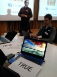
Using QGIS for wildlife surveys and reporting
Andrew Whitelee (@VerdantWildlife) from Taylor Wildlife lead an interactive talk highlighting the difficulty of undertaking robust repeatable wildlife surveys in the great outdoors. He showed how the use of high quality mapping and GPS tracking improved the quality of the surveys and how much sense the use of open source software made for small enterprises.
Slides
Video: https://www.youtube.com/watch?v=pJhXdYqEmuQ
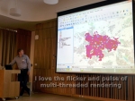
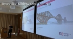
Them Thar Hills: shadin’, texturin’, blendin’
Ross McDonald (@mixedbredie) from Angus Council gave a lightning talk on different ways to generate hillshaded images from elevation models. Regular hillshaded images can be enhanced by generating texture shaded images. Texture shading enhances the drainage network and the visual hierarchy of the landscape. Blender can be used to create rich shaded relief by modelling real sunlight and reflection across the landscape. See textureshading.com for more information or press F7 in a recent version of QGIS to open the live style dock.
Slides
Video: https://www.youtube.com/watch?v=0nkNgtKGbw4
DOHA: Doha Online Historical Atlas
Michal Michalski from Scottish Government and the DOHA project showcased the mapping work he has been helping with in Doha and the archaeological investigation into the origins of the city. The website is a fantastic example of the integration of different resources including historic maps, photographs, videos and historic records. See http://originsofdoha.org/doha/index.html for more information.
Video: https://www.youtube.com/watch?v=xYegqHRoAic
3D indoor maps with QGIS
Tim Jenks (@eeGeo) from eeGeo gave a short talk on how QGIS and other tools were used to build navigable 3D maps of cities and buildings. See https://www.youtube.com/watch?v=c6T_v_e5Re8 for a demo.
Slides
Tom Armitage closed with some remarks on how open source software works and how the QGIS community supports the QGIS project. Roger Garbett managed the raffle (all 500 tickets sold!) with some great prizes (Splash-Maps voucher, QGIS t-shirt voucher, OS colouring map book, Art Lembo’s text book on geospatial processing, stickers and others) the proceeds of which will go to the QGIS project. There is, after all, no such thing as a free lunch. Even if fantastic and generous sponsors – Ordnance Survey, thinkWhere, Angus Council, Cawdor Forestry, eeGeo and EDINA – give us a lovely selection of food and drink (thanks BlueSkyCatering) and a top-class venue for a brilliant day out.
Slides
Video: https://youtu.be/cVEPbogf0To
The day ended in the Potting Shed with (strong) cask ales and ciders refreshing parched throats. Always a great way to wrap things up.


 The 5th QGIS user group meeting in Scotland takes place next Wednesday at the University of Glasgow. It is being hosted by the