QGIS Planet

8th Scottish QGIS UK user group meeting plans

It’s been a long time since we posted anything up here but hopefully the news of another user group happening in Stirling on 7th November will hopefully assuage your distress.

The event is very kindly hosted by Historic Environment Scotland in their restored Engine Shed and is also supported by Ordnance Survey, Cawdor Forestry, thinkWhere, SEPA and Registers of Scotland.

The programme is still being worked out but plan on attending one of two workshop sessions in the morning run by Ordnance Survey and thinkWhere and then a full afternoon of presentations and lightning talks.

Tickets are available through Eventbrite.

8th Scottish QGIS @UK user group

Live stream link

Here is the link to the live stream of the QGIS UK user group meeting in Edinburgh on Thursday.

Videos of the individual talks will be available after the event.

Supported and sponsored by thinkWhere, Ordnance Survey, Cawdor Forestry, EDINA (venue), WRLD3D, Angus Council, Registers of Scotland, Product Forge (streaming), OSGeo:UK (finance)

7th QGIS UK Scottish user group

The next event on the QGIS UK user group roadshow is the 7th Scottish meeting at the Informatics Forum in Edinburgh on 16th November.

Free tickets are available through http://qgis.uk/ but you better hurry – there are only 20 left!

The “I can probably say final agenda” agenda

QGIS UK Edinburgh: an overview

6th Scottish QGIS UK user group meeting
Informatics Forum, University of Edinburgh, Edinburgh
3rd November 2016

A full house with all tickets sold. Our biggest event yet. A last minute decision to video the talks. A first ever raffle to raise funds for the QGIS project. More than half the attendees were at a QGIS user group for the first time. All sectors represented and a range of talks from accessible introductions to QGIS functionality to wonderful technical geekery to varied FOSS4G use cases.

Slides

Video: https://youtu.be/kHDZmmzKU4U

How deep is your loch?
Phil Taylor (@scienceandmaps) from CEH opened up the day with a detailed explanation of how he lovingly captured the plumbed depths of four Scottish lochs and turned them into interactive 3D visualisations. You can see his results at http://contours.org.uk/bathymetry

Slides

Video: https://youtu.be/-q021mocJdI

QGIS Server: the good, not-so-good and the ugly
Fiona Hemsley-Flint showed us the exploratory work she and her team have done with QGIS Server as a possible replacement for MapServer and Cadcorp GeognoSIS. QGIS server is capable and can render complex styles and labels well but was generally 5 to 10 times slower than GeognoSIS in rendering the maps.

Slides

Video: https://youtu.be/TPoOOkurtlA

Installing QGIS on a Network
Tom Armitage (@MapNav_Tom) from the University of Edinburgh gave a quick run through of the requirements for installing QGIS 2.14.3 across 3000 computers.

Slides

Video: https://youtu.be/fv3fgI-u084

Mapping narrative: QGIS in the Digital Humanities 
Anouk Lang (@e_a_lang) from the University of Edinburgh explained how mapping and visualisation were used to engage students and explore literature in a different way.

Slides

Video: https://youtu.be/XlADXIrC9PE

QGIS Plug-in for Parallel Processing in Terrain Analysis
Art Lembo (@artlembo) from Salisbury University, Maryland, USA got everyone excited about advances in personal computing power and how graphics cards can be harnessed to speed up spatial processing. The trouble with geographic data is that it is usually a large chunk of data with relatively little processing required. Parallel processing likes small chunks of data that need huge amounts of processing. The plugin hits the limit of the ability of Python to pass through more data. That’s how fast the graphics cards are.

Slides

Video: https://youtu.be/mkDMFiVLdkg

Viewshed analysis and how to find the heart of Scotland
Neil Benny (@bennymapper) from thinkWhere gave a very useful overview of how to use the different tools in QGIS to generate viewsheds which a lot people at the event could see a use for in their workflows. See https://blog.thinkwhere.com/2016/08/25/viewsheds-and-visibility-analysis-in-qgis/ for more information.

Slides

Video: https://youtu.be/LOPuw2-oaPA

qgis2web: geocrustin’
Tom Chadwin (@tomchadwin) from NNPA gave an entertaining talk on how and why he developed the qgis2web plugin. He showed us how to use it and you can see why it is such a popular extension to QGIS.

Video: https://youtu.be/4gyW1aeoTvU

QGIS 3.0, WMTS previews and XYZ support in QGIS 2.18
Pete Wells (@lutraconsulting) from Lutra Consulting gave a more technical talk on some behind the scenes work that they have been doing to make using QGIS 3.0 even better for the user. No more waiting for the base map to load as the WMS server thinks about the request – tiled services quickly and seamlessly fill the screen. For more information see http://www.lutraconsulting.co.uk/blog/2016/10/26/qgis-xyz-tile-wmts-preview/

Video: https://youtu.be/Q83W0XJ2Y3g

Decision Support Systems in Forestry
Stephen Bathgate (@Forestry_Research) from the Forestry Commission gave a real world example of how a GIS, and then an open source GIS infrastructure, delivered improved workflows, better efficiencies and made a smaller workforce more effective.

Slides

Video: https://youtu.be/94_y1qbqk-w

Collecting spatial survey data with Leaflet and OpenStreetMap
Louise Sing (@sing_louise) from Forestry Commission gave a lightning talk on how she used tips learned at previous QGIS user group meetings to put together a simple Leaflet map to collection information about how people use different areas of forest.
Slides

Video: https://youtu.be/-SCvsqy6txU

Indoor 3D routing with QGIS and pgRouting
Tim Manners (@tmnnrs) from Ordnance Survey demonstrated the interactive 3D route solving application created using QGIS and the QGIS2threeJS plugin. It can be used to route between locations spread across multiple floors in a building. It can take into account width and height restrictions such as doorways and lifts and can be used to model mass evacuations of a workforce.

Slides

Video: https://youtu.be/H-v9SXwc3BQ

Using QGIS for wildlife surveys and reporting
Andrew Whitelee (@VerdantWildlife) from Taylor Wildlife lead an interactive talk highlighting the difficulty of undertaking robust repeatable wildlife surveys in the great outdoors. He showed how the use of high quality mapping and GPS tracking improved the quality of the surveys and how much sense the use of open source software made for small enterprises.

Slides

Video: https://www.youtube.com/watch?v=pJhXdYqEmuQ

Them Thar Hills: shadin’, texturin’, blendin’
Ross McDonald (@mixedbredie) from Angus Council gave a lightning talk on different ways to generate hillshaded images from elevation models. Regular hillshaded images can be enhanced by generating texture shaded images. Texture shading enhances the drainage network and the visual hierarchy of the landscape. Blender can be used to create rich shaded relief by modelling real sunlight and reflection across the landscape. See textureshading.com for more information or press F7 in a recent version of QGIS to open the live style dock.

Slides

Video: https://www.youtube.com/watch?v=0nkNgtKGbw4

DOHA: Doha Online Historical Atlas
Michal Michalski from Scottish Government and the DOHA project showcased the mapping work he has been helping with in Doha and the archaeological investigation into the origins of the city. The website is a fantastic example of the integration of different resources including historic maps, photographs, videos and historic records. See http://originsofdoha.org/doha/index.html for more information.

Video: https://www.youtube.com/watch?v=xYegqHRoAic

3D indoor maps with QGIS
Tim Jenks (@eeGeo) from eeGeo gave a short talk on how QGIS and other tools were used to build navigable 3D maps of cities and buildings. See https://www.youtube.com/watch?v=c6T_v_e5Re8 for a demo.

Slides

Tom Armitage closed with some remarks on how open source software works and how the QGIS community supports the QGIS project. Roger Garbett managed the raffle (all 500 tickets sold!) with some great prizes (Splash-Maps voucher, QGIS t-shirt voucher, OS colouring map book, Art Lembo’s text book on geospatial processing, stickers and others) the proceeds of which will go to the QGIS project. There is, after all, no such thing as a free lunch. Even if fantastic and generous sponsors – Ordnance Survey, thinkWhere, Angus Council, Cawdor Forestry, eeGeo and EDINA – give us a lovely selection of food and drink (thanks BlueSkyCatering) and a top-class venue for a brilliant day out.

Slides

Video: https://youtu.be/cVEPbogf0To

The day ended in the Potting Shed with (strong) cask ales and ciders refreshing parched throats. Always a great way to wrap things up.

qgisug_sponsors_white

Notes from the QGIS-UK South West user group

Yesterday Dartmoor National Park was host to the third QGIS user group for the South West region. We a great range of talks from the worlds of academia, offshore exploration and local government to name but a few. The slides from these are below.

Teaching in QGIS

Using PostGIS within our Geospatial Workflows at Lloyd’s Register

The Adoption of QGIS at Plymouth Community Homes

Integrating QGIS functionality into a data workflow through both automated processing and a plugin

PopChange: An Academic Open Source Project

Building a Mixed GIS Environment at the Met Office

We are looking at having another meet up in the spring and are thinking of running some workshops on form designing and plugin building. Keep an eye on the main QGIS user group page on Google+ for any news.

Thanks again to everyone who attending and presented.  We also need to give a special thanks to Clear Mapping Company for sponsoring the event.

Cheers

Matt

6th QGIS UK user group meeting in Edinburgh

The 6th QGIS UK user group meeting in Scotland is happening on the 3rd November 2016.  It is being hosted by the EDINA University of Edinburgh at the Informatics Forum and is sponsored by thinkWhere, Ordnance Survey, Angus Council and Cawdor Forestry.  Tickets are available through Eventbrite.

The almost final programme of presentations and lightning talks is as follows:

  • Phil Taylor (CEH) – How deep is your loch?
  • Fiona Hemsley-Flint – QGIS server
  • University of Edinburgh – packaging and deploying QGIS
  • Anouk Lang – Mapping narrative: QGIS in the humanities classroom
  • Art Lembo (Salisbury University, MD) – terrain analysis with massively parallel processing techniques (embarrasingly so)
  • Neil Benny (thinkWhere) – finding the heart of Scotland / viewshed analysis
  • Tom Chadwin – qgis2web and coding a QGIS plugin
  • Pete Wells (Lutra) – WMTS previews and XYZ support
  • Stephen Bathgate – decision support system in Forestry
  • Tim Manners (Ordnance Survey) – Creating an indoor routable network with QGIS and pgRouting
  • Andrew Whitelee – QGIS in forestry/ecology
  • Ross McDonald (Angus Council) – Them thar hills: shaded, textured and blended
  • Michal Michalski (The Origins of Doha and Qatar Project) – DOHA: Doha Online Historical Atlas
  • eeGeo – Using QGIS to create 3D indoor maps

Doors open from 9:00. Registration shortly thereafter. Start and welcome at 9:45 and a planned finish at 16:30. Geobeers to follow.

Agenda for 5th QGIS user group – Scotland

scottish thistleThe 5th QGIS user group meeting in Scotland takes place next Wednesday at the University of Glasgow.  It is being hosted by the School of Geographical and Earth Sciences and has been generously sponsored by thinkWhere and Ordnance Survey.  You can find the draft programme of talks and presentations here: 5th-QGIS-user-group-programme

All tickets are now gone but get on the waitlist and you may be lucky.

See you all there!

FOSS4G UK

foss4guk_2016_logo

There is a FOSS4G UK conference, unconference, workshop, hackathon, code sprint and party happening in Southampton in June this year.  If you are free from the 14th to 16th then this is a fantastic opportunity to come and find out more about free and open-source software for Geo.  Have a look at the OSGeo site (http://uk.osgeo.org/foss4guk2016/) for more information.  If you want to submit a talk and/or workshop then you can do so through the site.  Early bird tickets will be going on sale tomorrow (13 April) and will be available through the site from Eventbrite.
In brief: 4th QGIS user group in Scotland

Another sold-out event with a programme packed with useful, interesting and delightful talks. Fifty seven (57!) folk blew in from all over Scotland through a freezing rain but hot coffee and pastries were waiting in the Informatics Forum at the University of Edinburgh.

First up was an overview the current status of the QGIS project by Saber from Lutra Consulting. It was good for people new to QGIS and open-source to see how the project is organised and run and the direction it is taking. Pete, also from Lutra Consulting, then gave a quick summary of the bits of core functionality they have been working on including the new ruled based labelling system.
The group then split into two for 90 minute workshop sessions on cartographic labelling and advanced Atlas usage – a tough choice! Chris, from Ordnance Survey, presented a detailed how-to on the new ruled based labelling tools using some OS open data, interspersed with some slides on guidelines to good cartographic practices and labelling tips. The slides and material for this workshop are available here: https://dl.dropboxusercontent.com/u/185489368/QGIS-Scotland2015.pdf

Heikki, from thinkWhere, lead us through the process of using Atlas in Print Composer to automate map production for a series of maps containing a main context map and an inset overview map. Nothing better than doing something once and then being able to repeat it at the click of a button! The slides and material for this workshop are available here: https://github.com/HeikkiVesanto/Scottish_QGIS_User_Workshop

A break for lunch and a good hour of catching up with users from across all sectors – local government, central government, academia, forestry, planning consultancies, developers, student life and education. QGIS is popular and is obviously a flexible tool that meets many demands.

After lunch, Neil, from thinkWhere, organised a quick-fire “quirky QGIS quiz” with random questions from all aspects of FOSS4G demanding quick thinking for true/false answers. At least half the audience grabbed prizes courtesy of thinkWhere and Ordnance Survey.

What followed was a series of lightning talks on different aspects of using QGIS. Amy, from Cawdor Forestry, gave a brief overview of the plugins available in the QGIS plugin repository and highlighted some of her personal favourites. Paul, from Scottish Water, showcased some of the complex workflows created using SAGA, QGIS and the Processing Toolbox to model hydrological process. Ross, from Inverclyde Council, demonstrated the use of the QGIS Road Graph plugin to generate walking routes to school across a custom road and path network. Seb, from West Dunbartonshire Council, showed us how QGIS had put them in a happy place and showed how a “hearts and minds” campaign championing QGIS had changed the way they worked. Steve, fae Embra, gave some information on how to give back to the QGIS project through submitting Processing scripts and plugins to the repository. Don’t reinvent the wheel! Ross, from Angus Council, gave a quick demonstration of setting up a local plugin repository that could be used to share custom plugins or control access to plugins in an internet-less environment.

By this time, tea and cake was required and it gave everyone an opportunity to mix and ask questions of the speakers.

The last session was as series of longer talks started by Gemma, from Ordnance Survey, explaining how open-source software is used extensively at Ordnance Survey to underpin a lot of the cartographic processes and workflows. They use QGIS 2.8 LTR for stability and consistency across the business and a selection of plugins from both OS developers and the community. QGIS is used to generate all the cartographic styles sheets for the OS vector products: https://github.com/OrdnanceSurvey/OS-VectorMap-District-stylesheets

Tom, from EDINA, explained the processing of creating and delivering a QGIS training course to University staff and students. The first class sold out in next to no time and there is demand for more. Makes sense really, doesn’t it?

Steve, from GeoGeo, wrapped up the day with the kind of mapping we’d all like to be doing – high resolution elevation models, time series analysis of shadows, viewsheds across the Edinburgh skyline and analysis of rooftops for potential solar panels with sub 1m resolution LiDAR datasets. He uses a mix of QGIS, SAGA, Blender and other FOSS to inspiring effect. Check his Flickr stream: https://www.flickr.com/photos/stevefaeembra/

The day finished with Pete (Lutra Consulting) releasing into the open a new Search plugin for QGIS called Discovery (http://www.lutraconsulting.co.uk/products/discovery/) based on the PostGIS Search plugin from Tim Martin (Ordnance Survey). A very useful addition to any QGIS installation.

The day was sponsored by EDINA, thinkWhere and Ordnance Survey.

Links to slides will be coming shortly.

Photos from QGIS Scotland


A full house of 57 Sponsors The QGIS road map Plugin Review Live Demo Road Graph Plugin Processing Scripts QGIS at Scottish Water QGIS to the rescue Water work flows Making them happy QGIS: the right stuff Can you believe it's not ArcGIS?! Open source at Ordnance Survey QGIS Training QGIS is AWESOME Amazing eye candy 4th QGIS user group in Scotland Custom QGIS installer Advanced Atlas usage Open source at Ordnance Survey how to build a plugin Hi-res LiDAR Neil Benny, inquizitor Quirky QGIS quiz

4th QGIS UK user group meeting in Edinburgh

4th QGIS UK user group EdinburghOK. Here it is. The official call for offers of speaking, running a workshop, doing a lightning talk, generally helping, and sponsoring the 4th QGIS UK user group meeting in Scotland on 16th November. Tom Armitage has booked the Informatics Forum in Crichton Street for us again.

Tickets are available here: http://www.eventbrite.com/e/uk-qgis-user-group-scotland-tickets-19194628651

I am open to suggestions from you, the users, about how the day is organised but I imagine something that has a few talks, a workshop session and a good lunch break would tick most boxes.  So get in touch and let’s make it happen.

Use the contact form on the About Us page to get in touch or via twitter @mixedbredie.

Sponsored by OS thinkWhere EDINA


4th QGIS UK user group meeting in Edinburgh

4th QGIS UK user group EdinburghOK. Here it is. The official call for offers of speaking, running a workshop, doing a lightning talk, generally helping, and sponsoring the 4th QGIS UK user group meeting in Scotland on 16th November. Tom Armitage has booked the Informatics Forum in Crichton Street for us again.

Tickets are available here: http://www.eventbrite.com/e/uk-qgis-user-group-scotland-tickets-19194628651

I am open to suggestions from you, the users, about how the day is organised but I imagine something that has a few talks, a workshop session and a good lunch break would tick most boxes.  So get in touch and let’s make it happen.

Use the contact form on the About Us page to get in touch or via twitter @mixedbredie.

UPDATE: 4th-Scottish-QGIS-user-group-meeting agenda now available.

Sponsored by OS thinkWhere EDINA

Upcoming User Group Meetings

There are two upcoming user group meetings – one in Edinburgh and one in London. Tickets are available through Eventbrite. If you want to attend the Scottish event, click here, or if the South East is closer then click here.

As ever, we are always keen to hear from the users and if you have something you would like to share with the rest of the user group then please get in touch.  Lightning talks or longer 20 minute presentations welcomed.

Click here to get the FINAL AGENDA May 2015.


QGIS UK Edinburgh – Photos

QGIS UK user group Edinburgh QGIS UK user group Edinburgh QGIS UK user group Edinburgh QGIS UK user group Edinburgh QGIS UK user group Edinburgh QGIS UK user group Edinburgh QGIS UK user group Edinburgh QGIS UK user group Edinburgh QGIS UK user group Edinburgh QGIS UK user group Edinburgh QGIS UK user group Edinburgh QGIS UK user group Edinburgh

South-East User group meeting:

2nd South-East QGIS user group – 4th November

The Venue: Royal Borough of Windsor and Maidenhead, Town Hall, St. Ives Road, Maidenhead. SL6 1RF.

Tickets: You can grab them from here and they are FREE!

Agenda

9.30-10:  Arrive
10.00: Welcome
10.15 – 12:  Lutra Consultancy – Python Plugin Development *
12 – 12.30: Discussion / Its your floor: This part of the agenda is entirely driven by you. It’s your chance to stand up and let everyone know what you are doing with QGIS or ask a burning question about QGIS? The best question or lightening talk will win a prize! If your lightening talk requires a bit of power-point, then put together no more than a 5 slider presentation and send them over to [email protected]

12.30 – 1.30: Lunch / Networking: There is a cafe within the Town Hall, or a plethora of eating establishments in Maidenhead.
1.30 – 3.00: Talks

Tim Martin from the OS on Terrain5, Topo and building heights to create a 3d using the QGIS2ThreeJs plugin. *
Simon Miles from the RBWM doing a bit of show and tell on how QGIS is used and configured at the Council.

3.00 – 5.00: Unconference: This part of the day is over to you, its your user group! Bring along your own laptop, project or piece of code; or borrow one of the laptops dotted around the room and do a bit of show and tell, or ask someone a burning practical QGIS question. Some of the machines will have QGIS Master on them and there will be a Windows tablet running QGIS on to have a play with. Some suggested topics – Styling features, Creating forms, WMS resources, Print Composer

* Bring along your own laptop if you would like to follow along with the Plugin workshop in morning or with Tim Martin in the afternoon. Software and data requirements will be forwarded to you prior to the day.


Registration is open

Registration is open now for the Scottish QGIS user group.  You can register here:

https://www.eventbrite.co.uk/e/qgis-uk-scottish-user-group-tickets-13092023595

The planned agenda for the day is as follows:

  • arrive for coffee 9.00
  • welcome and intro 9.30
  • workshops 10.00 – 12.00
  • lightning talks 12.00 – 12.30
  • lunch 12.30 – 13.30
  • afternoon presentations 13.30 – 16.00
  • close
  • geobeers

There is a great line up of talks and after feedback from the last user group there are now two workshops in the morning for you to choose from.

  • Workshop 1: QGIS plugin development with Python
  • Workshop 2: Using the QGIS Processing module
  • Michael Spencer – Raster time series analysis using FOSS4G
  • Heikki Versanto – Visualising population demographics in 3D
  • Simon Willcocks – Using PgRouting with OS ITN in QGIS
  • Ross McDonald – Cartographic experiments in QGIS
  • Mag Low – Rendering OS MasterMap buildings using QGIS2threeJS
  • Paul Weedon – PostGIS, QGIS and Associated Street Data
  • Lightning talks – a few minutes to tell us about, well, anything really.

Thanks to EDINA, thinkWhere and Ordnance Survey for helping to make the day happen!


QGIS OpenLayers alternative: ArcGIS online basemap

The QGIS Ireland user group posted a method of adding the ArcGIS Online global raster basemap to QGIS to use as an alternative to the openLayers plugin:

http://ieqgis.wordpress.com/2014/08/09/adding-esris-online-world-imagery-dataset-to-qgis/


Scottish QGIS User Group – 21 October, Edinburgh

The next QGIS user group meeting in Scotland is happening on 21st October 2014.
It is being held in the School of Informatics at Edinburgh University.  For more info about the venue: http://www.ed.ac.uk/schools-departments/informatics/about/location

This is your chance to offer a short talk or presentation or workshop so we can build an exciting programme for the day.  The final programme and agenda will be released closer to the date.  Please let me know through the contact form or comments or twitter (@mixedbredie) if you have a presentation or talk you would like to share.

Ross


South-East QGIS User Group – Writeup

Since helping to organise the inaugural meeting in September 2013, this was the first UK QGIS South-East UG meeting which piggy-backs off the success of the Scottish and Welsh UG meetings.

Putting an agenda together isn’t the easiest thing to do at the best of times and especially given that the use of QGIS here in the UK is still in its infancy but thankfully without much need for pleading many kind people came together to help out and make the day a great success.

Imperial College hosted the event for us and everyone one agreed that the facilities were fantastic. A special thanks needs to go to Claudia Vitolo for arranging everything for us at Imperial. There was a good turnout with about 55 people turning up, with a real mix of public, private and academic backgrounds.

imperial_1

David McDermott started off proceedings with a talk about Atlas and Map Production. He cleanly illustrated to the audience through screenshots how Surrey Heath Borough Council are using this fantastic feature of 2.2 to produce lots of maps, quickly, efficiently and importantly eye-pleasing.

imperial_2

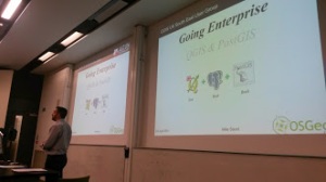
Mike Saunt demonstrated through a mixture of presentation and live demo a series of tweaks within QGIS and using a bit of SQL in PostGIS, how QGIS can be an Enterprise GIS tool. For those in the audience that new to QGIS or looking for alternative GIS solutions were keen to ask questions about the QGIS/PostGIS architecture which Mike was very happy to answer, sighting many case examples.

imperial_3

Jerry Clough gave a well received talk on OpenStreetMap and promoted a lot of conversation. Jerrys’ talk was a real mixed bag of factoids and tips on OSM in general and using it within QGIS.

Andrew Bell gave the audience a treat by demonstrating how with some simple PostGIS SQL you could within QGIS draw a line or route (from A to B) which would automatically buffer and select features from the Ordnance Survey PoI (Points of Interest) layer that fell within the buffer. All very simple but very effective process. Andrew admitted that this had a lot of scope and could be adapted for Emergency Planning for example.

View presentation here

The afternoon sessions saw two workshops;

Pete Wells from Lutra gave a whistle stop run through of using Python and QGIS, and went as far as producing a very simple plugin all within the space of an hour and ten minutes. It was a well attended talk and the sort of workshop that future user groups should try to repeat.

The Ordnance Survey did an Introduction to QGIS using OS Opendata and was equally well attended as Pete Wells workshop, as both workshops ran at the same time. The talk was loosely based on the successful OS MasterClasses that have been run over the past few years.

The schedule of the day quickly slipped, mainly due to the great audience participation at the end of the presentations. As a result the afternoon workshops, ‘its your floor’ and discussion sessions were shortened so that a 4pm finish was achievable.

Its your floor was a bit of a wild card slot in the days agenda. Prior to the event the attendees were asked  if they wanted to take to the stage and chat about what they were doing to QGIS, effectively 5 slides in 5 minutes. Two brave souls stepped upto the mark and gave informative but lightning talks about what they had been up to. This is certainly a part of the agenda that the South-East region will be repeating again.

The day ended with a lively debate about the role and future of the UK QGIS user group and it might be that moving forward such a debate becomes an earlier item on the days agenda.

One of the discussion points was on the cost of running future events. Based on an online poll conducted earlier on this year and feedback from the Scottish group, it was clear that for the group to continue future events will probably longer be free and as such a minimal donation would be required to attend. The true cost of hosting an event is probably more than most imagine. The single biggest cost is catering, in the case of this meeting and the inaugural meeting back in September 13, the combined cost just for catering was in excess of £1400. Luckily in both cases and in fact in all of the user group meetings that have occurred catering and venue hire costs have been met through sponsorship. However such kind support from private companies will not last indefinitely. The exact minimum donation cost may vary from event to event, depending on venue hire costs and catering.

Over a series of discussion topics a few themes kept on popping up which put into question the role of the user group. Behind the scenes of the user group, as with any user group or community there are also people busy working away to do all sorts of things in the background. The user group has a loose working community which is referred to as regional leads but in fact these regional leads are not standing alone but a few people supporting them. This working group has been discussing how we can work more closely with the core QGIS project and hopefully soon we will be able to clearly define how we achieve this. Where this thought process is going is that the role of the user group is just that, a user group and not a QGIS developer group. Clearly some people within the wider UK QGIS UG will be more developer minded than others and as such would be encouraged to participate the development of QGIS. Others may want to help out with updating manuals or bug hunting. While others might not be interested in any of the above and just want to create maps, data or GIS processes and share these with the group which should equally be encouraged.  We as a user group should be there to encourage any of the above users.

Simon Miles


Slides – Scottish QGIS User Group Meeting

An introduction from Ross McDonald to the inaugral QGIS user group meeting in Scotland.

Neil Benny from thinkWhere getting passionate about QGIS and open source spatial software.

Martin Dobias from Lutra showing us the super performance enhancements coming in the next version of QGIS.

Charley Glynn from Ordnance Survey demonstrating some of the map eye candy they’re producing with QGIS.

Pete Wells from Lutra showing us how to use Python with QGIS.

Videos of the talks will be posted here including Heikki Versanto showing how to connect to a huge variety of data sources.


Back to Top

Sustaining Members