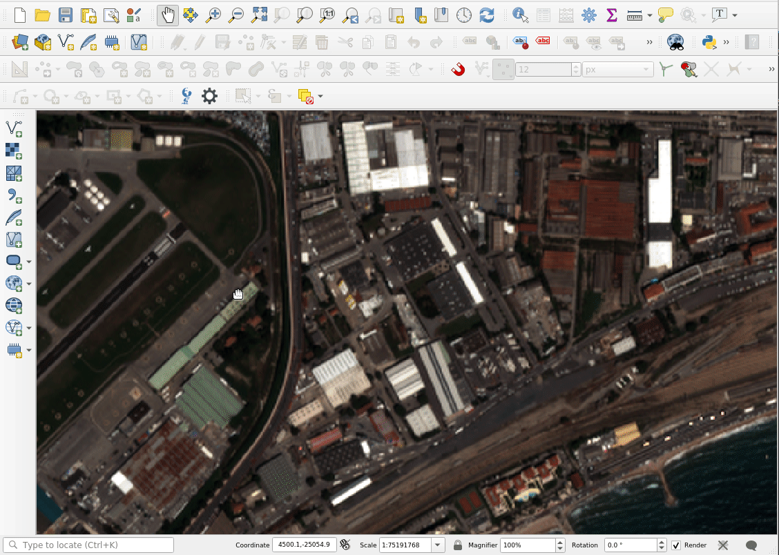
New release for QField : 3.3 “Darién”
Oslandia is the main partner of OPENGIS.ch around QField. We are proud today to forward the announcement of the new QField release 3.3 “Darién”. This release introduces a brand new plugin framework that empowers users to customize and add completely new functionalities to their favourite field application.
The plugin framework comes with other new features and improvements for this release, detailed below.
Main highlights

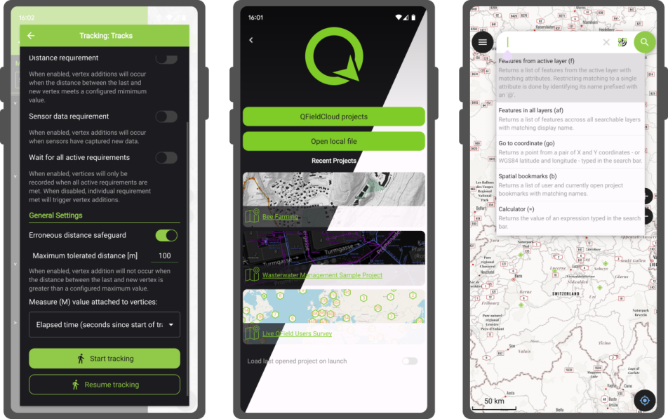
One of the biggest feature additions of this version is a brand new drawing tool that allows users to sketch out important details over captured photos or annotate drawing templates. This was a highly requested feature, which is brought to all supported platforms (Android, iOS, Windows, macOS, and, of course, Linux) with the financial support of the Swiss QGIS user group.
Also landing in this version is support for copying and pasting vector features into and from the clipboard. This comes in handy in multiple ways, from providing a quick and easy way to transfer attributes from one feature to another through matching field names to pasting the details of a captured feature in the field into a third-party messenger, word editing, or email application. Copying and pasting features can be done through the feature form’s menu as well as long pressed over the map canvas. Moreover, a new feature-to-feature attributes transfer shortcut has also been added to the feature form’s menu. Appreciation to Switzerland, Canton of Lucerne, Environment and Energy for providing the funds for this feature.
The feature form continues to gain more functionalities; in this version, the feature form’s value map editor widget has gained a new toggle button interface that can help fasten data entry. The interface replaces the traditional combo box with a series of toggle buttons, lowering the number of taps required to pick a value. The German Archaeological Institut – KulturGutRetter sponsored this feature.
Other improvements in the feature form include support for value relation item grouping and respect for the vector layer attributes’ « reuse last entered value » setting.

Finally, additional features include support for image decoration overlay, a new interface to hop through cameras (front, back, and external devices) for the ‘non-native’ camera, the possibility to disable the 3-finger map rotation gesture, and much more.
User experience improvements
Long-time users of QField will notice the new version restyling of the information panels such as GNSS positioning, navigation, elevation profile, and sensor data. The information is now presented as an overlay sitting on top of the map canvas, which increases the map canvas’ visibility while also achieving better focus and clarity on the provided details. With this new version, all details, including altitude and distance to destination, respect user-configured project distance unit type.
The dashboard’s legend has also received some attention. You can now toggle the visibility of any layer via a quick tap on a new eye icon sitting in the legend tree itself. Similarly, legend groups can be expanded and collapsed directly for the tree. This also permits you to show or hide layers while digitizing a feature, something which was not possible until now. The development of these improvements was supported by Gispo and sponsored by the National Land Survey of Finland.
Plugin framework
QField 3.3 introduces a brand new plugin framework using Qt’s powerful QML and JavaScript engine. With a few lines of code, plugins can be written to tweak QField’s behaviour and add new capabilities. Two types of plugins are possible: app-wide plugins as well as project-scoped plugins. To ensure maximum ease of deployment, plugin distribution has been made possible through QFieldCloud! Amsa provided the financial contribution that brought this project to life.

Our partner OPENGIS.ch will soon offer a webinar to discover how QField plugins can help your field (and business) workflows by allowing you to be even more efficient in the field.
Users interested in authoring plugins or better understanding the framework, can already visit the dedicated documentation page and a sample plugin implementation sporting a weather forecast integration.
A question concerning QField ? Interested in QField deployment ? Do not hesitate to contact Oslandia to discuss your project !


 For those unfamiliar with Oslandia,
  Oslandia is a French company specializing in open-source Geographic Information Systems (GIS). Since our establishment in 2009, we have been providing consulting, development, and training services in GIS, with reknown expertise. Oslandia is a dedicated open-source player and the largest contributor to the QGIS solution in France.
 Some may still be unfamiliar with #QGIS ?
 Today, we are delighted to announce our strategic partnership aimed at strengthening and promoting QField, the mobile application companion of QGIS Desktop.
 This partnership between Oslandia and OPENGIS.ch is a significant step for QField and open-source mobile GIS solutions. It will consolidate the platform, providing users worldwide with simplified access to effective tools for collecting, managing, and analyzing geospatial data in the field.
 QField, developed by OPENGIS.ch, is an advanced open-source mobile application that enables GIS professionals to work efficiently in the field, using interactive maps, collecting real-time data, and managing complex geospatial projects on Android, iOS, or Windows mobile devices.
 QField is cross-platform, based on the QGIS engine, facilitating seamless project sharing between desktop, mobile, and web applications.
 QFieldCloud (
 At Oslandia, we are thrilled to collaborate with OPENGIS.ch on QGIS technologies. Oslandia shares with OPENGIS.ch a common vision of open-source software development: a strong involvement in development communities, work in respect with the ecosystem, an highly skilled expertise, and a commitment to industrial-quality, robust, and sustainable software development.
 With this partnership, we aim to offer our clients the highest expertise across all software components of the QGIS platform, from data capture to dissemination.
 On the OpenGIS.ch side, Marco Bernasocchi adds:
 Both companies are committed to continue supporting and improving QField and QFieldCloud as open-source projects, ensuring universal access to this high-quality mobile GIS solution without vendor dependencies.
 And now, are you ready for the field?
 If you need training, support, maintenance, deployment, or specific feature development on these platforms, don’t hesitate to contact us. You will have access to the best experts available:
 You will probably interact first with our pre-sales engineer Bertrand Parpoil. He leads Geographical Information System projects for 15 years for large corporations, public administrations or hi-tech SME. Bertrand will listen to your needs and explore your use cases, to offer you the best set of services.
  Régis Haubourg also takes part in the first steps of projects to analyze your usages and improve them. GIS Expert, he knows QGIS by heart and will make the most of its capabilities. As QGIS Community Manager at Oslandia, he is very active in the QGIS community of developers and contributors. He is president of the Francophone OSGeo local chapter ( OSGeo-fr ), QGIS voting member, organizes the French QGIS day conference in Montpellier, and participates to QGIS community meetings. Before joining Oslandia, he led the migration to QGIS and PostGIS at the Adour-Garonne Water Agency, and now guides our clients with their GIS migrations to OpenSource solutions. Régis is also a great asset when working on water, hydrology and other specific thematic subjects.
 Loïc Bartoletti develops QGIS, specializing in features corresponding to his fields of interests : network management, topography, urbanism, architecture… We find him contributing to advanced vector editing in QGIS, writing Python plugins, namely for DICT management. Pushing CAD and migrations from CAD tools to GIS and QGIS is one of his major goals. He will develop your custom applications, combining technical expertise and functional competences. When bored, Loïc packages software on FreeBSD.
 Vincent Mora is senior developer in Python and C++, as well as PostGIS expert. He has a strong experience in numerical simulation. He likes coupling GIS (PostGIS, QGIS) with 3D numerical computing for risk management or production optimization. Vincent is an official QGIS committer and can directly integrate your needs into the core of the software. He is also GDAL committer and optimizes low-level layers of your applications. Among numerous activities, Vincent serves as lead developer of the development team for
 Hugo Mercier is an officiel QGIS committer too for several years. He regularly talks in international conferences on PostGIS, QGIS and other OpenSource GIS softwares. He will implement your needs with new QGIS features, develop innovative plugins ( like
 Paul Blottière completes our QGIS committers : very active on core development, Paul has refactored the QGIS server component to bring it to an industry-grade quality level. He also designed and implemented
 Julien Cabièces recently joined Oslandia, and quickly dived into QGIS : he contributes to the core of this Desktop GIS, on the server component, as well as applications linked to numerical simulation. Coming from a satellite imagery company with industrial applications, he uses his flexibility to answer all your needs. He brings quality and professionalism to your projects, minimizing risks for large production deployments.