


Building an interactive app with geocoding in Jupyter Lab
This post aims to show you how to create quick interactive apps for prototyping and data exploration using Panel.
Specifically, the following example demos how to add geocoding functionality based on Geopy and Nominatim. As such, this example brings together tools we’ve previously touched on in Super-quick interactive data & parameter exploration and Geocoding with Geopy.
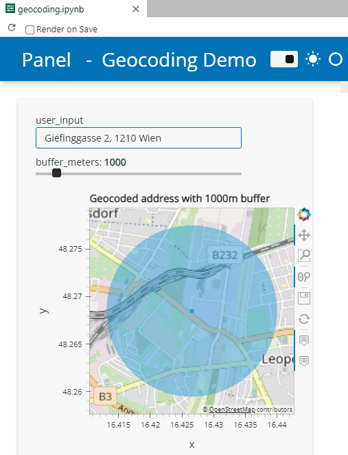
Here’s a quick preview of the resulting app in action:
To create this app, I defined a single function called my_plot which takes the address and desired buffer size as input parameters. Using Panel’s interact and servable methods, I’m then turning this function into the interactive app you’ve seen above:
import panel as pn
from geopy.geocoders import Nominatim
from utils.converting import location_to_gdf
from utils.plotting import hvplot_with_buffer

locator = Nominatim(user_agent="OGD.AT-Lab")

def my_plot(user_input="Giefinggasse 2, 1210 Wien", buffer_meters=1000):
    location = locator.geocode(user_input)
    geocoded_gdf = location_to_gdf(location, user_input)
    map_plot = hvplot_with_buffer(geocoded_gdf, buffer_meters,
                                  title=f'Geocoded address with {buffer_meters}m buffer')
    return map_plot.opts(active_tools=['wheel_zoom'])

kw = dict(user_input="Giefinggasse 2, 1210 Wien", buffer_meters=(0,10000))

pn.template.FastListTemplate(
    site="Panel", title="Geocoding Demo",
    main=[pn.interact(my_plot, **kw)]
).servable();
You can find the full notebook in the OGD.AT Lab repository or run this notebook directly on MyBinder:
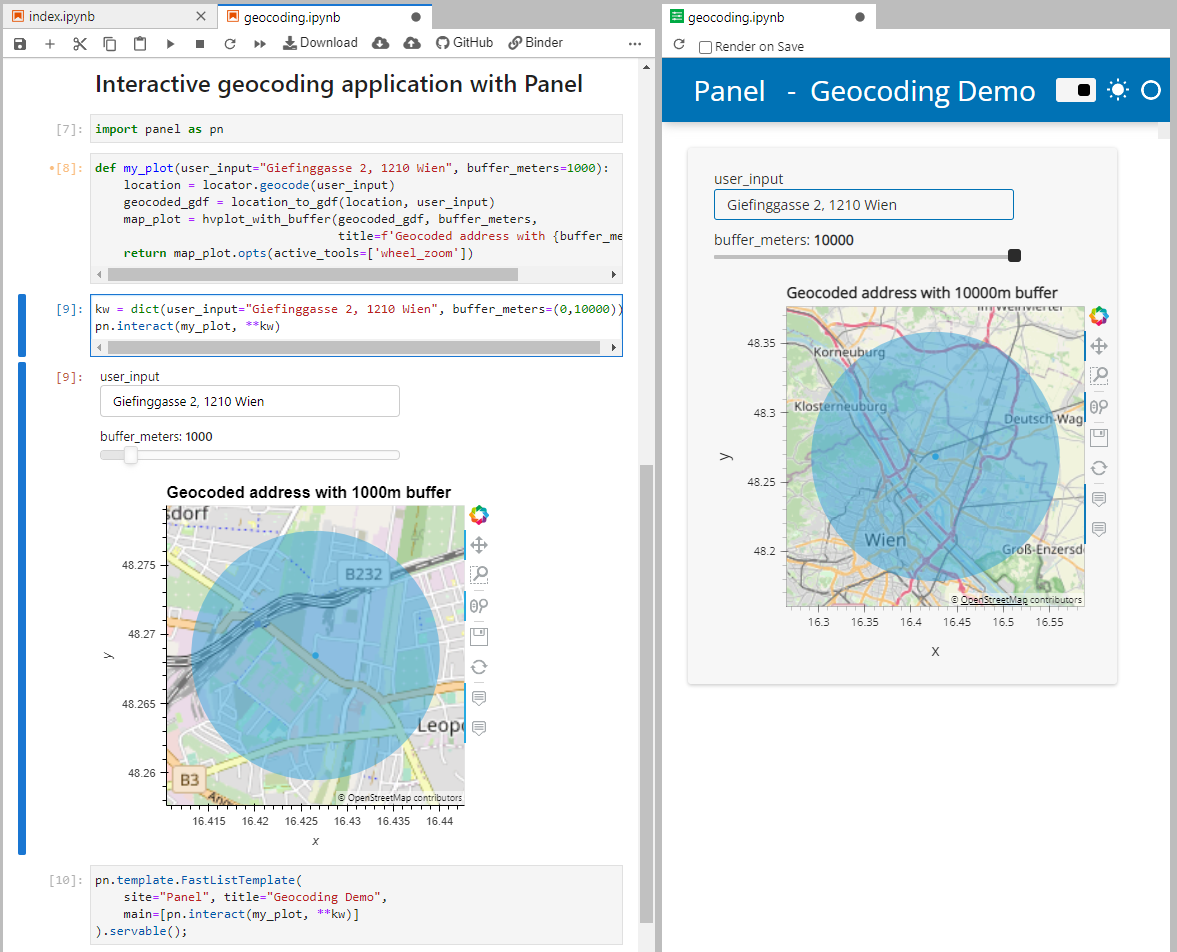
To open the Panel preview, press the green Panel button in the Jupyter Lab toolbar:

I really enjoy building spatial data exploration apps this way, because I can start off with a Jupyter notebook and – once I’m happy with the functionality – turn it into a pretty app that provides a user-friendly exterior and hides the underlying complexity that might scare away stakeholders.
Give it a try and share your own adventures. I’d love to see what you come up with.
