


AGIT & GI_Forum 2015 wrap-up
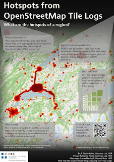
It’s my pleasure to report back from this year’s AGIT and GI_Forum conference (German and English speaking respectively). It was great to meet the gathered GIS crowd! If you missed it, don’t despair: I’ve compiled a personal summary on Storify, and papers (German, English) and posters are available online. Here’s a pick of my favorite posters:

I also had the pleasure to be involved in multiple presentations this year:
QGIS at the OSGeo Day
As part of the OSGeo Day, I had the chance to present the latest and greatest QGIS features for map design in front of a full house:
A. Graser: Kartendesign mit QGis (Top 10 Neuerungen) volles Haus, 2016 im Audimax? #AGIT2015 http://t.co/ShjAOQObg2
—
Jochen Schwarze (@jochens100570) July 10, 2015Routing with OSM
On a slightly different note, my colleague Markus Straub and I presented an introduction to routing with OpenStreetMap covering which kind of routing-related information is available in OSM as well as a selection of different tools to perform routing on OSM.
Solving the “unnamed link” problem
In this talk, I presented approaches to solving issues with route descriptions that contain unnamed pedestrian or cycle paths.
fight "unknown road" driving directions for #cycling and #pedestrian navigation. @underdarkGIS at #GIForum2015 http://t.co/eRvY51gDsP
—
gicycle (@gicycle_) July 09, 2015Here you can find the full open access paper: Graser, A., & Straub, M. (2015). Improving Navigation: Automated Name Extraction for Separately Mapped Pedestrian and Cycle Links. GI_Forum ‒ Journal for Geographic Information Science, 1-2015, 546-556, doi:10.1553/giscience2015s546.
Inferring road popularity from GPS trajectories
In this talk, my colleague Markus Straub presented our new approach to computing how popular a certain road is. The resulting popularity value can be used for planning as well as routing.
Popularity as a viable option for computing alternative routes #GIForum2015 http://t.co/SLZFhLyfVa
—
Anita Graser (@underdarkGIS) July 08, 2015Here you can find the full open access paper: Straub, M., & Graser, A. (2015). Learning from Experts: Inferring Road Popularity from GPS Trajectories. GI_Forum ‒ Journal for Geographic Information Science, 1-2015, 41-50, doi:10.1553/giscience2015s41.

