Related Plugins and Tags

QGIS Planet

Physical Maps on QGIS Cloud

QGIS Cloud is a great cloud hosting service for QGIS Server by Sourcepole. After online registration and installation of an (experimental) plugin, QGIS projects can be uploaded to the cloud quite comfortably.

For a quick test, I tried to recreate the map from “Open Data for Physical Maps”. Right now, one of the limitations is that raster layers cannot be uploaded. Instead of the SRTM data, I therefore chose OCM landscape from OpenLayers plugin to provide some hillshade. The process of uploading data and publishing the project went smoothly and I didn’t encounter any problems.

You can explore the map online at qgiscloud.com/anitagraser/corine_austria.

Considering the complexity of the Corine dataset, rendering is quite fast – certainly much better than on my notebook.


Open Data for Physical Maps

Corine Land Cover is a European program to create a land cover inventory of Europe. The data is freely available and a valuable input for many analyses. In this post, we’ll be using it to create a physical map.

For the background, reused the hillshade presented in “Mapping Open Data With Open GIS”

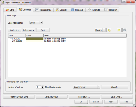
Instead of the standard grayscale, I defined a sand-colored colormap that looks warmer and more natural:

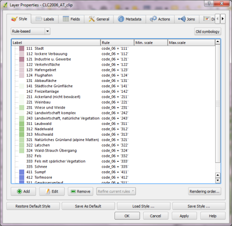
On top of this hillshade, I put the Corine land cover layer. Instead of the official, rather bright colors I selected a more neutral color palette and varying transparency values: Water areas are drawn with no transparency while forests are set to 50 % and built-up areas to up to 80 % transparency. I also skipped classes such as “bare rock” by setting them to be totally transparent:

On top of the land cover, I added a river dataset and styled it with the same color used for water surfaces in the Corine layer. Obviously, this is an optional step. Big rivers are visible within the land cover data too.

After adding a mask and labels, the map is ready to add the finishing touches in Print Composer: Title, explanatory text and a scale bar. I decided against adding a legend to this particular map since I hope that the color choices are intuitive enough.

If you want to create your own physical map, you can use Corine Land Cover for European regions or the National Vegetation Classification in the U.S.


  • Page 1 of 1 ( 2 posts )
  • corine land cover

Back to Top

Sustaining Members