Related Plugins and Tags

QGIS Planet

8th Scottish QGIS UK user group meeting plans

It’s been a long time since we posted anything up here but hopefully the news of another user group happening in Stirling on 7th November will hopefully assuage your distress.

The event is very kindly hosted by Historic Environment Scotland in their restored Engine Shed and is also supported by Ordnance Survey, Cawdor Forestry, thinkWhere, SEPA and Registers of Scotland.

The programme is still being worked out but plan on attending one of two workshop sessions in the morning run by Ordnance Survey and thinkWhere and then a full afternoon of presentations and lightning talks.

Tickets are available through Eventbrite.

8th Scottish QGIS @UK user group

Live stream link

Here is the link to the live stream of the QGIS UK user group meeting in Edinburgh on Thursday.

Videos of the individual talks will be available after the event.

Supported and sponsored by thinkWhere, Ordnance Survey, Cawdor Forestry, EDINA (venue), WRLD3D, Angus Council, Registers of Scotland, Product Forge (streaming), OSGeo:UK (finance)

7th QGIS UK Scottish user group

The next event on the QGIS UK user group roadshow is the 7th Scottish meeting at the Informatics Forum in Edinburgh on 16th November.

Free tickets are available through http://qgis.uk/ but you better hurry – there are only 20 left!

The “I can probably say final agenda” agenda

6th QGIS UK user group meeting in Edinburgh

The 6th QGIS UK user group meeting in Scotland is happening on the 3rd November 2016.  It is being hosted by the EDINA University of Edinburgh at the Informatics Forum and is sponsored by thinkWhere, Ordnance Survey, Angus Council and Cawdor Forestry.  Tickets are available through Eventbrite.

The almost final programme of presentations and lightning talks is as follows:

  • Phil Taylor (CEH) – How deep is your loch?
  • Fiona Hemsley-Flint – QGIS server
  • University of Edinburgh – packaging and deploying QGIS
  • Anouk Lang – Mapping narrative: QGIS in the humanities classroom
  • Art Lembo (Salisbury University, MD) – terrain analysis with massively parallel processing techniques (embarrasingly so)
  • Neil Benny (thinkWhere) – finding the heart of Scotland / viewshed analysis
  • Tom Chadwin – qgis2web and coding a QGIS plugin
  • Pete Wells (Lutra) – WMTS previews and XYZ support
  • Stephen Bathgate – decision support system in Forestry
  • Tim Manners (Ordnance Survey) – Creating an indoor routable network with QGIS and pgRouting
  • Andrew Whitelee – QGIS in forestry/ecology
  • Ross McDonald (Angus Council) – Them thar hills: shaded, textured and blended
  • Michal Michalski (The Origins of Doha and Qatar Project) – DOHA: Doha Online Historical Atlas
  • eeGeo – Using QGIS to create 3D indoor maps

Doors open from 9:00. Registration shortly thereafter. Start and welcome at 9:45 and a planned finish at 16:30. Geobeers to follow.

Agenda for 5th QGIS user group – Scotland

scottish thistleThe 5th QGIS user group meeting in Scotland takes place next Wednesday at the University of Glasgow.  It is being hosted by the School of Geographical and Earth Sciences and has been generously sponsored by thinkWhere and Ordnance Survey.  You can find the draft programme of talks and presentations here: 5th-QGIS-user-group-programme

All tickets are now gone but get on the waitlist and you may be lucky.

See you all there!

In brief: 4th QGIS user group in Scotland

Another sold-out event with a programme packed with useful, interesting and delightful talks. Fifty seven (57!) folk blew in from all over Scotland through a freezing rain but hot coffee and pastries were waiting in the Informatics Forum at the University of Edinburgh.

First up was an overview the current status of the QGIS project by Saber from Lutra Consulting. It was good for people new to QGIS and open-source to see how the project is organised and run and the direction it is taking. Pete, also from Lutra Consulting, then gave a quick summary of the bits of core functionality they have been working on including the new ruled based labelling system.
The group then split into two for 90 minute workshop sessions on cartographic labelling and advanced Atlas usage – a tough choice! Chris, from Ordnance Survey, presented a detailed how-to on the new ruled based labelling tools using some OS open data, interspersed with some slides on guidelines to good cartographic practices and labelling tips. The slides and material for this workshop are available here: https://dl.dropboxusercontent.com/u/185489368/QGIS-Scotland2015.pdf

Heikki, from thinkWhere, lead us through the process of using Atlas in Print Composer to automate map production for a series of maps containing a main context map and an inset overview map. Nothing better than doing something once and then being able to repeat it at the click of a button! The slides and material for this workshop are available here: https://github.com/HeikkiVesanto/Scottish_QGIS_User_Workshop

A break for lunch and a good hour of catching up with users from across all sectors – local government, central government, academia, forestry, planning consultancies, developers, student life and education. QGIS is popular and is obviously a flexible tool that meets many demands.

After lunch, Neil, from thinkWhere, organised a quick-fire “quirky QGIS quiz” with random questions from all aspects of FOSS4G demanding quick thinking for true/false answers. At least half the audience grabbed prizes courtesy of thinkWhere and Ordnance Survey.

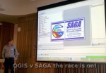
What followed was a series of lightning talks on different aspects of using QGIS. Amy, from Cawdor Forestry, gave a brief overview of the plugins available in the QGIS plugin repository and highlighted some of her personal favourites. Paul, from Scottish Water, showcased some of the complex workflows created using SAGA, QGIS and the Processing Toolbox to model hydrological process. Ross, from Inverclyde Council, demonstrated the use of the QGIS Road Graph plugin to generate walking routes to school across a custom road and path network. Seb, from West Dunbartonshire Council, showed us how QGIS had put them in a happy place and showed how a “hearts and minds” campaign championing QGIS had changed the way they worked. Steve, fae Embra, gave some information on how to give back to the QGIS project through submitting Processing scripts and plugins to the repository. Don’t reinvent the wheel! Ross, from Angus Council, gave a quick demonstration of setting up a local plugin repository that could be used to share custom plugins or control access to plugins in an internet-less environment.

By this time, tea and cake was required and it gave everyone an opportunity to mix and ask questions of the speakers.

The last session was as series of longer talks started by Gemma, from Ordnance Survey, explaining how open-source software is used extensively at Ordnance Survey to underpin a lot of the cartographic processes and workflows. They use QGIS 2.8 LTR for stability and consistency across the business and a selection of plugins from both OS developers and the community. QGIS is used to generate all the cartographic styles sheets for the OS vector products: https://github.com/OrdnanceSurvey/OS-VectorMap-District-stylesheets

Tom, from EDINA, explained the processing of creating and delivering a QGIS training course to University staff and students. The first class sold out in next to no time and there is demand for more. Makes sense really, doesn’t it?

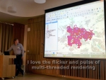
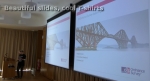
Steve, from GeoGeo, wrapped up the day with the kind of mapping we’d all like to be doing – high resolution elevation models, time series analysis of shadows, viewsheds across the Edinburgh skyline and analysis of rooftops for potential solar panels with sub 1m resolution LiDAR datasets. He uses a mix of QGIS, SAGA, Blender and other FOSS to inspiring effect. Check his Flickr stream: https://www.flickr.com/photos/stevefaeembra/

The day finished with Pete (Lutra Consulting) releasing into the open a new Search plugin for QGIS called Discovery (http://www.lutraconsulting.co.uk/products/discovery/) based on the PostGIS Search plugin from Tim Martin (Ordnance Survey). A very useful addition to any QGIS installation.

The day was sponsored by EDINA, thinkWhere and Ordnance Survey.

Links to slides will be coming shortly.

4th QGIS UK user group meeting in Edinburgh

4th QGIS UK user group EdinburghOK. Here it is. The official call for offers of speaking, running a workshop, doing a lightning talk, generally helping, and sponsoring the 4th QGIS UK user group meeting in Scotland on 16th November. Tom Armitage has booked the Informatics Forum in Crichton Street for us again.

Tickets are available here: http://www.eventbrite.com/e/uk-qgis-user-group-scotland-tickets-19194628651

I am open to suggestions from you, the users, about how the day is organised but I imagine something that has a few talks, a workshop session and a good lunch break would tick most boxes.  So get in touch and let’s make it happen.

Use the contact form on the About Us page to get in touch or via twitter @mixedbredie.

Sponsored by OS thinkWhere EDINA


4th QGIS UK user group meeting in Edinburgh

4th QGIS UK user group EdinburghOK. Here it is. The official call for offers of speaking, running a workshop, doing a lightning talk, generally helping, and sponsoring the 4th QGIS UK user group meeting in Scotland on 16th November. Tom Armitage has booked the Informatics Forum in Crichton Street for us again.

Tickets are available here: http://www.eventbrite.com/e/uk-qgis-user-group-scotland-tickets-19194628651

I am open to suggestions from you, the users, about how the day is organised but I imagine something that has a few talks, a workshop session and a good lunch break would tick most boxes.  So get in touch and let’s make it happen.

Use the contact form on the About Us page to get in touch or via twitter @mixedbredie.

UPDATE: 4th-Scottish-QGIS-user-group-meeting agenda now available.

Sponsored by OS thinkWhere EDINA

QGIS UK Edinburgh – Photos

QGIS UK user group Edinburgh QGIS UK user group Edinburgh QGIS UK user group Edinburgh QGIS UK user group Edinburgh QGIS UK user group Edinburgh QGIS UK user group Edinburgh QGIS UK user group Edinburgh QGIS UK user group Edinburgh QGIS UK user group Edinburgh QGIS UK user group Edinburgh QGIS UK user group Edinburgh QGIS UK user group Edinburgh

Scottish QGIS User Group – 21 October, Edinburgh

The next QGIS user group meeting in Scotland is happening on 21st October 2014.
It is being held in the School of Informatics at Edinburgh University.  For more info about the venue: http://www.ed.ac.uk/schools-departments/informatics/about/location

This is your chance to offer a short talk or presentation or workshop so we can build an exciting programme for the day.  The final programme and agenda will be released closer to the date.  Please let me know through the contact form or comments or twitter (@mixedbredie) if you have a presentation or talk you would like to share.

Ross


Slides – Scottish QGIS User Group Meeting

An introduction from Ross McDonald to the inaugral QGIS user group meeting in Scotland.

Neil Benny from thinkWhere getting passionate about QGIS and open source spatial software.

Martin Dobias from Lutra showing us the super performance enhancements coming in the next version of QGIS.

Charley Glynn from Ordnance Survey demonstrating some of the map eye candy they’re producing with QGIS.

Pete Wells from Lutra showing us how to use Python with QGIS.

Videos of the talks will be posted here including Heikki Versanto showing how to connect to a huge variety of data sources.


Scottish QGIS User Group 19th March 2014

scottish thistleThe Scottish QGIS user group meeting is happening on 19th March 2014 in Stirling at the Stirling Management Centre.  Doors open at 9:30 with a 10:00 start and a planned finish of 16:00.  Registration is through Eventbrite and there are 50 places available working on a first come, first served basis.

Details on how to get to the Stirling Management Centre are available here.

The agenda will be published a bit closer to the time once speakers have been finalised.  If you would like to present let me (Ross McDonald) know as it would be good to have a mix of input to the day.  There are both 20 minute and “lightning talk” 5-10 minute slots available.

A big thank-you to thinkWhere for hosting this first QGIS user group event in Scotland.

If you want two days of geo discussion then think about attending the AGI Scotland – Future Cities event in Glasgow the day before.  Check the AGI Scotland website for more details.


Scottish QGIS User Group Overview

Scottish QGIS User Group
Stirling, 19th March 2014

It was a long time coming but the wait was worth it. Forty two excited QGIS users and open-source GIS enthusiasts arrived at the Stirling Management Centre on a brilliantly sunny March day.  People had traveled from all over the UK to make the day happen: Charley Glynn from OS in Southampton, Pete Wells, Martin Dobias and Saber Razmjooei from Brighton as well as others from Aberdeen, Inverness, Dundee, Edinburgh, Glasgow, Cumbria and most places inbetween. The event was supported by thinkWhere, based in Stirling, and Neil Benny and Heikki Vesanto provided suitably geeky geo entertainment.

Neil Benny, QGIS EvangelistFirst up was Neil Benny (thinkWhere) who provided us with an overview of QGIS through the years to the current top features available in version 2.2 “Valmiera”. The questions on everyone’s minds were answered when he presented a series of slides outlining the benefits of using open source software, highlighting the savings and investments and the importance of investing in training. His top 10 feature comparison of proprietary v open source desktop GIS provoked much discussion.

After a coffee break I presented a short talk on how Angus Council is moving to a mixed hybrid GIS environment to take advantage of the flexibility of the open source licence and the variety of tools available to deliver results. Available here http://vimeo.com/89959143

Martin Dobias of Lutra Consulting and core QGIS developer revealed some of the performance enhancements available in the development version of QGIS. The multi-threaded multi-core rendering impressed everyone and will prove a huge draw card to seasoned GIS’ers used to single threaded applications.Martin Dobias, Core Developer

Saber Razmjooei (Lutra) filled in an open slot talking about the autoTrace plugin they developed for a group of Local Authorities across the UK. Modeled on the MapInfo trace tool it forms a key part of a lot of Council workflows and is a good example of how future plugin development work can deliver savings.

Pete Wells, plugin developerPete Wells (Lutra) delivered a very comprehensive overview of Python and QGIS and how they interact at different levels through the python bindings. There was a lot of interest in this and this was reflected in the feedback forms we collected where Python, plugins, hands-on workshops and tutorials feature high on the list of wants.

Charley Glynn (OS) unveiled some fantastic cartography using the OS vector products of MasterMap, VectorMap Local and District. He also revealed the work OS has been doing to make corporate styles available to the public and the Ordnance Survey’s bias towards open source software. Again the feedback forms revealed a desire to get hands on with QGIS to create good looking custom cartography. The next Scottish user group meeting will definitely be having some hands-on workshops.Charley Glynn, OS Cartographer IMG_20140319_152620

Heikki Vesanto (thinkWhere) bravely ventured into live demos of how to connect to just about any spatial data format available. Local files, local databases, WMS feeds, WFS feeds, text files, CSV and URLs with images and custom map templates using the Atlas generator. An excellent overview of just how flexible QGIS is when it comes to consuming data and converting data to almost every format supported by OGR and GDAL.

Thanks must go to the generosity of thinkWhere in supporting a feature filled programme of presentations and keeping us topped up with coffee. As a result the first Scottish QGIS user group meeting was a success and there is definitely a desire for more events like this.

Slides and videos of the presentations will be available here shortly.


Scottish QGIS User Group

scottish flagThe inaugural Scottish QGIS user group meeting is being planned and organised for mid-March next year.  If you would like to participate, I am looking for user presentations, case studies, map displays and practical demos and tutorials.

The event will be held in Stirling and will be a full day of networking and open-source geo-goodness.  Full details will go out in the new year and will be available through Eventbrite, this blog, the Google+ group, Twitter and probably a heap of other channels.  After the success of the English and the Welsh events we are hoping the Scottish event will raise the bar even higher.  Please use the contact form to get in touch with me, Ross McDonald.


Programme: Scottish QGIS User Group

The programme of events for the Scottish QGIS user group meeting in Stirling is now available:

Time

Event

Speaker

9:30

Registration

10:00

Welcome Ross McDonald / Alan Moore

10:30

QGIS Evangelism Neil Benny

11:00

Break

11:30

Data auditing in PostGIS Mike Saunt

12:00

QGIS performance enhancements Peter Wells

12:30

Lunch

13:30

Land Terrier Management Mike Saunt
Developing QGIS Martin Dobias
User Group, eh? Ross McDonald

14:30

Break

15:00

Cartography in QGIS Charley Glynn
Data Connections in QGIS Heikki Vesanto

16:00

Close
Geobeers

You can download the ScottishQGISUserGroupAgenda here.


  • Page 1 of 1 ( 15 posts )
  • scotland

Back to Top

Sustaining Members