We are extremely pleased to announce the winning proposals for our 2017 QGIS.ORG grant programme. Funding for the programme was sourced by you, our project donors and sponsors! Note: For more context surrounding our grant programme, please see:
Our intent with the QGIS.ORG Grant Programme is to support work from community that would typically not be funded by client/contractor agreements, and that contributes to the broadest possible swathe of our community by providing cross-cutting, foundational improvements to the QGIS Project.
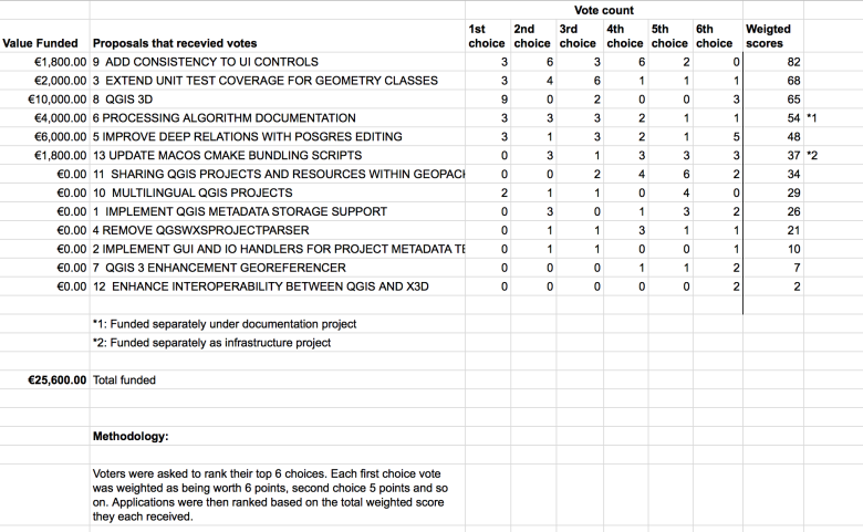
Voting to select the successful projects was carried out by our QGIS Voting Membership. Each voting member was allowed to select up to 6 of the 13 submitted proposals by means of a ranked selection form. The full list of votes are available here (on the first sheet). The second sheet contains the calculations used to determine the winner (for full transparency). The table below summarizes the voting tallies for the proposals:
A couple of extra notes about the voting process:
- The PSC has an ongoing program to fund documentation so elected to fund the processing documentation work separately from the grant programme (note *1).
- Voting was carried out based on the technical merits of the proposals and the competency of the applicants to execute on these proposals.
- No restrictions were in place in terms of how many proposals could be submitted per person / organization, or how many proposals could be awarded to each proposing person / organization.
- Because of the importance of having good packaging systems on each of the three major platforms, the PSC elected to additionally fund the work on MacOS bundling scripts (note *2).
- Although the budget for the grant programme was €20,000.00, the total amount for the four winning proposals is €19,800.00, with an additional €5, 800.00 being made available to support the processing work and and MacOS packaging work.
- Voting was ‘blind’ (voters could not see the existing votes that had been placed).
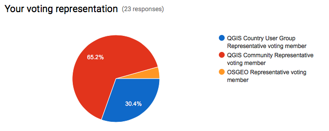
We had great participation in the voting process. Of the 27 voting members, 23 registered their votes.
On behalf of the QGIS.ORG project, I would really like to thank everyone who submitted proposals for this call. There were many interesting proposals that I believe would be of great benefit to QGIS and I hope others perusing the proposals list will use their initiative and funding interesting proposals independently if they can.
Below you can find the detailed proposals of the successful applications – we look forward to seeing the results of their work land in the code base soon!
Details of the approved grant proposals
9 ADD CONSISTENCY TO UI CONTROLS
Proposer: Nyall Dawson
Amount: €1800
Details: Across the QGIS UI, numerous inconsistencies exist in the way different properties like opacity and rotation are exposed to users. These inconsistencies make QGIS harder to use, as behavior from one dialog differs to the behavior in another dialog. Some examples of this include:
- Rotation of labels is done in the opposite direction in labeling to symbology. Accordingly, an equal rotation value will result in different rotation between labels and symbols.
- Scales are inconsistently presented, with use of both the scale numerator and denominator in different dialogs. “Minimum” and “Maximum” scales also vary between dialogs, with some dialogs using “minimum” scale as the largest scale and some using “minimum” as the smallest scale. The labeling scale based visibility controls are the biggest offenders here.
- Controls vary between specifying “opacity”, “transparency” and “alpha”. While these all have similar results, users must adopt values to map “opacity” to “transparency” in different dialogs. This is further compounded by different ranges used for each (eg 0-100%, or 0-255).
Due to the usual API freeze, it has not been possible to fix these discrepancies. The current API break introduced with version 3.0 allow a window for addressing these issues and standardizing behavior and API.
Despite the benefits in providing a consistent UI, the work involved in standardizing is fiddly (careful attention must be paid to not breaking existing projects) and repetitive, and unlikely to be undertaken by developers on a volunteer basis. Furthermore it is highly unlikely that a commercial organisation could justify sponsoring UI standardisation efforts. Without grant funding it is unlikely that these issues will be addressed during the 3.0 development cycle, and the inconsistencies would remain for the lifetime of QGIS 3.x.
In this proposal I will:
- convert all “transparency” controls to “opacity” controls, and consult with the community to determine the ideal value range presented (0-100% or 0-255) before making all opacity controls use the same range.
- Ensure that rotation always operates in the same direction.
- Fix the labeling scale ranges to use the same scale range definitions as layer visibility
- As much as possible, automatically upgrade existing projects so that they open in QGIS 3.0 without any loss of transparency/rotation/scale settings
- (As much as possible without large refactoring), adapt the PyQGIS API so for consistent naming and use of opacity/rotation and scale setting/getting methods. Making the API consistent makes scripting QGIS and writing plugins easier.
This proposal relates to the issues described at:
History: No work has currently been undertaken in this regard.
Qualifications: I am currently one of the most active QGIS developers, with a long history of quality contributions to the project. I’m passionate about seeing QGIS 3.0 address these kinds of long standing UI issues which detract from QGIS’ otherwise professional image and ease of use.
Implementation Plan: The work will be undertaken prior to the QGIS 3.0 feature freeze period.
Proposal Link:
3 EXTEND UNIT TEST COVERAGE FOR GEOMETRY CLASSES
Proposer: Nyall Dawson
Amount: €2000
Details: Since QGIS 2.8, there has been an increased focused on creation of quality automated regression (“unit”) tests designed to flag issues in code before the code is introduced to the QGIS codebase. The increase in stability of recent QGIS versions can be directly attributed to this growth in unit testing. Despite this, many areas of the QGIS codebase remain with little or no unit test coverage.
One critical area which has insufficient unit tests is the geometry classes. The geometry classes form the basis of all geometry interpretation, algorithms, and rendering within QGIS. In order to provide stable QGIS releases, it is crucial that these fundamental classes are rock-solid, efficient, and do not suffer regressions between releases.
Some years ago (shortly after the introduction of the new geometry engine, in which support for Z/M values and curved geometries was added) I added full test coverage for the Point and Linestring classes, and partial coverage for the Polygon class. Unfortunately, writing geometry tests is tricky and time consuming. There’s many corner cases with unusual or invalid geometries which need to be tested. The time commitment required prevented me from writing additional tests, and to date the remaining classes (including multi geometries and all curved geometry types) have little or no test coverage.
This proposal covers writing additional unit tests to cover all the remaining geometry classes.
It is important to note that unit tests do NOT ensure bug free software. Unit tests only protect existing logic and avoid regressions when the covered parts of the code base are changed in future releases. Despite this disclaimer, the process of creating unit tests usually stress-tests existing code and in itself CAN reveal existing bugs. This was certainly the case when the existing tests for Point and Linestring classes were added – creation of the tests alone resulted in many fixed bugs and stabler Point and Linestring geometry handling.
History: This work would continue on from work I begun a number of years ago to provide 100% unit test coverage for the base geometry classes.
Qualifications: I have a long history of quality contributions to the QGIS project, and am currently one of the most prolific committers to the QGIS codebase. I have a long history with adding unit tests to QGIS and advocating for their increased usage amongst developers.
Implementation Plan: This work would be targeted to the QGIS 3.0 release, and would be committed to the codebase prior to the feature freeze/bug fixing period leading up to the 3.0 release.
Proposal Link:
8 QGIS 3D
Proposer: Martin Dobias
Amount: €10000
Details: I would like to propose a project that introduces 3D rendering capabilities in QGIS.
To summarize the planned work, the following features can be expected:
- 2D view of map canvas rendered on the graphics hardware (GPU) allowing smooth zooming and panning of map view
- 3D perspective view of the map
- generation of 3D terrain model from DEM (digital elevation model) layers
- map layers rendered as a texture on top of the 3D terrain
- support for true 3D rendering of vector layers rather than having just flat appearance
- map view widget that is dockable in the main window and synchronized with the main map canvas
- support for picking (identification) of objects in 3D view and X/Y/Z coordinate display
- support for 3D map view in map composer
The overall target is to introduce an extensible framework for 3D map view within QGIS, so that in the future developers can add various 3D rendering techniques for map data, using custom geometries and materials (which may involve writing own vertex/fragment shaders), possibly even allowing multi-pass rendering for advanced effects (e.g. to render shadows cast by buildings with a particular sun position).
3D support in QGIS is not only about adding the extra dimension to the rendering: it is also about making it possible to use graphics hardware for rendering of map in 2D – making map browsing even more pleasant and faster at the same time. Rendering 2D maps with OpenGL also opens the door to various new graphical effects that would be otherwise very expensive
to achieve by using just CPU for map rendering.
This proposal does not assume addition of new geometry types like polyhedral surface (with read support for those) into QGIS – the aim of the work is to get 3D rendering engine running and new geometry types may be added at some point later.
State of the art
QGIS features very good 2D rendering capabilities, however its 3D support has been very limited. Prior work on 3D in QGIS includes:
- Globe plugin – a C++ plugin developed by Matthias Kuhn and Sourcepole based on OpenSceneGraph and osgEarth libraries. OpenSceneGraph is a generic toolkit that provides higher-level abstraction on top of OpenGL, making it easier to develop 3D applications than directly using low-level OpenGL interfaces.OsgEarth project then builds on top of OpenSceneGraph and provides a toolkit for working with geographical data: it has a terrain engine that combines elevation layers into a terrain, applies textures from “image” layers and adds feature layers with true 3D objects.The plugin acts as a bridge from QGIS environment and feeds scene data into osgEarth to do the 3D rendering.
- Qgis2threejs plugin – a Python plugin developed by Minoru Akagi. It is able to export QGIS project (with various configuration options) into a HTML page that uses three.js library to render map in 3D within web browser using WebGL.
- Horao – developed by Oslandia. It is a standalone 3D viewer based on OpenSceneGraph that may be controlled by a QGIS plugin to display map from QGIS in 3D environment. It has explicit support for true 3D geometries in PostGIS.
While these projects solve some use cases for 3D rendering of map data, each of them have their own limitations. For example, osgEarth library used by Globe plugin has its own data access and rendering of vector features implementation, duplicating QGIS code and not having parity in their capabilities. Moreover it has been difficult over time to keep the build working on all platforms supported by QGIS. The main limitation of Qgis2threejs plugin is the fact that the 3D view is exported to web browser, so the user cannot use benefits of having 3D view tightly integrated with the rest of QGIS. The fact that Horao has a standalone viewer
application results in similar limitations as when using Qgis2threejs (although it has some degree of integration with QGIS application).
Proposed approach
Now that QGIS 3.0 is based on Qt5, we can use some of the great new functionality added recent releases of Qt5. In version 5.5, a new framework for working 3D graphics has been introduced and every major Qt5 release since has been adding more functionality, improving performance, compatibility and stability. The 3D support nicely integrates with the rest of the Qt framework, providing a familiar API and at the same time staying very generic and highly efficient.
The 3D framework provides high level abstractions just like other libraries (e.g. OpenSceneGraph, three.js). 3D scene is built with nodes (called entities) with various components (e.g. transformation, mesh, material).
The idea is to build 3D support in QGIS on top of the Qt 3D framework. From my initial tests of the framework this looks feasible and it will allow us to stick with Qt APIs without requiring extra dependencies.
The work can be divided into the following chunks of work:
- Rendering engine core: develop a framework that will do rendering of the map scene in 3D. The engine will have the responsibility of processing raster layers with elevation into a mesh geometry and texturing the mesh with map images rendered by the existing QGIS 2D rendering engine. The engine will support levels of detail (LOD) and tiling in order to be able to display high-resolution data in real time without having to load all the data into memory at the time of scene creation (which may be prohibitively expensive with more complex layers). 3D scene will be dynamically updated as user browses the map, keeping the amount of rendered triangles low while appropriate quality of the terrain for given zoom level.
All of the processing needs to be done in the background, so the user may freely browse the map and the scene will be continuously updated with data (changing between higher/lower detail when zooming, loading more data when moving map).
- Handling of user input: controller for camera that will make the camera fly on top of the map. Support for picking will be added to allow identification of objects in the map and display of coordinates at the mouse position.
- Integration with QGIS environment: dockable 3D map widget for the main window, synchronization with 2D map canvas, support for printing of 3D views in map compositions.
- Advanced 3D rendering techniques: interface that will allow adding new methods for data visualization in 3D and exploration of methods for rendering. By default map layers will be rendered into map image with the existing 2D map renderer – this interface will allow map layers to instead have 3D renderer associated which will provide entities with custom meshes and materials. As a result we will be able to achieve true 3D appearance of objects (e.g. point clouds, trees as 3D models, tesselation of polygons, buildings with extruded geometry and custom texture). Implementation of the advanced techniques is a task with nearly unlimited scope, so the idea is to develop a suitable interface and as the time will allow, implement some techniques.
History: For this proposal I have studied various sources:
- looked into existing 3D viewer projects related to QGIS
- explored Qt 3D framework
- researched some academic papers regarding terrain generation and vector data display
As a proof of concept, I have created a simple prototype in C++ using Qt 3D framework. It displays aerial imagery on top of a terrain model created from a raster layer (DEM) and allows simple camera control. The code is available here: https://github.com/wonder-sk/qgis3d
Qualifications: I have been a core QGIS developer for more than 10 years and I have a very good knowledge of QGIS codebase, especially the existing 2D map rendering pipeline.
Previously when working at the university, on a project for stereo matching (creation of point cloud out of a pair of images) I worked on visualization of 3D data using OpenGL.
Implementation Plan: The plan is to work on the project between May and July 2017. As of now, the plan for QGIS releases (according to the mail from Paolo) is that QGIS 3.0 will have feature freeze in July 2017 and final release in September 2017. If nothing changes in the QGIS release schedule in meanwhile, the 3D support could be integrated into QGIS master branch before the feature freeze and thus released in QGIS 3.0.
If the project would be accepted, the first step will be to develop a prototype of the 3D rendering engine, then prepare a more detailed architecture proposal as a QEP and continue the implementation once the QEP gets accepted by the community. The work progress should be available on a branch in GitHub for anyone interested.
Proposal Link: https://github.com/wonder-sk/qgis3d
6 PROCESSING ALGORITHM DOCUMENTATION
Proposers: Matteo Ghetta, Alexander Bruy
Amount: €4000
Details: This proposal aims to improve the existing Processing algorithms documentation. With the pull request https://github.com/qgis/QGIS/pull/3911 it is possible to add external links for the documentation (both local and remotes). However the effective use of the pull request is not yet included in Processing.
With this proposal the existing code will be incorporated in Processing, allowing to have a Short Help tab (the existing one on the right of the Processing algorithm window) and a Long Help tab (next to the Log tab).
The Short Help tab will be collapsible in order to have a bigger window for the algorithm parameters, while the Long Help tab will point to the on-line existing documentation of Processing for each algorithm (http://docs.qgis.org/testing/en/docs/user_manual/processing_algs/index.html).
The default link of the on-line documentation will be added in the QGIS Settings (thanks to the pull request already merged) in order to have the standard documentation visible but to let the user the choice to overwrite it and load custom paths.
In addition to the code part, this proposal aims also to document the GDAL/OGR provider and the QGIS core algorithms. Existing documentation will be reviewed and pictures will be added when useful, while for algorithm not yet documented, the help will be written from scratch with description and additional pictures.
Currently there are:
- 49 GDAL/OGR total algorithms, 35 to enhance with pictures, 14 to write from scratch
- 154 QGIS algorithms, 38 to enhance, 116 to write from scratch
This means a total of 73 algorithm to enhance and 130 to write from scratch.
History: The pull request https://github.com/qgis/QGIS/pull/3911 is already merged and it is worth to make it effective to have nice, rich and translatable documentation for the Processing algorithms.
Qualifications: Matteo Ghetta: working since the release 2.0 on the documentation and made several improvements and pull request to both documentation and Processing code.
Alexander Bruy: core developer since 2010, co-maintainer of the QGIS Processing framework.
Implementation Plan: The code and the documentation will be ready for the QGIS 3 release.
Proposal Link:
5 IMPROVE DEEP RELATIONS WITH POSTGRES EDITING
Proposer: Régis Haubourg
Amount: €6000
Details: QGIS has reached a mature level and offers now a very good framework to create professional applications. One of the main reasons is that QGIS is a very strong client for spatial databases, and in particular with PostgreSQL and postGIS for which it was initially created.
Since version 2.14, QGIS offers the not-so-well-known ability to handle transaction groups, which means it can instantly evaluate triggers on database side, and refresh all layers in the same transaction. This is a big win for usability, but some drawbacks glitches remain, such as the lack of the undo/redo edit buffer, a very raw way of saving (ie quitting edition session) or having the legend cluttered by so many edit symbols (a pen symbol). Current proposal is to go a step beyond to make QGIS even better for PostgreSQL by achieving the following targets:
1 Restore an undo /redo feature by taking advantage of PostgreSQL. If possible we will try to take advantage of PostgreSQL named Savepoints.
2 Allow to have some layers not switching to edit mode in QGIS, even if they belong to the same connection. These layers will still benefit from the instant refresh, but won’t clutter the legend with the edit pen symbol everywhere, nor risk to load QGIS snapping cache for nothing. A UI for those settings could be an evolution of the current “identify layer” list in the project properties.
3 We would like to submit a mechanism to allow converting error messages raised by the provider, like a RAISE from postgres, into custom user oriented message. Say for instance, instead of a “provider error – duplicate key for… “, QGIS project could be tuned to display first “You tried to insert a feature using the same identifier as another one”.
The error message list and regexp rules would be optionally stored in qgis project or read from a datasource table (for instance when error messages rewrites are shared by other applications). The original error message would be still avaiblable by expanding the details of the messageBar and in the general message log.
4 Cherry on cake point, we wish to have QGIS take advantage of PostgreSQL NOTIFY signals to trigger behavior in QGIS when something changes in the database (see https://www.postgresql.org/docs/9.5/static/sql-notify.html) . A first implementation proposal is to allow a map canvas refresh, but we can imagine really dynamic applications driven by the database events by converting NOTIFY messages into QGIS signals (oh yeah!).
History: In our team, we already use transaction groups for production tools and that is much appreciated. We already use some python logic to catch error message and convert them to more user oriented ones. We frequently develop applications where QGIS is linked with heavy database containing most of the intelligence. Having a really interactive edition process, speaking the same langage as average users, and being able to be triggered from database process will unleashed many possible applications.
Qualifications: Oslandia has three QGIS developers, two of them being core comiters and high skills with Postgres and Postgis (core comiter too). We believe that developing using thick databases is a major strength of QGIS, and we have great fun getting involved in that area of the code 
Implementation Plan: We currently are quite involved in QGIS 3 server refactoring and major changes such as Auxiliary Storage for project or core solutions for label connectors. We also are involved in applications build on top of QGIS for Water management like QWAT or QGEP. Such changes would benefit immediatly to those project. Our target is to provide those improvements with all necessary unit tests for 3.0 release.
Proposal Link: coming soon..
13 UPDATE MACOS CMAKE BUNDLING SCRIPTS
Proposer: Larry Shaffer
Amount: €1800
Details: Currently, the macOS bundling routines (to create a self-contained QGIS.app application) in CMake scripts where created by William Kyngsburye many years ago. Since then, CMake has added many features for bundling, e.g. BundleUtilities ( https://cmake.org/cmake/help/v3.0/module/BundleUtilities.html), that handle similar functionality to what has been arduously maintained in the CMake scripts. While the current setup does function, it is quite antiquated and adding any new QGIS dependencies to be bundled is an error-prone ordeal. I propose to fully update the bundling routines to leverage modern CMake capabilities, since building on macOS usually uses the latest CMake versions. Once completed, anyone with appropriate dependencies should be able to produce a production-ready QGIS.app bundle, including the QGIS project itself.
History: I will first build upon the existing work to ensure there is a minimal bundled QGIS.app, then completely refactor the same functionality using a modern CMake code workflow.
Qualifications: I have extensive knowledge in CMake and frequently utilize it in my work for my employer, Boundless Spatial. I have already completed a fully bundled QGIS.app distribution by my employer (similar to the first phase of the proposed work here), though Boundless now uses a different installation approach. I have been working for years on the OSGeo4Mac project in anticipation of producing better CMake bundling routines, to ensure the QGIS project can independently produce its own macOS distributions.
Implementation Plan: Basic work will follow these steps:
- Append minimal bundling to existing CMake setup, so there is a least a functioning bundling routine, regardless of whether the proposed work is accomplished in time for the major next release.
- Ensure the QGIS.app bundle is code-signed
- Create a new methodology, based upon CMake’s BundlesUtilities, *in-line* next to the existing CMake routines, so both can be used, until there is a valid replacement.
- Focus on minimal bundling, then add GRASS
- Continue extending bundling routines to include major Processing providers, e.g. OTB, Saga, TauDEM, etc.
- Ensure new method’s QGIS.app is properly code-signed
- Enable bundling on Travis CI infrastructure, via Travis’ cron jobs, thereby adding the capability for the QGIS project to produce fully bundled nightlies of macOS builds.
- Once new method represents a full replacement, old method will be removed, not just deprecated
Intended completion is in time for QGIS 3.0 release and packaging efforts.
Since the new method does not affect any existing code, as soon as useable functionality is achieved, it will be merged directly into master, then further code committed as work progresses.
Proposal Link: None at this time. Should I consider a QEP? Not many developers beyond the few existing packagers and experimenters would be involved. I would prefer to write a blog post after the work is completed, though post to the QGIS dev mailing list the intention to do the work, if this proposal is granted.


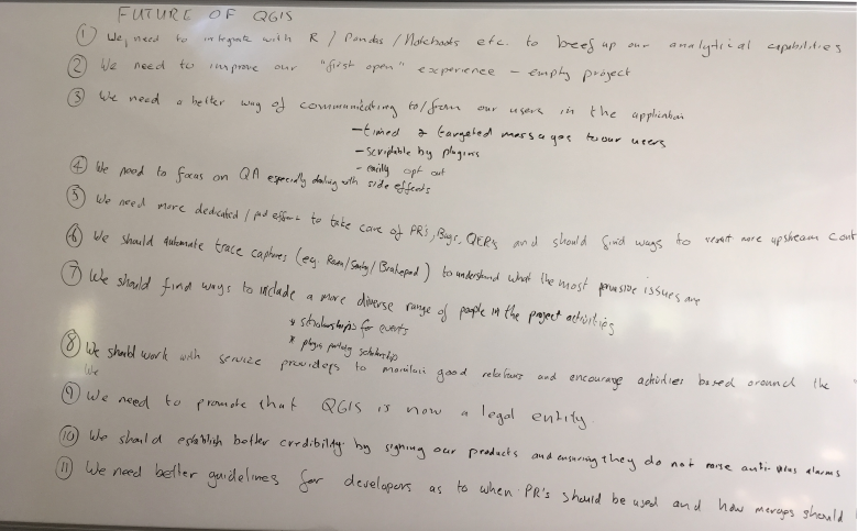
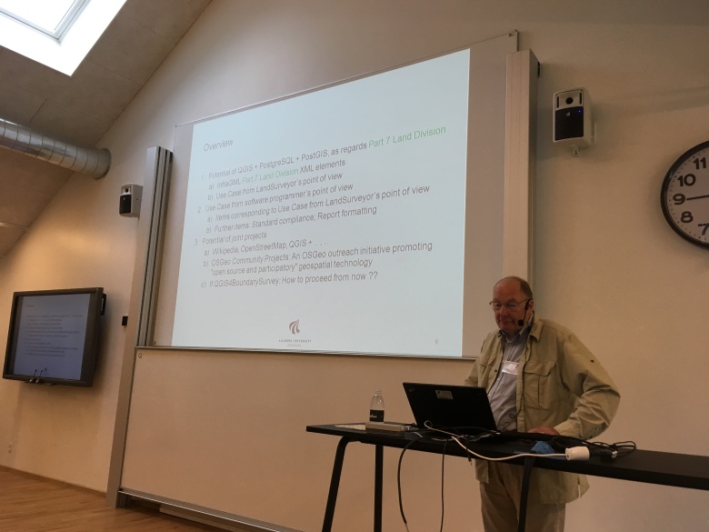
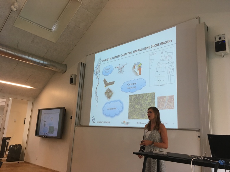
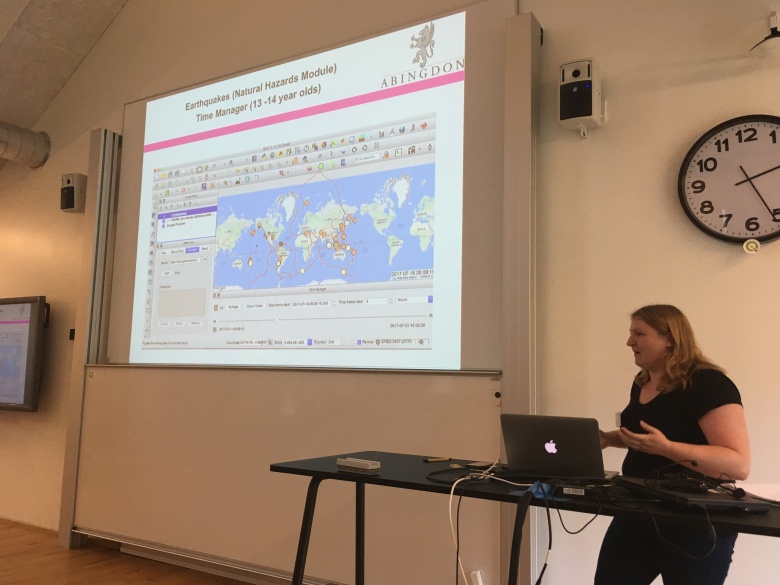
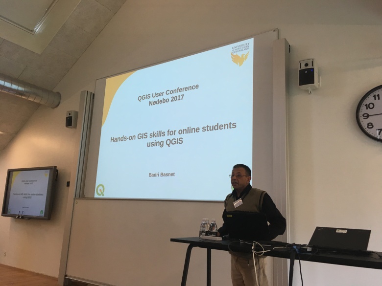
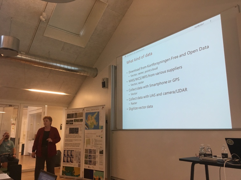
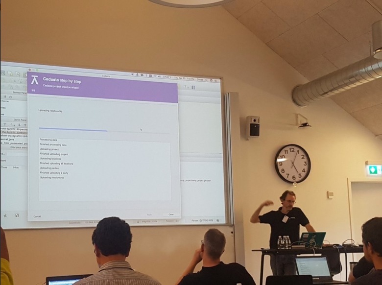
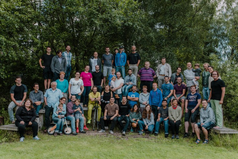
 and to reminisce. For example, about the awesome time we had at the first QGIS User Conference organized at the University of Copenhagen campus in Nødebo.
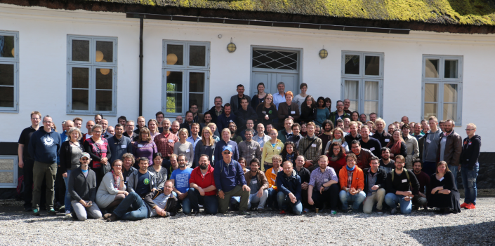


 ). Services like