One of my favorite features of QGIS – Rule based styling.
One of my favorite features of QGIS is the rule based rendering.
If you’re using MapInfo think of thematics + queries but on steroids. Rule based rendering allows you to you set, well, rules on what gets rendered and how. The rules are based on a simple SQL style query language that’s built into QGIS.
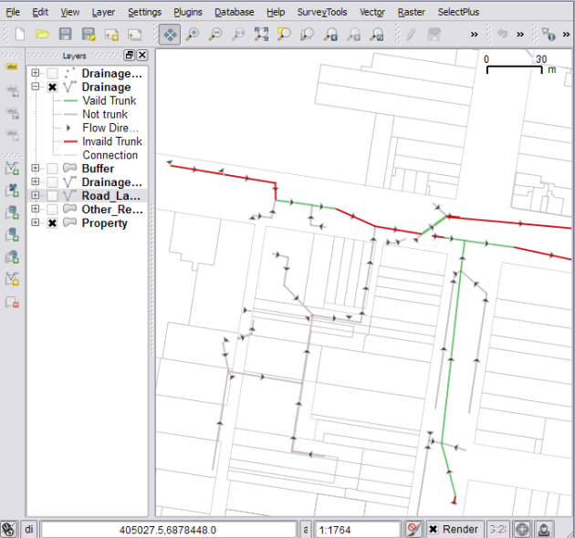
Take for example the above screen shot. The screen shot is from a current project I am doing in QGIS to clean up our current stormwater/drainage layer. The layer is a in a bit of a mess at the moment so I needed a way to visualize what I have cleaned up and what I haven’t, so enter QGIS rule based styling.
For example: A pipe that has an upstream and downstream invert and is part of the trunk (main) network is then considered valid (for this situation anyway), so I created the following rule:
network_type = 'Trunk' AND Description != 'Drainage Imaginary Pipe' AND (US_Invert > 0 AND DS_Invert > 0)
We also have little connecting pipes that I don’t want to include in valid trunk as they are only used to connect pits to pipes and are just cosmetic, I have excluded them by adding “Description !=’Drainage Imaginary Pipe’” to the above filter.
Next I wanted to show invalid trunk network pipes (ones without an up or downstream invert), so we just invert the last condition and swap the last AND for a OR:
network_type = 'Trunk' AND Description != 'Drainage Imaginary Pipe' AND (NOT US_Invert > 0 OR NOT DS_Invert > 0)
I also need to show but no highlight the non trunk pipes and the connecting pipes, so I made the next two rules and set their styles to a light gray:
NOT network_type = 'Trunk' AND NOT Description = 'Drainage Imaginary Pipe'
Description = 'Drainage Imaginary Pipe'
Finally I want to show pipe direction on all pipes but not the connecting pipes, again as they are just cosmetic:
Description != 'Drainage Imaginary Pipe'
You will also note in the screenshot above that I have a max zoom scales set on the last three rules, this is because when I zoom out all that info becomes overwhelming at that scale and distracts from showing the invalid parts of the main trunk line.
So after all that, the results:
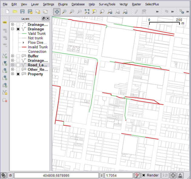
and if I zoom out pass 5,000:
I think you can see how this rule based rendering could be very powerful, in fact I have about four different rule sets I use with the drainage layer to show different things to different people.
The rules I have shown above are pretty simple, you can go pretty crazy and use them to render OpenStreetMap data: http://www.youtube.com/watch?v=NBBYtH2svw0
The worst part about the rule based rendering is that I have gotten so used to their power that I feel crippled when I go back to MapInfo and try to do styling :)
Happy mapping.
What is your favorite QGIS feature?
Filed under: Open Source, qgis Tagged: gis, map-rendering, mapping, Open Source, OSS, qgis, Quantum GIS, styling, thematics


