Related Plugins and Tags

QGIS Planet

New Download: Osm2po Light Style

Inspired by the “OSM Bright Minimal” style for Tilemill, I’ve created a similar background map style for osm2po layers in QGIS trunk (uses features unavailable in 1.7.3): osm2po_light_style.qml. Together with a grey background (RGB:232,232,232) and an OSM natural layer (RGB:208,208,208 for water), the style looks like this:

example map using osm2po_light_style.qml

It’s plain and bright, so any overlay will stand out nicely. Hope you find it useful.


New Download: Osm2po Style

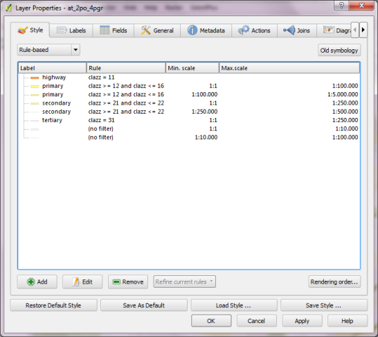
I’ve added a new style for osm2po layers to the QGIS Resources Github repo. It contains the following rules:

the rules

and looks like this:

the map

Enjoy!


Osm2po Part 2 – PgRouting on OSM the Easy Way

This is the follow up post to “An osm2po Quickstart” which covers loading the OSM network into PostGIS and using the result with pgRouting. After parsing the OSM file, e.g.

C:\Users\Anita\temp\osm2po-4.2.30>java -jar osm2po-core-4.2.30-signed.jar prefix=at "C:\Users\Anita\Geodaten\OpenStreetMap Data\austria.osm.pbf"

you should find a folder with the name of the prefix you chose inside the osm2po folder. It contains a log file which in turn provides a command line template for importing the OSM network into PostGIS, e.g.

INFO commandline template: psql -U [username] -d [dbname] -q -f "C:\Users\Anita\temp\osm2po-4.2.30\at\at_2po_4pgr.sql"

Using this template, we can easily import the .sql file into an exiting database. My pgRouting-enabled database is called wien_ogd.

C:\Users\Anita\temp\osm2po-4.2.30\at>psql -U [username] -d wien_ogd -q -f C:\Users\Anita\temp\osm2po-4.2.30\at\at_2po_4pgr.sql

Now, the data is ready for usage in QGIS:

The osm2po table in QGIS

Using “pgRouting Layer” plugin, it’s now straightforward to calculate shortest paths. I had to apply some changes to the plugin code, so please get the latest version from Github.

A shortest path in osm2po network

Using osm2po turned out to be far less painful than I expected and I hope you’ll find this post useful too.


An osm2po Quickstart

This post covers the necessary steps to use osm2po on Windows. Osm2po is both, a converter and a routing engine. It parses OpenStreetMap data and makes it routable. While osm2pgrouting seems to be limited by the amount of memory that is available on your system, osm2po is able to convert large sets like europe.osm. It generates SQL Insert scripts for PostGIS, compatible with pgRouting and Quantum GIS.

To get started, download osm2po and an OSM binary file like e.g. austria.osm.pbf. Extract osm2po and you’ll find the .jar file together with the tool’s documentation (German only though).

That’s all, you’re ready!

To load your network from the .pbf run:

C:\Users\Anita\temp\osm2po-4.2.30>java -jar osm2po-core-4.2.30-signed.jar prefix=at "C:\Users\Anita\Geodaten\OpenStreetMap Data\austria.osm.pbf"

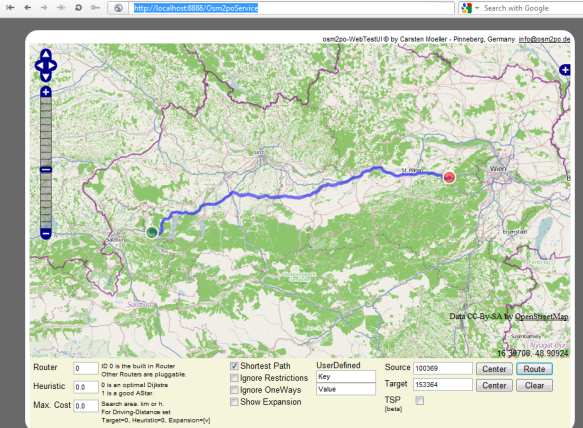
Once finished, you should be able to test the results by visiting http://localhost:8888/Osm2poService in your browser:

A shortest path using osm2po routing

Next up: How to use osm2po with pgRouting.


Back to Top

Sustaining Members