QGIS Planet

QGIS Grant Programme 2022 Results

We are extremely pleased to announce the four funded proposals for our 2022 QGIS.ORG grant programme. Funding for the programme was sourced by you, our project donors and sponsorsNote: For more context surrounding our grant programme, please see: QGIS Grants #7: Call for Grant Proposals 2022

These are the proposals:

  1. Add SQL Logging to the debugging/development panel
  2. QGIS setting registry enhancement
  3. Fix handling of provider default value clauses/Autogenerate/nextval(…) handling
  4. Support building QGIS application on Qt 6

Since the total requested budget is equal to the available budget, there is no need for a voting this year.

On behalf of the QGIS.ORG project, I would like to thank everyone who submitted proposals for this call!

Reports from the winning grant proposals 2021

With the QGIS Grant Programme 2021, we were able to support eight proposals that are aimed to improve the QGIS project, including software, infrastructure, and documentation. The following reports summarize the work performed in the proposals. 

  1.  QGIS Server and services documentation (#213) – Report
    The Services chapter of the QGIS Server documentation needed some love to
    be effectively representative of the underlying implementation. Numerous
    services, requests or parameters were not documented at all. Some others
    also had very sketchy descriptions. Thanks to this QEP, the Services
    chapter is now in a much better shape!
  2. Rework handling of multi-layer, mixed-format datasets (#216) – Report
    While the work was partly motivated as an opportunity to clean up some
    older parts of the QGIS codebase which were fragile and had low test
    coverage, it has also resulted in many improvements and polish in the
    QGIS user interface.
  3. Port DB Manager Table Management Functionalities to Browser: SQL execution (part 3) (#205) – Report
    Besides SQL execution functionalities, an additional PR adds to QGIS core the query layer management tool that was provided by DB Manager plugin. The new API is fully covered by unit tests.
  4. Locale support for numeric input and display: revision and enhancements (#210) – Report
    The work has been completed with multiple pull requests that fixed all localization issues that have been reported plus countless unreported issues that have been identified along the way.
  5. Integrate GPS Tools plugin functionality into core QGIS (#217) – Report
    This grant sees the removal of the old, unmaintained “GPS Tools” core plugin, with all functionality from the plugin moved to reusable Processing algorithms or the unified Data Source Manager dialog. Since the functionality now uses the Processing framework, users gain the ability to run these tools in batch modes, as part of graphical models, and from 3rd party scripts and plugins. As a bonus the new tools are all fully covered by unit tests.
  6. QGIS Server, OGC tests and Continuous Integration: OGC API Features (part 2 (#212) – Report
    Thanks to the QEP funding, the OGC API Features standard for QGIS Server is
    now checked in QGIS continuous integration since end-November 2021.
  7. Fixing terrain and camera issues in 3D (#215) – Report
    These improvements should make the 3D map view easier to use. Especially the camera control issues (unintuitivie camera rotation and wrong center point) were quite tricky to fix.
  8. Review process on plugins.qgis.org and improvements (#219) – This proposal has been withdrawn.

Thank you to everyone who participated and made this round of grants a great success and thank you to all our sponsor and donors who make this initiative possible!

QGIS Annual General Meeting – 2021

Dear QGIS Community

We recently held our 2021 QGIS Annual General Meeting. The agenda included approval of the annual report and financial report 2020, as well as the new budget for 2022.

The minutes of this meeting are available for all to view.

Regards

Marco Bernasocchi (QGIS.ORG Chair)

QGIS Grants #7: Call for Grant Proposals 2022

Dear QGIS Community,

We are very pleased to announce that this year’s round of grants is now available. The call is open to anybody who wants to make a funded contribution to QGIS, subject to the call conditions outlined in the application form.

The deadline for this round is in four weeks, on 13th February 2022.

As of 2022, we are changing the procedure in the following ways:

  • The project budgets should account for PR reviewing expenses to ensure timely handling of the project-related PRs and avoid delays caused by relying on reviewer volunteer time. 
  • In the week after the QEP discussion period, the proposal authors are expected to write a short summary of the discussion that is suitable for use as a basis on which voting members make their decisions. 

Also, note the following guidelines established in previous years: 

  • The proposal must be submitted as a ‘QEP’ (QGIS Enhancement Proposal) issue in the repo: https://github.com/qgis/QGIS-Enhancement-Proposals (tagged as Grant-YEAR). Following this approach will allow people to ask questions and provide public feedback on individual proposals.
  • Proposals must clearly define the expected final result, so that we can properly assess if the goal of the proposal has been reached.

For more details, please read the introduction provided in the application form.

We look forward to seeing all your great ideas for improving QGIS!

QGIS and Log4j

The Log4J vulnerability has been dominating recent tech news. Consequently, we’ve received many request asking whether QGIS is affected. Therefore, we’d like to clarify:

QGIS is not a Java application. QGIS is built using C++ and Python. QGIS therefore does not use any Java component, including Log4j(ava).

It is technically possible that a plugin interfaces with Java applications. If you are aware of any potential vulnerabilities, please contact the plugin developers through the contact information provided in the plugin metadata.

QGIS LTR 3.16.13 reverted to 3.16.11

Dear community,

Due to some rather severe issues in the 3.16.13 and .12 Windows MSI installers, we decided to temporarily revert back the available download to the latest release without those issues, 3.16.11. The website rebuild has been performed and you’ll see everywhere that 3.16.11 is the latest LTR. This is true for Windows only as other OS will keep delivering the latest 3.16.13.

Next Friday 19th November is the planned release date for 3.16.14 which should bring fixes to both the above mentioned issues and restore the normal release flow.

Quoting our release manager Jürgen Fischer:”Only the 3.16.13 MSI is broken (not sure if 3.16.12-2 is affected). OSGeo4W
v2 was meanwhile fixed. All other platforms are not affected at all. The next release is on Friday and will also produce a fresh MSI.”

We apologize for the inconvenience and would like to take the opportunity to remind you how much work goes into producing and maintaining the high quality product that you’ve grown to love and that this is only possible thanks to our sustaining members and volunteers. If you or your organisation is relying on QGIS, it might be a good time to consider joining QGIS’ funding effort at https://qgis.org/funding or https://github.com/sponsors/qgis/

Have a great week, cheers

Marco

Original post: https://lists.osgeo.org/pipermail/qgis-user/2021-November/050193.html


Megaphone icon made by BomSymbols from www.flaticon.com

PSA: Update to 3.16.13

This is a public service announcement:

Our developers have discovered a critical issue in QGIS 3.16.12 which may cause plugins to hang on Windows. All users are encouraged to upgrade to 3.16.13


Megaphone icon made by BomSymbols from www.flaticon.com

QGIS 3.22 Białowieża is released!

We are pleased to announce the release of QGIS 3.22 ‘Białowieża’!

Installers for all supported operating systems are already out. QGIS 3.22 comes with tons of new features, as you can see in our visual changelog. QGIS 3.22 Białowieża is aimed at celebrating the 100-year anniversary of Białowieża National Park, Poland. You can learn more about the project and this release of QGIS at the dedicated project website, https://qgisbialowieza.pl.

We would like to thank the developers, documenters, testers and all the many folks out there who volunteer their time and effort (or fund people to do so). From the QGIS community we hope you enjoy this release! If you wish to donate time, money or otherwise get involved in making QGIS more awesome, please wander along to qgis.org and lend a hand!

QGIS is supported by donors and sustaining members. A current list of donors who have made financial contributions large and small to the project can be seen on our donors list. If you would like to become a sustaining member, please visit our page for sustaining members for details. Your support helps us fund our six monthly developer meetings, maintain project infrastructure and fund bug fixing efforts.

QGIS is Free software and you are under no obligation to pay anything to use it – in fact we want to encourage people far and wide to use it regardless of what your financial or social status is – we believe empowering people with spatial decision making tools will result in a better society for all of humanity.

QGIS Open Day – 24 Sept 2021

Dear QGIS Users

On Friday, 24 September 2021 we will be holding our monthly QGIS Open Day!

Programme

My QGIS. Each of us has a specialty in QGIS and our own workflows and tricks join this months QGIS Openday to learn from each other.

Where to watch

Please see the event wiki page at for all the details of times and links for participation.

Recordings

All of the YouTube live-streamed events will be recorded and made available on the QGIS Open Day Youtube channel.

If you missed the last event, have a look at the excellent contributions by Leonardo Nazareth (Brazil), Victoria Neema (Kenya), and Tim Sutton (Portugal):

(YouTube live streams sometimes take 24 hours to be available for catch-up viewing. Be sure to check back here for updates!)

Code of Conduct

Participants are kindly reminded to please read and observe our QGIS Code of Conduct and Diversity Statement to make these events a great experience for everyone!

Please contact Amy on Twitter @amzenviro or via the Telegram Channel if you have any queries or need help setting up events.

We look forward to seeing you there!

Regards

The QGIS Open Day Organising Team!

In memory of Martin Isenburg

Being part of an open community like QGIS is a unique experience. We get to engage with and become friends with people from many different backgrounds and walks of life. Each person brings their unique flavour to the project and helps create something that is more than just the sum of its parts. The QGIS community is blessed enough to also have attracted some of the greatest minds in the Open Source Geospatial community.

Martin Isenburg was one of these great minds – his work on LASTools and making LiDAR data accessible to the world was truly groundbreaking. The .LAS/.LAZ formats for point cloud data have become ubiquitous, supported by virtually all point cloud processing tools in existence.

This week we received the incredibly sad news that Martin is no longer with us. Martin was a regular fixture at QGIS Hackfests, sitting quietly to one side doing incredible things with his plugin that integrates LASTools into QGIS or sharing a stand-up paddleboard outing with fellow QGISers.

Beyond being a gifted software developer, Martin was acutely aware of our impact on the world and its perilous ecological state. Like many in the QGIS community, he cared not only about technology but also about the potential of technology to transform lives and improve the planet and the human condition. With great sadness, we say a last goodbye to Martin Isenburg and wish his loved ones our deepest condolences.

Thank you, Martin, we will miss you.

The QGIS Community

QGIS 3.20 Odense is released!

We are pleased to announce the release of QGIS 3.20 ‘Odense’!

Installers for all supported operating systems are already out. QGIS 3.20 comes with tons of new features, as you can see in our visual changelog. The Danish user group also provides additional background information about Odense and the map featured on the splash screen on their website.

We would like to thank the developers, documenters, testers and all the many folks out there who volunteer their time and effort (or fund people to do so). From the QGIS community we hope you enjoy this release! If you wish to donate time, money or otherwise get involved in making QGIS more awesome, please wander along to qgis.org and lend a hand!

QGIS is supported by donors and sustaining members. A current list of donors who have made financial contributions large and small to the project can be seen on our donors list. If you would like to become a sustaining member, please visit our page for sustaining members for details. Your support helps us fund our six monthly developer meetings, maintain project infrastructure and fund bug fixing efforts.

QGIS is Free software and you are under no obligation to pay anything to use it – in fact we want to encourage people far and wide to use it regardless of what your financial or social status is – we believe empowering people with spatial decision making tools will result in a better society for all of humanity.

Håvard Tveite has passed away

It is with a heavy heart that we announce that on 2021-05-31, our friend and colleague Håvard Tveite has passed away at the age of 59 after a period of illness.

Håvard was a very active member of the QGIS community, providing valuable input to the documentation, developing numerous plugins, and taking care of the QGIS Resources Sharing Repository to name just a few of his contributions.   

Besides his contributions to the QGIS project, Håvard was also an active volunteer in the Norwegian Orienteering Federation and in the International Orienteering Federation Map Commission (more: https://orienteering.sport/norwegian-great-havard-tveite-has-passed-away/)

The QGIS community would like to extend our heartfelt condolences to Håvard’s wife Ingrid and son Nils.  Håvard’s contributions to the QGIS Project will leave a lasting impact on the lives of many people around the world as they benefit from the work he has done on a daily basis.

R.I.P. Håvard

Reports from the winning grant proposals 2020

With the QGIS Grant Programme 2020, we were able to support ten proposals that were aimed to improve the QGIS project, including software, infrastructure, and documentation. The following reports summarize the work performed in the proposals. We’ll update this blog post as more reports come in:

  1. Quality Assurance methodology and infrastructure (Alexandre Neto, Alexander Bruy, Giovanni Manghi)

    The Tester plugin has been updated to run on QGIS 3.x. It allows to run automated and semi-automated tests and helps to conduct testing by providing step-by-step instructions to perform manual or verification tasks. An initial small set of tests for QGIS core functionality has been implemented as a separate QGIS Core Tests plugin. Furthermore, a test management system and test plan based on KIWI TCMS has been set up and documentation for testers has been created and published.

  2. Smarter map redraws + tile download manager (Martin Dobias)

    Smarter Map Redraws avoid the annoying flicker when map in the map canvas is zoomed or moved. It is especially noticeable with background maps. The work has reduced the problem especially for raster layers. See the videos of comparison before/after.
    Tile Download Manager is not going to be very visible to the users, but it should make QGIS behave nicely with remote servers – until now it would be common that QGIS would request raster/vector tiles, then abort the requests while they were in progress when map got moved/zoomed, only to start those requests again – this should be avoided now.

  3. DB Manager Table Management Functionalities to Browser Port – part 2 (Alessandro Pasotti)

    QGIS browser now exposes a new “Fields” item for vector layers that can be expanded to show the underlying fields, an icon identifies the base field type. New context menu items allow user to create and delete fields. At the connection level, a new context menu item allows you to create a new table for all DB connections that support the Connections API (PG, Spatialite, GPKG, MSSQL). All the new functions are implemented using the new connections API and exposed to Python for plugins/scripts. There have been many other small improvements in the API and in the browser, such as homogenization of the error/warning/success reporting .

  4. QGIS Server, OGC tests and Continuous Integration (Paul Blottiere)
    A Python tool named pyogctest has been implemented to run OGC tests in command line for the WMS 1.3.0 testsuite and has been integrated with GitHub Action in QGIS continuous integration mechanism to avoid regressions. The documentation chapter about OGC and conformance tests is now up-to-date with an explanation of how pyogctest can be used locally for server developers. Moreover, pyogctest is now also integrated with QGIS-Server-CertifSuite for the nightly tests. This way we have an homogeneous testing environment with CI. 
  5. QGIS Server performance monitoring (Paul Blottiere)
    The whole QGIS-Server-PerfSuite has been upgraded to use 3.10 and 3.14 releases side by side with 2.18 and master branch. Performances may be now monitored daily with the latest releases. Moreover, a simple anomalies detection mechanism has been implemented and a mail is sent if a regression is detected. Several scenarios have been added to compare performance with the same data but relying on different providers (PostGIS, Spatialite, Geopackage and Shapefile). Finally, a simple mechanism based on multiprocessing has been implemented to simulate multi-clients situation. 
  6. FileGeodatabase spatial index in OpenFileGDB driver (Even Rouault)
    This work has been successfully completed in GDAL master (for GDAL 3.2) and automatically benefits QGIS when it uses the OpenFileGDB driver. Performance-wise, for example, counting the number of features intersecting a spatial filter which returns 81 046 polygons, now runs in 400 ms with GDAL 3.2dev and the OpenFileGDB driver, versus 6.7 s before (full scan), vs 890 ms with the FileGDB driver (with FileGDB SDK 1.5). Interactive display in QGIS with the OpenFileGDB driver is as fluid as with the FileGDB one. Comparing behaviour of OpenFileGDB and FileGDB drivers with strace shows that they read a similar amount of data in the .spx file, which confirms it is uses correctly. The filegdb reverse engineered specification was also updated.
  7. MacOS packages (Peter Petrik)
    All tasks from the proposal except the notarization process have been addressed since the work necessary to address critical bugs in projection, grass, saga, gdal, python and other parts of the MacOS packages exceeded expectations. (A note about the workaround for notarization has been added to the QGIS.org webpage for now.) Key improvements for QGIS 3.16 MacOS Packages are: QGIS-Mac-Packager without homebrew dependencies, updated GDAL3, PROJ6 & GRASS 7.8.2, fixed Grass, Saga &, GDAL provider loading, and many more. 
  8. Evaluate Qt for Python (Denis Rouzaud)
    The initial evaluation was followed by a report on the migration to Qt-for-Python. The report’s recommendations are now being discussed in QEP#237.
  9. Settings registry (Denis Rouzaud)
    The complete implementation of the core part has been achieved (settings, registry and Python bindings). All core settings were migrated. Other settings still have to be migrated, CI tests should be added to avoid usage of the old API and potential GUI improvements are outlined in the report.
  10. To be continued 

Thank you to everyone who participated and made this round of grants a great success and thank you to all our sponsor and donors who make this initiative possible!

QGIS Open Day – 26 March 2021

Dear QGIS Users

On Friday, 26 March 2021 we will be holding our monthly QGIS Open Day! What is a QGIS Open Day you may be wondering to yourself? It is an initiative to replace the wonderful community meetups we used to hold every six months when times were different. Like our in-person meetings, the event is organised on the principle of self-organisation and community participation.

Programme

  • QGIS INTEGRATED (The open day that shows QGIS working as part of an ecosystem with other software and programs to create dynamic and shareable spatial data, maps, and systems)

Where to watch

Please see the event wiki page at QHF-March-2021 Wiki for all the details of times and links for participation.

Recordings

All of the YouTube live-streamed events will be recorded and made available to users who couldn’t make the live events. YouTube live streams sometimes take 24 hours to be available for catch-up viewing. Be sure to check back here for updates!

Code of Conduct

Participants are kindly reminded to please read and observe our QGIS Code of Conduct and Diversity Statement to make these events a great experience for everyone!

Please contact me, Zinziswa Xakayi by email [email protected] or via the Telegram Channel username @zinzixakayi if you have any queries or need help setting up events.

We look forward to seeing you there!

Regards

The QGIS Open Day Organising Team!

QGIS Grant Programme 2021 Results

We are extremely pleased to announce the 8 winning proposals for our 2021 QGIS.ORG grant programme. Funding for the programme was sourced by you, our project donors and sponsorsNote: For more context surrounding our grant programme, please see: QGIS Grants #6: Call for Grant Proposals 2021.

The QGIS.ORG Grant Programme aims to support work from our community that would typically not be funded by client/contractor agreements. This means that we did not accept proposals for the development of new features. Instead proposals focus on infrastructure improvements and polishing of existing features.

Voting to select the successful projects was carried out by our QGIS Voting Members. Each voting member was allowed to select up to 6 proposals. The full list of votes are available here (on the first sheet). The following sheets contain the calculations used to determine the winner (for full transparency). The table below summarizes the voting tallies for the proposals:

qgis-grants-2021

A couple of extra notes about the voting process:

  • Voting was carried out based on the technical merits of the proposals and the competency of the applicants to execute on these proposals.
  • No restrictions were in place in terms of how many proposals could be submitted per person / organization, or how many proposals could be awarded to each proposing person / organization.
  • Voting was ‘blind’ (voters could not see the existing votes that had been placed).

We received 39 votes from 23 community representatives and 16 user group representatives.

On behalf of the QGIS.ORG project, I would like to thank everyone who submitted proposals for this call!

QGIS 3.18 Zürich is released!

We are pleased to announce the release of QGIS 3.18 ‘Zürich’!

Installers for all supported operating systems are already out. QGIS 3.18 comes with tons of new features, as you can see in our visual changelog. Additionally, QGIS 3.16 ‘Hannover’ has now replaced 3.10 as LTR.

If you are using the OSGeo4W installer, please read the corresponding announcement by our release manager Jürgen Fischer.

We would like to thank the developers, documenters, testers and all the many folks out there who volunteer their time and effort (or fund people to do so). From the QGIS community we hope you enjoy this release! If you wish to donate time, money or otherwise get involved in making QGIS more awesome, please wander along to qgis.org and lend a hand!

QGIS is supported by donors and sustaining members. A current list of donors who have made financial contributions large and small to the project can be seen on our donors list. If you would like to become a sustaining member, please visit our page for sustaining members for details. Your support helps us fund our six monthly developer meetings, maintain project infrastructure and fund bug fixing efforts.

QGIS is Free software and you are under no obligation to pay anything to use it – in fact we want to encourage people far and wide to use it regardless of what your financial or social status is – we believe empowering people with spatial decision making tools will result in a better society for all of humanity.

QGIS Grants #6: Call for Grant Proposals 2021

Dear QGIS Community,

We are very pleased to announce that this year’s round of grants is now available. The call is open to anybody who wants to make a funded contribution to QGIS, subject to the call conditions outlined in the application form.

The deadline for this round is 21st March 2021.

For more details, please read the introduction provided in the application form.

We look forward to seeing all your great ideas for improving QGIS!

QGIS Open Day – 26 Feb 2021

On Friday, 26 February 2021 we will be holding our monthly QGIS Open Day! What is a QGIS Open Day you may be wondering to yourself? It is an initiative to replace the wonderful community meetups we used to hold every six months when times were different. Like our in-person meetings, the event is organised on a principle of self-organisation and community participation.

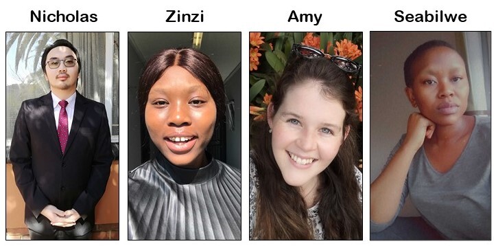
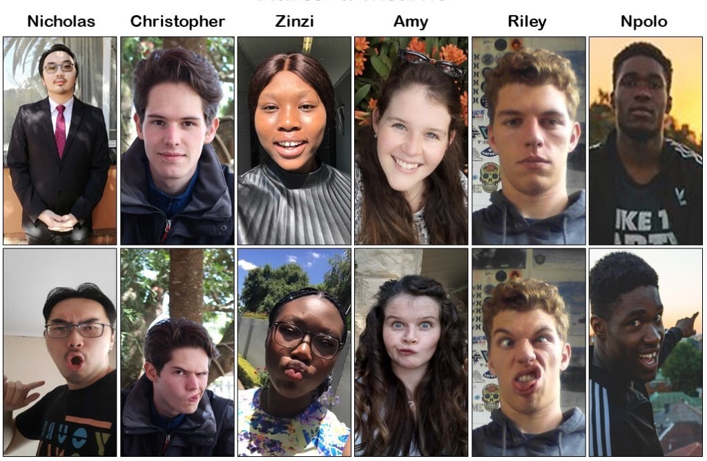
This open day will have the theme of “QGIS Plugged In!” and will be hosted, organised, focussed on and presented by young GIS practitioners from around the world!

Where to watch

Please see the event wiki page for all the details of times and links for participation.

Many of the events may be recorded and made available to users who couldn’t make the live events. YouTube live streams should be automatically available for catchup viewing. Be sure to check back on the wiki page (link above) for updates!

Being a good open source citizen

Participants are kindly reminded to please read and observe our QGIS Code of Conduct and Diversity Statement to make these events a great experience for everyone!

Contact

Please contact Zinziswa Xakayi by email ([email protected]) or via the QGIS Open Day Telegram User Group (https://t.me/joinchat/Aq2V5RPoxYYhXqUPoxRWPQ user @zinzixakayi) if you have any queries or need help setting up events.

We look forward to seeing you there!

Regards the QGIS Open Day Organising Team!

Scheduled maintenance for plugins repository


We are running out of space on our server running https://plugins.qgis.org – a sign of success, given the large number of plugins and plugin versions hosted on the platform. On Thursday 28 January at 9am West European Time, we will bring the server offline for a scheduled upgrade to the storage space on the server. We anticipate that the work will be completed within an hour. We thank you for your patience whilst we undertake this critical maintenance.


The maintenance of QGIS infrastructure is undertaken largely by volunteers and the cost of servers and hosting related costs are funded by your donations and sustaining memberships. If you would like to help support this (and the many other excellent initiatives carried out by QGIS.org), please consider heading over to https://qgis.org/en/site/getinvolved/governance/sustaining_members/sustaining_members.html#how-can-you-support-the-qgis-development to find out how you can help!

QGIS 3.16 Hannover is released!

We are pleased to announce the release of QGIS 3.16 ‘Hannover’!

Installers for all supported operating systems are already out. QGIS 3.16 comes with tons of new features, as you can see in our visual changelog.

We would like to thank the developers, documenters, testers and all the many folks out there who volunteer their time and effort (or fund people to do so). From the QGIS community we hope you enjoy this release! If you wish to donate time, money or otherwise get involved in making QGIS more awesome, please wander along to qgis.org and lend a hand!

QGIS is supported by donors and sustaining members. A current list of donors who have made financial contributions large and small to the project can be seen on our donors list. If you would like to become a sustaining member, please visit our page for sustaining members for details. Your support helps us fund our six monthly developer meetings, maintain project infrastructure and fund bug fixing efforts.

QGIS is Free software and you are under no obligation to pay anything to use it – in fact we want to encourage people far and wide to use it regardless of what your financial or social status is – we believe empowering people with spatial decision making tools will result in a better society for all of humanity.

Back to Top

Sustaining Members