QGIS Planet

Save the date & call for contributions: QGIS user conference and contributor meeting in Bratislava

We are happy to announce that QGIS User Conference will take place on 9-10 September 2024 in Bratislava, Slovakia.


The traditional Contributor Meeting will be held right after the conference on 11-13 September 2024 at the same venue.

Learn more about the user conference and the contributor meeting at the event’s web site: https://uc2024.qgis.sk/

The call for papers for the user conference is now open – you can submit proposals for talks and workshops by 31 March 2024:
https://uc2024.qgis.sk/call-for-papers/

We have also started call for sponsors, with sponsorship opportunities at various levels. More details here:
https://uc2024.qgis.sk/sponsors/

User Conference

The QGIS User Conference is an annual event that brings together users and developers of QGIS. The conference provides an opportunity for attendees to learn about the latest developments in QGIS, share their experiences with others, and network with other QGIS users and
developers.

Contributor Meeting

QGIS Contributor Meetings are volunteer-driven events where contributors to the QGIS project from around the world get together in a common space – usually a university campus. During these events, contributors to the QGIS project take the opportunity to plan their work, hold face-to-face discussions and present new improvements to the QGIS project that they have been working on. Everybody attending the event donates their time to the project for the days of the event.
As a project that is built primarily through online collaboration, these meetings provide a crucial ingredient to the future development of the QGIS project. The event is planned largely as an ‘unconference’ with minimal structured programme planning.

For more details and to sign up, please visit the corresponding wiki page https://github.com/qgis/QGIS/wiki/27th%E2%80%90Contributor%E2%80%90Meeting%E2%80%90in%E2%80%90Bratislava

Reporting Back From the User Conference & Contributor Meeting in Den Bosch

Last week, we had our 25th Contributor Meeting in ‘s-Hertogenbosch, The Netherlands. Prior to the meeting, the International QGIS User Conference, brought together 200 participants from all around the world who came to learn about QGIS and exchange ideas and best practices.

The conference programme was jam-packed with great content. Over 50 presentations were given during the conference, with the participants enjoying the Dutch atmosphere whilst building up their knowledge of QGIS and sharing their ideas. With more than 20 years of development behind us, QGIS has become a stable platform that supports geospatial decision making, analysis and decision making in all sorts of endeavours. We saw lots of talks that demonstrated this maturity, for example a presentation John Holden and Blake Esselsteyn showed how QGIS is being used to determine voting districts to support the democratic process, Angelina Savchuk showed how QGIS is being used to support the work of the Red Cross, whilst Nick Vervaal showed us how QGIS is used to make high tech artistic laser cut maps from wood.

We were honoured to be joined by Lucho Ferrer who came all the way from Peru! Ujaval Gandhi travelled all the way from India and wowed the audience with his workshop on QGIS Actions.

There are two mobile offerings for QGIS users who want to take their work out to the field. Both QField and MerginMaps had a strong presence at the User Conference, causing a lot of excitement and buzz in the audience.

Contributor Meeting

As is traditional, the contributor meeting (which was held directly after the two day user conference) was full of workshops, sessions, and spontaneous get-togethers to facilitate the exchange between community members, including sessions on:

  • Onboarding Day
  • Plans for the certification programme
  • Getting around in the QGIS community
  • Translating QGIS 
  • Documentation system and process
  • Editing the documentation online on GitHub
  • Building documentation on your local machine and using Git to make a pull request (submission)
  • Compiling QGIS
  • Making your first pull request to QGIS
  • Create QGIS issues and feature requests
  • OGC API in QGIS
  • QGIS vision
  • QGIS website update
Everyone worked hard to advance the project, the open plan space facilitating lots of ad hoc conversations which are hard to match in an online environment.
OGC API in QGIS: current support and proposed developments, hosted by Joana Simoes

From the QGIS community we would like to extend a huge ‘thank you!’ to the local organising team who hosted a flawless event and worked so hard to make sure everyone had the best experience possible. Thank you and see you next year!

Getting ready for our user conference and contributor meeting in ‘s-Hertogenbosch

In a few weeks, our 25th Contributor Meeting and International QGIS User Conference uc2023.qgis.nl will take off on 18 April.

Register or become a speaker yourself. For details on all the exciting opportunities to get involved, check out the introduction by our awesome organizing team:

Save the date: QGIS user conference and contributor meeting in ‘s-Hertogenbosch

We are happy to announce that our 25th Contributor Meeting will be held in ‘s-Hertogenbosch, The Netherlands from 20 to 23 April 2023.

uc2023.qgis.nl

Leading up to the contributor meeting, we will also have a two-day International QGIS User Conference, on 18 & 19 April.

QGIS Contributors Meetings are volunteer-driven events where contributors to the QGIS project from around the world get together in a common space – usually a university campus. During these events, contributors to the QGIS project take the opportunity to plan their work, hold face-to-face discussions and present new improvements to the QGIS project that they have been working on. Everybody attending the event donates their time to the project for the days of the event. As a project that is built primarily through online collaboration, these meetings provide a crucial ingredient to the future development of the QGIS project. The event is planned largely as an ‘unconference’ with minimal structured programme planning. We do this to allow attendees the freedom to meet dynamically with those they encounter at the event. Those sessions that are planned are advertised on the event web page and we try to enable remote participation through video conferencing software. Although our hosts are not funded and donate the working space to us, we show our appreciation by making one of our software release’s splash screens in honour of that host, which is a great way to gain exposure of your institution and country to the hundreds of thousands of users that make use of QGIS.

For more details and to sign up, please visit the corresponding wiki page.

QGIS Events Cancellation

Dear QGIS Community:

Due to the uncertainty caused by rapidly unfolding global events related to the COVID-19 virus, we have decided to cancel all in-person QGIS events until further notice. This includes the 25th QGIS Contributor meeting and User Conference that was scheduled to be held this year in Nødebo, Denmark. In the interim, we will pursue ways to meet virtually from time to time, and of course, continue working using our normal collaboration process via email and GitHub.

Thank you for your understanding,

The QGIS Team

A Coruña contributors meeting: another step forward for the QGIS.ORG project!

IMG_20190310_101428_486~2

On behalf of QGIS.ORG and the whole community, I’m would like to extend our thanks and congratulations to all the local volunteers who helped to make the event happen, with special thanks to Luigi “Ginetto” Pirelli, who spearheaded the effort. The event, which included a full week of workshops, a user conference, and contributor meeting, marked another milestone in the history of QGIS.

It was possibly the largest meeting we have had to date. It especially gratifying seeing more diversity and new faces. Our inclusive and welcoming community has always been a point of pride and it was amazing seeing how newcomers easily and pleasantly integrating in the community, producing good and tangible results within just a few days.

Many decisions were made, many discussions were fruitfully concluded, many tortillas were eaten, plans were laid out. These events are critical for preparing the way for the future of the QGIS.ORG project.

Our heartfelt thanks to all who donated their time and intellect, and to the many donors and sponsors to make all this possible.

See you in Bucharest next August, for the 23rd QGIS meeting!

QGIS.ORG

Call for presentations: QGIS User Conference and Developer Meeting, 2019

The next International QGIS User Conference and Developer Meeting will take place in the week from 4 to 10 March 2019 in A Coruña (Spain).


coru
The call for presentations and workshop registration is out and you can apply using the online registration form. Note that the deadline for presenting proposals is 21 Dec 2018. If you need any info please email your queries to: [email protected]


The International QGIS User and Developer Conference wants to be the reference conference for the QGIS community, a meeting point for the family of users and developers associated with the QGIS project. Attending the conference is an opportunity to gather experience and share knowledge about QGIS. The language of the conference is English.


The event is organized by the Spanish QGIS Association [1], the Spanish user group, and the Galician Xeoinquedos community [2] with the help of A Coruña municipality [3]. The event is under the QGIS.org umbrella. We look forward to seeing you there!


Do you want to host a QGIS developer meeting?

Each year the QGIS.ORG community holds two developer meetings. These events are an important part of  our project – they provide an invaluable opportunity for us all to meet face to face and share ideas, discuss issues and plan the future of QGIS.

The host of the developer meeting gets a special bonus for hosting the meeting: One of our releases will be named after the town / village / city etc. where the event was held – like this:

Screen Shot 2017-09-02 at 11.11.31 PM.png

We want to have a better idea of which venues we will be using for future events to help with out planning. So I am putting out a call for venue proposals:

If you would like to host a QGIS developer meeting (estimated 50 people per event) or a QGIS Conference (estimated 100-150 people per event) please contact us!

Please don’t submit proposals unless you have the authority to make such a proposal and are willing to act as the local organiser for the event. To make a proposal, fill out this form and tell us about your great venue!


Plotting the future of QGIS

During the developer hackfest at our recent QGIS Conference in Nødebo, the developers present had a discussion session about the future (post 3.0) road map for QGIS. Note that the ideas laid out here do no necessarily represent a consensus between all the QGIS developers and community members since those present at the hackfest were only a subset of the great QGIS community. However the discussion probably provides a good idea of the kind of things on our minds as we move forward to QGIS 3.0 and beyond. Just a note before you get too excited reading the article below: This was a future looking session of great ideas that will take QGIS forward, but there may not be anybody actively working on these ideas (if you are looking for something to fund it would be a great start!). Here are twelve ideas that were raised (in no particular order)…

1. We need to beef up the analytical capabilities in QGIS

There was a general feeling that we should have stronger analytical capabilities in QGIS. Somewhere along the line we lost ManageR (the R integration with QGIS) and we have missed the boat in having something like Pandas / Jupyter Notebooks, embedded into QGIS (with iface available to the console). Whilst many data scientists are using R, going the python route with Pandas and Jupyter Notebooks might be a better fit in terms of being harmonious with the other work that has been done to provide python bindings for QGIS. But hey, why not provide both a Jupyter Notebook that supports both Python and R out of the box? Technically curious may want to look here for some hints on how we might go about integrating Jupyter into the QGIS application…

2. We need to improve our ‘first open’ experience

Especially for new users and novice GIS users, starting a QGIS project with a blank white canvas and many buttons and menus can be quite intimidating. We want to provide some basic projects (e.g. based on OpenStreetmap tiles) that can appear as a default layer when you open the QGIS application so that you can immediately get a sense of place and space – much like you would get in Google maps or any web mapping application. Naturally we will provide the option to disable this for those who are not interested in this functionality, but we would make it a default behaviour for new users…

3. We need a better way of communicating with our users

We do not even know simple things like how many users we have (I estimate broadly between 500 000 and 1 000 000 users based on downloads). Most users are silent users – they never communicate with the upstream project via our mailing lists or other communication mechanisms. Not knowing stuff about our users makes it hard to build a better product for them, and not having a communication channel with our users makes it hard for us to let them know about important updates, bug fixes, events etc. and it is a bit silly to be in this situation because every time a user opens QGIS, we have an opportunity to share this kind of information with them. So in the future it would be nice to have a way to provide timed and targeted messages to our users (for example letting them know when we have made a new blog post on the official QGIS blog). It would be nice to have the notification system scriptable by plugin. Of course it should be easy to opt out of or filter the messages by category (e.g. don’t show me event announcements) we share with our users. Imagine on the projects list view you see when you first open QGIS that we have a panel to the right of the projects list which just lists the headlines of the latest announcements. Perhaps there are other ways we can communicate with our users, but we should really make it a priority to get to know our users and this seems like a good start. By seeing how many times a given article gets read after it as been posted in the QGIS announcement area, we might get a better indication of how many users we have. Another example – when a new LTR bug fix comes out, we can publicise it better to make sure users are aware of the important fixes.

4. We need to focus on Quality Assurance (QA)

Especially as relates to reducing the incidence of side effects, QA is going to be critical as the project grows and gains a user base that uses it for critical functions. Side effects happen when e.g. a developer implements one feature that (probably unbeknownst to him) breaks another feature. Side effects are bad because they are hard to test for and hard to trace back to the root cause. The development of QGIS happens in a largely ad hoc manner – developers get contracts to build features their clients need, there is no top-down approach to how we roll out new features. This makes it difficult for us to ensure that side effects do not happen. We are not only concerned with side effects, but QA in general and would like to have the time and resources to spend on really taking the work that has already been put in place (automated testing on Travis for example) to the next level.

5. We need more dedicated (paid) effort to take care of the project

QGIS has become too big of a project to rely entirely on volunteers to take care of all aspects of the project. Many of us still contribute many hours of unpaid volunteer time to the project and will continue to do so. It has long been my vision that we eventually recruited a corps of professional (i.e. paid) contributors to work on QGIS, especially to take care of things that contract work will never cover. For example triaging the pull request queue (which is extremely time consuming), managing the issues in the issue tracker, expanding our test suite coverage, writing documentation, fixing bugs and building ‘cross cutting functionality that typically would not be funded by client work but that everyone will derive benefit from. Our project revenue (from sponsorships and donations) has been steadily growing (thank you to all of those that have contributed!) and if we can increase the revenue a little more we will reach the point where we can start to recruit some of our community members to work for QGIS.org on a professional basis – maybe on a part time basis in the beginning, but eventually building a corps of full time paid staff. This has long been a vision of mine for QGIS and if it is the one thing we achieve while I am project chair, I will be a happy chappie!

6. We need to automate trace captures

This relates somewhat to 3. above – when a user experiences a crash in QGIS, we have no automated way to get that crash information (and no Apple / Microsoft do not pass along the tracebacks to us when they offer to let you post them to their domain 🙂 ). Services like Sentry can aggregate crash data and help us understand the impact of different issues – and thus how to prioritise fixes.

7. We need to find ways to include a more diverse range of people in the project

In this particular brain storming session, we had one lady (hi Sophie!) in a room full of maybe 40 men.

We also have little representation from Africa, Asia, Latin America. A few years ago we added a diversity statement and a code of conduct to our web site, but  we need to ‘get out there’ and be more active about ensuring that people of all ages, genders, races, religions and cultures feel welcomed into our project and start actively participating as ‘makers’ not just consumers. We are a friendly and welcoming project and we should take the effort to let everyone know they are welcome in our community. Some ideas were aired about e.g. having scholarships to fund people from developing nations who would like to attend our conferences and hackfests, and scholarships to fund new developers to port plugins to QGIS 3.0 or similar more entry level tasks. It would be great to have users out there in the commercial world reach out to us to help make this happen (e.g. by offering to fund the travel and expenses of a developer who would normally not be able to attend due to costs).

8. We need to work on maintaining good relations with providers

QGIS sports a growing list of independent commercial support providers – some with very large user bases. I’ve written before here on the blog about some things providers should do to be ‘QGIS friendly’. We really want to encourage providers to use the QGIS LTR’s (Long Term Releases) as the basis for their support services, upstream their fixes to the QGIS project and avoid providing forked copies of QGIS to their clients. Why? It will improve the quality of the LTR QGIS packages and clients of every support provider will benefit. We would also really like to appeal to our commercial support providers to refer to QGIS upstream LTR builds as the ‘Official’ QGIS releases and not some lesser adjective like the ‘Community’ QGIS Release. There was the sentiment in the meeting that  calling it a community release implies that the vendor’s packaged copy is the ‘good one’ and the QGIS.org is the ‘not so good one’ and we would like to reverse that perception. It may seem like splitting hairs to some but we would like to see that there is not fragmentation in the user base of QGIS so we think that it is important to set the right tone from the get-go.

9. We need to promote that QGIS is now a legal entity

It has taken a lot of work, planning and hoop jumping, but QGIS.org is now a legal entity – a Swiss Association / Verein. We are VAT registered, have our own bank account and can now hold our own trademarks and IP instead of working through a proxy. We hope this will open a new chapter in the future growth of QGIS – in particular in our ability to attract much more substantial funding and to make formal agreements with entities where needed. A huge thank you to Andreas Neumann (QGIS PSC Member and project treasurer) for making the whole process happen!

10. We should establish credibility by code signing our products

There was some discussion about the fact that QGIS installers don’t always get recognised by operating systems as a ‘good’ application – virus checkers might flag it or system preferences my reject applications that are not code signed. The good news is that since the meeting Jürgen Fischer has added code signing for the Windows binaries (if that makes you happy please buy him a beer or something :-)) and there is work in progress by Larry Shaffer (who might also be motivated by beer :-)) to have code signed MacOS installers. Of course Linux users are probably scoffing here since they have a nice package distribution mechanism in place and they are already signed.

11. We need a smoother path to integration of code contributions

There was an extended discussion in our meeting about how we should manage contributions to QGIS as we move forward. Some were in favour of forcing everyone to use Pull Requests (PR’s) with a peer review. Others were in favour of also being able to push directly to the code base. Various other permutations were discussed. For now we are going to continue on with our current approach more or less which is to not prevent direct pushes to the code tree, but to discourage it – and of course non-core users will be required to use PR’s since they don’t have direct push rights to the official repo. Suffice to say we are aware of the fact that we have a large backlog of PR’s that are not merged and that it can sometimes be difficult to get your work merged. Hopefully in the future the ideas outlined in point 5. above will help to alleviate this situation….

12. Intergalactic domination

This was a late addition to our meeting notes, but still a worthwhile cause. Martin Dobias  felt strongly that we should include in our roadmap (thus not pictured below), plans for intergalactic domination and hey, if we are going to do something like that, we will need a good GIS to help us find our way around right? 🙂

Thanks to Nyall Dawson for prompting the discussion, it was great to once again experience how convivial and constructive our community discussions are, even when the topics can sometimes get difficult or technically involved!

Screen Shot 2017-08-25 at 12.20.05 PM


Report back on the 3rd QGIS Conference in Nødebo, Denmark

We just wrapped up the 3rd QGIS User Conference at the University of Copenhagen’s “Skovskolen” Forestry and Landscape College, just outside of Copenhagen. The conference programme was split into three parts:

  1. A general user conference of three days
  2. The a QGIS hackfest – where many developers brought their families along
  3. A week of workshops where attendees can learn in-depth topics such as expressions or the new QGIS Web Client version 2

We are extremely grateful to the event sponsors (you can find links to our sponsors at the bottom of this page):

Click to view slideshow.


Here are some of the highlights from the conference presentations:

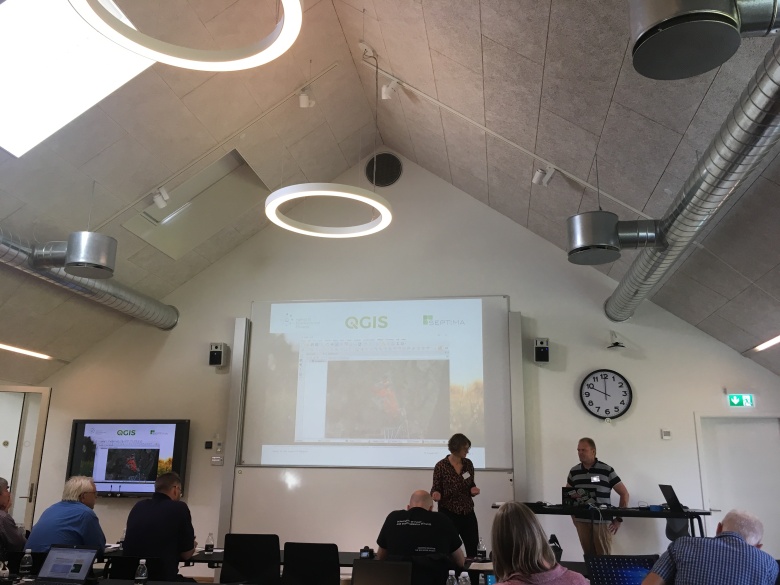
Search – a cool unifiedsearch tool for QGIS

Klavs Pihlkjaer (from Septima) showed off the QGIS (version 2) search plugin. The plugin provides a unified search interface for datasets loaded in QGIS. You can also search external OGC services. If you are still using QGIS 2.x releases, run, don’t walk to try the search plugin. The Search Plugin also allows you to create third party plugins (via a simple python API) that integrate with it by adding new search sources to the list. If you are using QGIS 3, check out the ability to write plugins for the new locator bar! Klavs is still looking at porting his work over to work with the upcoming QGIS 3 release.

Impact Analysis plugin

Bo Victor Thomsen showed off the plugin he has built to support searching through many layers in multiple databases and database tables in a fast an efficient way. The layers do not need to be loaded in QGIS and the system uses a centralized configuration management approach so that adding new searchable sources is done once and is then immediately available for all users (e.g. in an enterprise environment) of the plugin. The plugin is currently used when searching municipal databases to see if there is any impact assessment needed or inspection needed in a given place.

Danish National Data Search

Mie Winstrup and Tom Weber showed off the national data search plugins they have developed for Denmark that allow you to easily search for local and national data. They want to be an example for other countries to show how easy it is to make national data searchable and available.

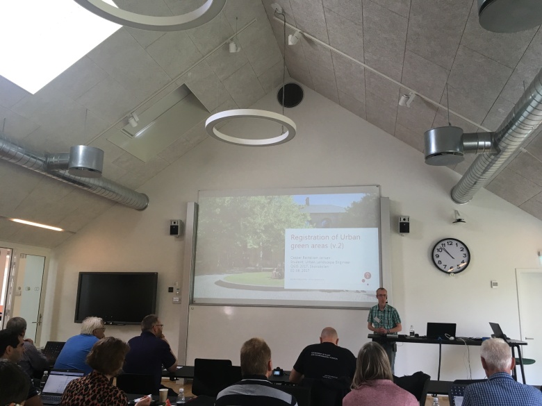
Casper Bertelsen on registering urban green areas

Casper showed the system he has developed for managing a cadaster of green spaces. The system includes versioning so that you can see changes over time. It also implements topology rules to ensure that areas do not overlap. He also provides tools for administrations to e.g. see what the maintenance cost for a given area will be.

QGIS as a digitizing platfom

Saber Razmjooei from Lutra Consulting showed off QGIS as a digitizing platform. He also showed us new digitizing coming in QGIS 3. He showed off some of the great tools coming in QGIS 3 for node editing.

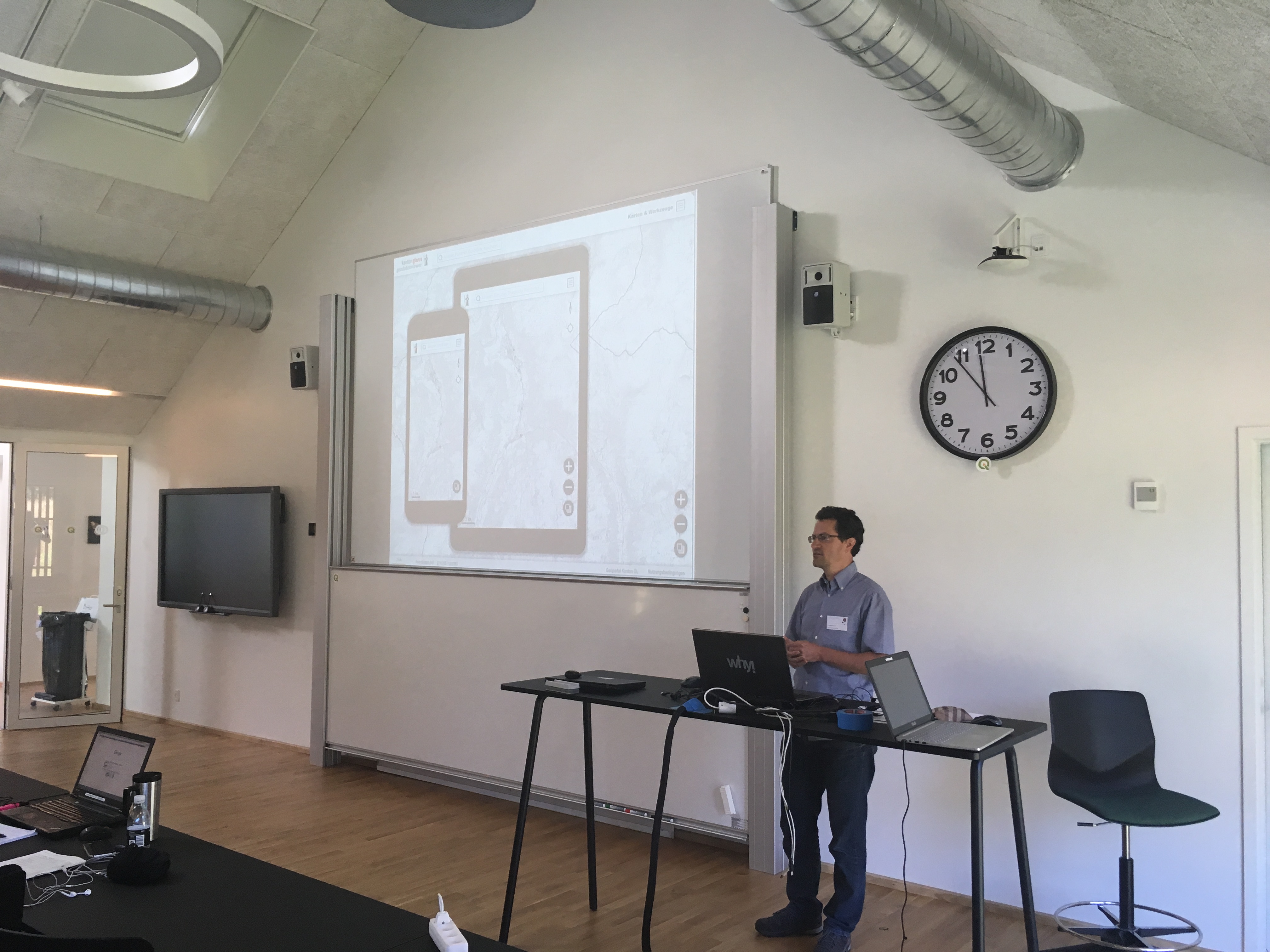
QGIS Web Client – Version 2

Andreas Neumann showed of the new generation of QGIS Web Client (QWC2). The new web client is really nice – responsive design and takes advantage of open layers 3 including rotating maps, permalink for any map view / set of layers, map tools for measure, draw, export etc.

Future plans include improved redlining tools including text, polygons, user authentication via LDAP or oauth, support QGIS ‘drag and drop’ forms, clip and ship and a QGIS plugin for the configuration so you do not need to edit JSON files. Also thinking about supporting vector tiles for the base maps.

I bet you didn’t know you could do this with QGIS

Nyall Dawson gave an awesome demo of the power and capabilities of QGIS’ labelling, symbology and expression features. His demo took us through an adventure story where each scene in the story was rendered using QGIS (based on the upcoming version 3 release). This included animated clouds floating by, lightning effects, electrical effects, smoke effects and many more cool and interesting ideas that really showed off the power and versatility of QGIS.
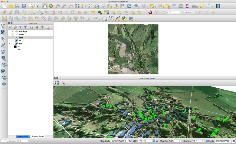
Screen Shot 2017-08-09 at 10.42.51 AM

QGIS 3D

Martin Dobias (Lutra Consulting) gave a presentation on the QGIS grant proposal  work he has been doing to support 3D visualizations natively in QGIS 3.  His work leverages the new Qt 3D framework provided in Qt5 (the toolkit used to develop QGIS) and allows you to use an elevation model to model a 3D terrain and use a new tab in the vector style properties dock to extrude features out from the landscape. We have had a number of 3D  tools in QGIS in the paste but none has ever been a mainstream component of QGIS, enabled and ready to use ‘out of the box’. Expect Martin’s work to change that. There were many ideas passed around about how the 3D support in QGIS could be extended but the grant proposal only supports the first-pass implementation, so please do fund Martin’s work if you would like to see him add specific features in the future.


QIGS as a cadastral management platform

Prof. Erik Stubkjaer gave two presentations – one as a call for interest in those interested in building land parcel / cadastral management tools. He also gave an overview of the state of domain models for managing and recording property rights, including LADM (Land Administration Domain Model) and STDM (Standard Tenure Domain Model). He outlined that world aid organizations are increasingly putting an emphasis on enabling better tax revenue as a path to economic and social stability, and having a cadaster is a key element to the enablement. There are already a number of cadastral management tools out there for QGIS – it would be great to heed Prof. Stubkjaer’s clarion call and build a generic toolset for cadastral management in QGIS.

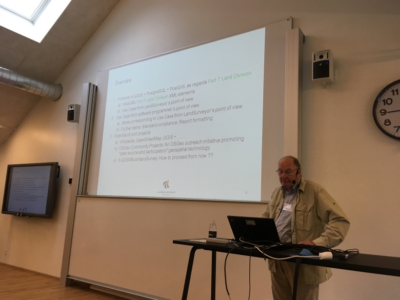
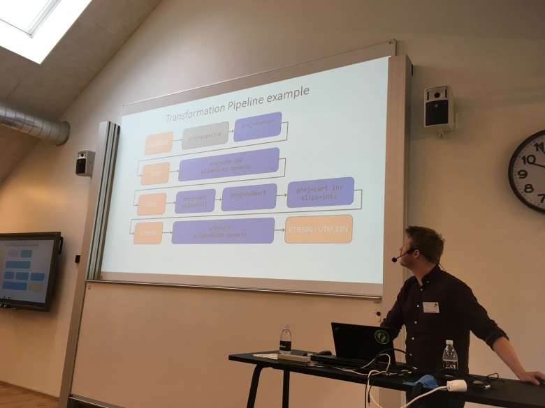
The future of coordinate reference system support in QGIS

Kristian Evers from the Danish Agency for Data Supply and Efficiency spoke about the use of Coordinate Reference Systems in QGIS and the use of WGS84. He pointed out the fact that there are 6 different versions of WGS84 and they vary by up to a meter. He also highlighted the issue that e.g. ETRS89 drifts more out of sync each year. In addition the earth is dynamic with plates shifting and different regions moving with different velocities. He showed a really nice video made in Australia highlighting the issue (see here: http://www.icsm.gov.au/gda2020/ for details and the video). They use a plate fixed datum (which moves with the plates) together with a global datum (fixed to the center of the earth). This new approach is being planned / used in other places too (e.g. Iceland) and are called “dynamic datums”.  The dynamic datums will rely on a time stamp too as well as coordinates.

To address this they are introducing the concept of transformation pipelines in Proj.4 (the library used by QGIS to support projection) – there will be a new release of Project.4 which includes support for this.
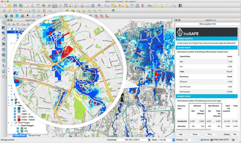
InaSAFE

Tim Sutton (your humble blog post author) gave a presentation about InaSAFE – a plugin for QGIS that helps communities prepare for disasters.

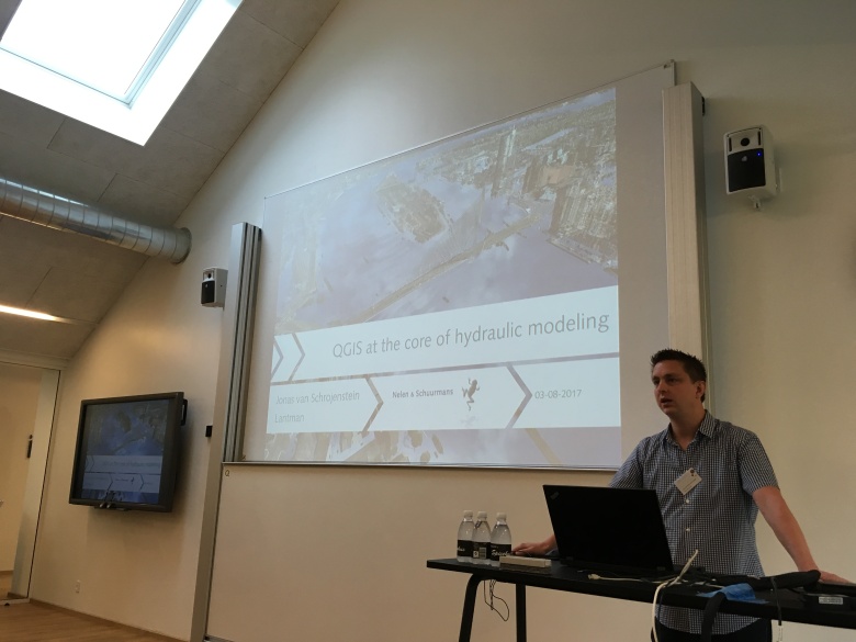
Jonas van Schrojenstein Lantern (from Nelen & Schuurmans)

Jonas’ company built really fast and efficient models for flood models including 3D visualization. They have a really nice plugin for QGIS that lets you view a pipe model and different behaviors based on changed water levels. It requires a specific data model (d3i) in the Postgres backend and then you can visualize water levels in any pipe section. The plugin also lets you do the digitizing of the pipe network etc. The software also requires the use of som 3di services that Jonas will clarify how the licensing etc. should work.

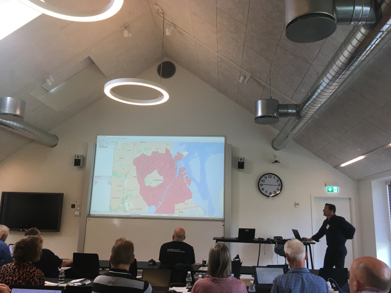
Mie Winstrup – Septima – sometimes Open Source is just plain better

Mie shared a case study about how they used Open Source to replace a tool built with ArcMap + Model Builder for flood modeling. They used malstroem  – a python command line module and also integrated with QGIS. It assumes the terrain is an impermeable surface and that water flows from one cell to another. The tool models where water will accumulate in the landscape and what the depths are at each ‘blue spot’. It also models how much water will flow from the blue spots (based on modeled precipitation amount e.g. 100mm rain). It generates an event layer which shows how many cubic meters of water will spill over to the neighboring watershed.

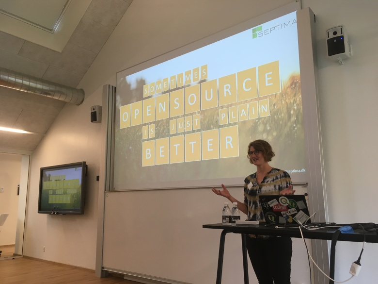
https://github.com/Septima/qgis-malstroem

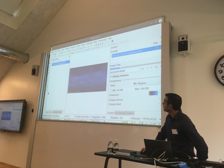
Saber Razmjooei – Lutra consulting – Crayfish plugin

Crayfish C++ plugin for QGIS adds a new renderer for gridded data. Works with HDF, NetCDF and GRIB.

What to watch out for in QGIS 3.

Nyall Dawson (core QGIS developer) gave a talk on what to expect in QGIS 3. The talk was not a feature round up but rather aimed at those concerned about the potential gotchas they will have to take care of when they migrate from QGIS 2 to QGIS 3 in their production environments. I record


Monica Balestrin Nunes & Ana Paula Maciel (National Secretariat for Housing in the Ministry of Cities, Brazil)

Monica and Ann Paula presented a talk on how the Ministry of Cities in Brazil are using QGIS and mapping to manage the roll out of housing projects to support  provision of housing for the poor “My House, My Life”. The project aims to help 4.5 million people get into housing.  They used QGIS to develop a site selection process too. They used a simple process to map urban areas, developed versus undeveloped urban areas, schools. They also used public transport as a parameters to further constrain the available areas. These data were used to produce a synthesis map which shows high, medium and low suitability of areas for housing development. They used a digital coding system to classify each area (which can be mapped back to the high, medium and low assessment ratings). They also used GeoServer, GeoKettle, PostgreSQL/PostGIS.

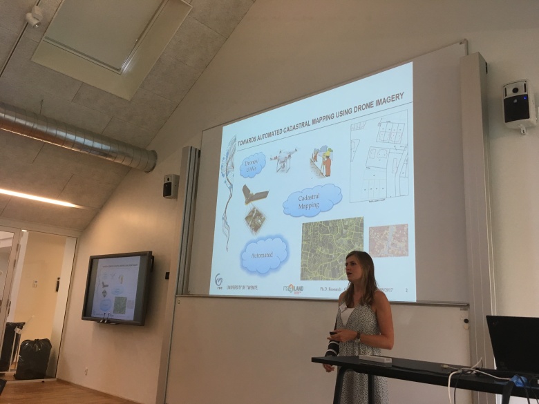
Sophie Commelinck – University of Twente

Automated cadastral mapping using UAVs. Sophie showed workflows she is building for automatic extraction of parcel boundaries from UAV imagery. She showed some interesting work in doing boundary line detection using the SLIC algorithm which creates smoothed lines along boundaries. See http://github.com/scrommelinck/boundarylinedelineation for more details.

Sophie.JPG

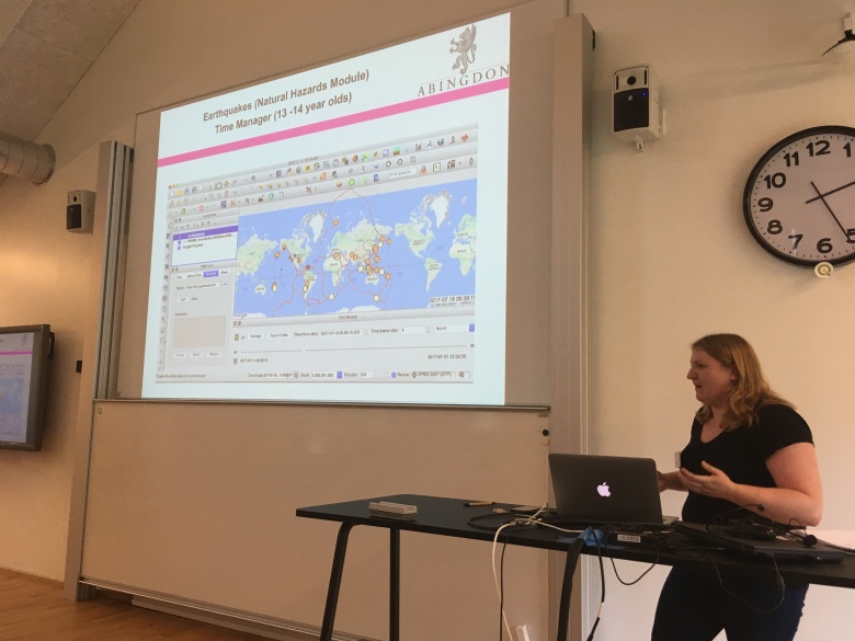
Kimberley Briscoe, Abingdon School, UK

Kimberley has been doing interesting things with high school kids learning GIS via QGIS. This work included using the time manager plugin to visualize global earthquakes and using r.lake.coordinates to do flood modeling. They also use ‘field trip gb’ mobile app to do field data collection. Many other plugins were used like EVIS, QGIS2Threejs. They also use interesting national datasets like crime etc. and data from http://data.gov.uk for their classroom work.

Kimberly.JPG

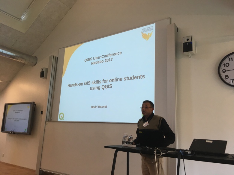
Badri Basnet – The University of Southern Queensland

Badri is a lecturer and has 90% online students in many different locations worldwide and with varying levels of internet access.  Badri has made many open content QGIS training videos and worksheets that he uses for his courses (which are based on QGIS). His videos are all on YouTube.

Badri.JPG

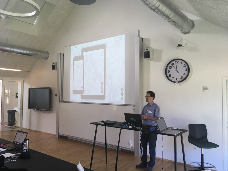
QField – Matthias Kuhn and Marco Bernasocchi (opengis.ch)

Matthias and Marco gave presentations on QField – an Android field data collection app based on QGIS (but with a mobile centric user interface). Matthias showed us many of the cool features QField has, whilst Marco outlined strategies for integrating field work, web publishing and desktop GIS work in a seamless workflow. I made some videos with my phone – audio and video quality is not brilliant but should be enough to follow along for those interested:

Lene Fischer (Skovskolen)

Lene (who also happens to be the event organizer – hurrah for the great job she did along with her team of volunteers!) showed how they approach teaching GIS and QGIS using ‘flipped learning’ where users first need to self study content on their own, and then use the lecturer as a consultant.

Lene.JPG

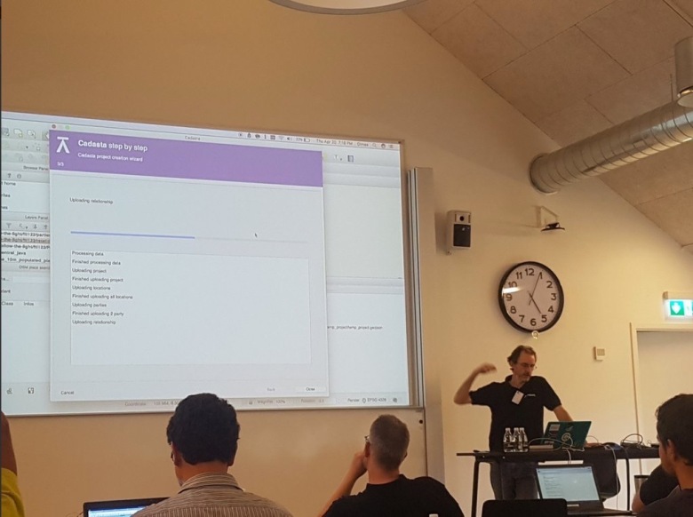
Tim Sutton – Cadasta

Your trusty author again – I presented work we have been doing to support mapping land rights of people in developing nations using the Standard Tenure Domain Model style approach where tenure is treated as a continuum rather than an absolute. You can find out more about this project at Cadasta.org
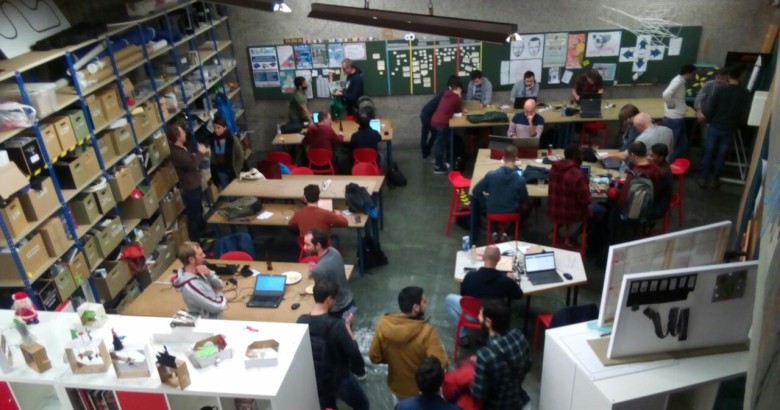
tim-cadasta

Workshops

The event was also filled with great workshops – two during the main conference, and then a week of post conference workshops. Most of the workshops were presented by developers or QGIS project members and represented a fantastic opportunity for attendees to learn straight from the experts!
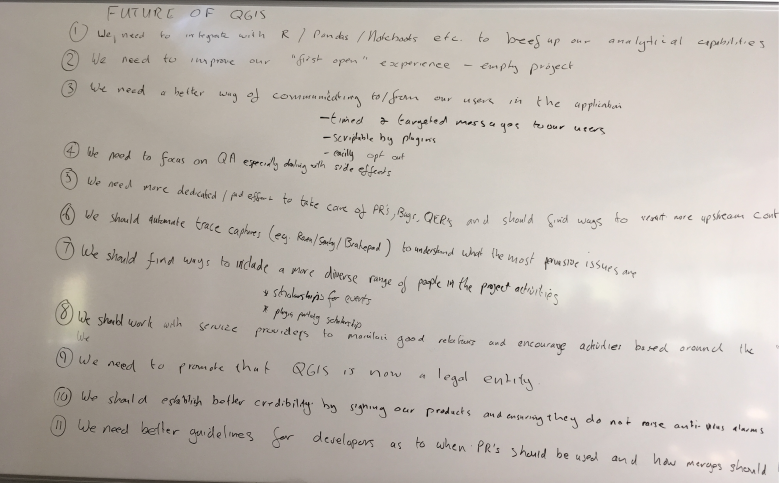
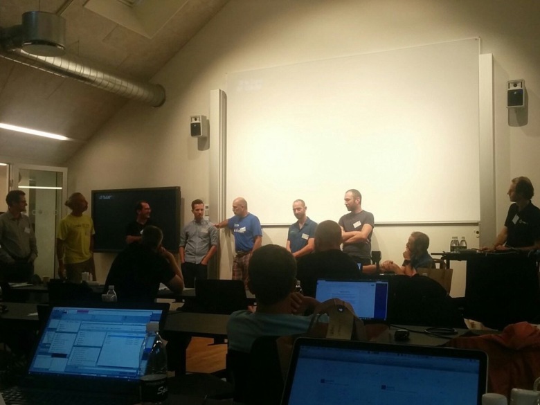
Town hall meeting

At the end of the user conference, we held a town hall meeting where developers and active QGIS community members fielded a range of questions from the audience. It is always a please to hold these sessions – we get a direct channel of communication with our users and they get to speak directly to the people making the software they use and find out why we make the choices we make!
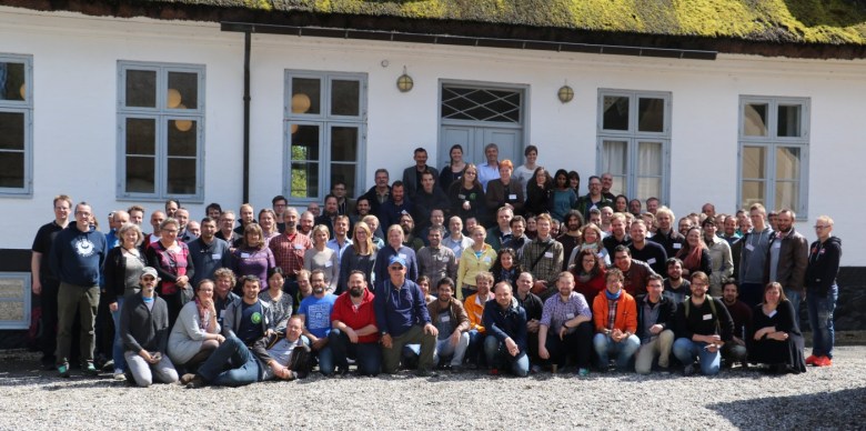
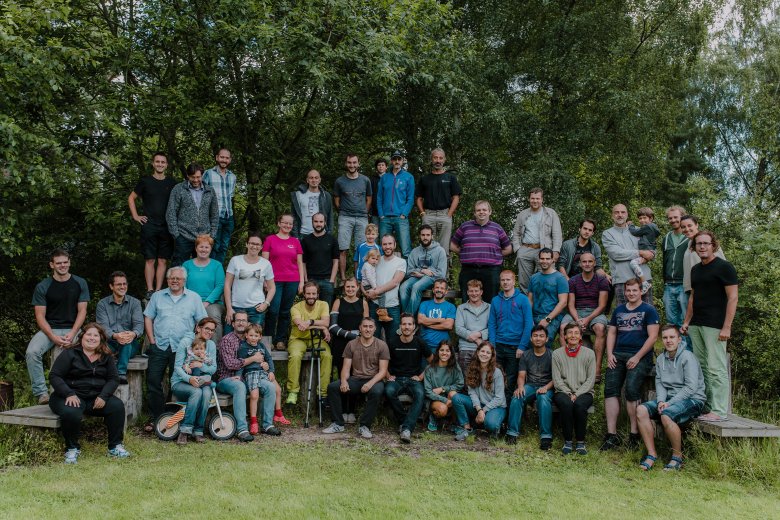
town-hall.jpg

Hackfest

The “hackfest” (developer meeting – we use ‘hack’ in the positive sense of the word) was a chance for the QGIS community members to roll up their sleeves and work on new features, bug fixes, documentation and general polish of QGIS and related resources. It is always great to be able to work side by side for a few days – compared to our very geographically dispersed nature over the rest of the year. It was especially nice this event that many developers brought their families along to enjoy the beautiful scenery and great facilities at the Skovskolen. Here is a group photo taken by Mary Anne Lister:

IMG_2288

Thanks

On behalf of the whole QGIS community, I would like to extend our heartfelt thanks to Lene Fischer (event organizer), her team of volunteers, all the attendees who took the time to attend the conference – and of course all the developers and QGIS Community Members who attended and made it such a great event!


Event sponsor links:


3rd QGIS User Conference

This year, we are looking forward to the 3rd installment of our annual QGIS conference and it will be the biggest one yet!

The QGIS community, developers and users are meeting from August 2–11, 2017 in Nødebo at University of Copenhagen’s Forest and Landscape College.

1st user conference in Nødebo 2015

The program consists of the main conference, as well as a developer meeting and multiple workshops, including:

  • QGIS Expressions
  • Plugin development in Python
  • QGIS Server and Web Client
  • QField
  • QGIS cartography

The program is already online. So register and make sure to get a spot in your favorite workshops!

Let’s meet and make QGIS even better!

Call for presentations and workshop proposals: QGIS Conference 2017

NOTE: Deadline for proposals is May 15 2017

We are going back to Nødebo! Each year we combine one of our QGIS Developer Meetings with a User Conference. The User Conference is a great opportunity for QGIS users to meet developers and share their experiences – both with developers and with other users. Our first ever User Conference was held in Nødebo, Denmark in 2015 and we are thrilled to be going back to the beautiful venue at the University of Denmark’s Forest and Landscape College.

1k0a4924

The user conference will be combined with the QGIS Developer Meeting and a summer school event, with the first week being focussed on the User Conference, the intermediate weekend on the QGIS Hackfest and the second week on the Summer School. The event will run from the 2nd of August through to the 11th of August 2017.

We would like to invite those who are interested in presenting a talk to apply now (NOTE: Deadline for proposals is May 15 2017). There are four kinds of contributions you can make (see the conference website for full details):

  • 20 minute ‘lightning’ talks
  • 1-2 hour short workshops
  • half and full day workshops
  • posters (which should be presented in the form of a map)

We have identified a number of themes for the User Conference:

  • QGIS Software Development
  • New Technology
  • Business
  • Government/Municipality
  • Science
  • Education

Presenters of full day workshops are eligible for a EUR 1000 reimbursement to offset their costs. You can find out more details at the conference web page (as well as registering your talk / presentation):

https://qgis2017.wordpress.com/presentations/

We are looking forward to seeing a great programme come together for the conference!


Present at the 2nd International QGIS User and Developer Conference!

The Call for Presentations and Workshops for the 2nd International QGIS User and Developer Conference, is already open!

The Local Organising Committee of the 2nd International QGIS User and Developer Conference, is pleased to announce the call for Presentations and Workshops for the 2016 Conference to be held in Girona (May 25th – 26th). If you have an open source geospatial story to tell, based on QGIS, we want to hear it!


Call for Presentations
Deadline: February 15th

The QGIS Conference presentations are 20 minutes long, with time for Q&A at the end of each talk. Presentations may cover any aspect related with the use or development of QGIS software. Anyone can can submit a presentation proposal and take part in the conference as a presenter. The received proposals will be reviewed by the program committee.

See full details at http://www.sigte.udg.edu/jornadassiglibre/en/international-qgis-user-and-developer-conference/conferencia-qgis/


Call for Workshops
Deadline: February 15th

There are two kinds of workshops depending on the duration: 2 hours or 4 hours. If you want to actively participate in the 2nd Int. QGIS Conference and impart a workshop, don’t hesitate to send your workshop proposal to [email protected]

The proposal should be a brief abstract pointing out the expected duration of the workshop (2 hours, 4 hours) as well as a few lines describing the content of the workshop, pre-requisites for the attendants (if needed), name of the instructor…

The instructors of the selected workshops will receive a free pass for the conference.

See full details at http://www.sigte.udg.edu/jornadassiglibre/en/international-qgis-user-and-developer-conference/workshops-qgis/

For further details, please send an email at [email protected]

Back to Top

Sustaining Members