QGIS Planet

Save the date & call for contributions: QGIS user conference and contributor meeting in Bratislava

We are happy to announce that QGIS User Conference will take place on 9-10 September 2024 in Bratislava, Slovakia.


The traditional Contributor Meeting will be held right after the conference on 11-13 September 2024 at the same venue.

Learn more about the user conference and the contributor meeting at the event’s web site: https://uc2024.qgis.sk/

The call for papers for the user conference is now open – you can submit proposals for talks and workshops by 31 March 2024:
https://uc2024.qgis.sk/call-for-papers/

We have also started call for sponsors, with sponsorship opportunities at various levels. More details here:
https://uc2024.qgis.sk/sponsors/

User Conference

The QGIS User Conference is an annual event that brings together users and developers of QGIS. The conference provides an opportunity for attendees to learn about the latest developments in QGIS, share their experiences with others, and network with other QGIS users and
developers.

Contributor Meeting

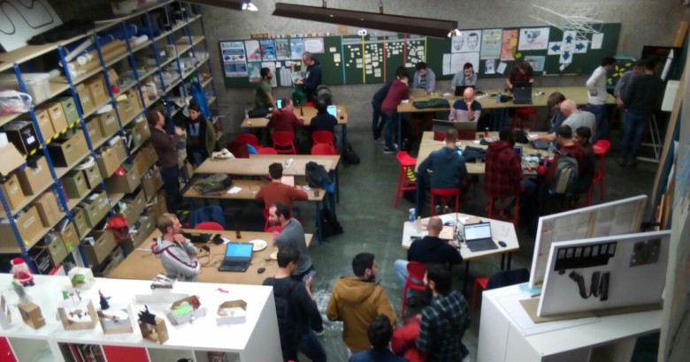
QGIS Contributor Meetings are volunteer-driven events where contributors to the QGIS project from around the world get together in a common space – usually a university campus. During these events, contributors to the QGIS project take the opportunity to plan their work, hold face-to-face discussions and present new improvements to the QGIS project that they have been working on. Everybody attending the event donates their time to the project for the days of the event.
As a project that is built primarily through online collaboration, these meetings provide a crucial ingredient to the future development of the QGIS project. The event is planned largely as an ‘unconference’ with minimal structured programme planning.

For more details and to sign up, please visit the corresponding wiki page https://github.com/qgis/QGIS/wiki/27th%E2%80%90Contributor%E2%80%90Meeting%E2%80%90in%E2%80%90Bratislava

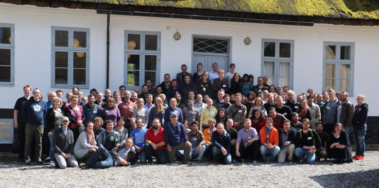
QGIS Contributor meeting at BIDS ‘23 Vienna

We are happy to announce that OSGeo kindly extended an invitation to have a QGIS contributor meeting joining the OSGeo Community Sprint 2023 during the Big Data from Space 2023 conference in Vienna.

The 26th QGIS Contributor Meeting will be held from Monday, November 6th to Thursday, 9th.

For more details and to sign up, please visit the corresponding OSGeo announcement page.

About QGIS contributor meetings

QGIS Contributors Meetings are volunteer-driven events where contributors to the QGIS project from around the world get together in a common space – usually a university campus. During these events, contributors to the QGIS project take the opportunity to plan their work, hold face-to-face discussions and present new improvements to the QGIS project that they have been working on. Everybody attending the event donates their time to the project for the days of the event. As a project that is built primarily through online collaboration, these meetings provide a crucial ingredient to the future development of the QGIS project. The event is planned largely as an ‘unconference’ with minimal structured programme planning. We do this to allow attendees the freedom to meet dynamically with those they encounter at the event. Those sessions that are planned are advertised on the event web page, and we try to enable remote participation through video conferencing software. Although our hosts are not funded and donate the working space to us, we show our appreciation by making one of our software release’s splash screens in honour of that host, which is a great way to gain exposure of your institution and country to the hundreds of thousands of users that make use of QGIS.

About OSGeo

The Open Source Geospatial Foundation (OSGeo) has a long tradition of organizing code sprints for developers of Free and Open Source GIS software.

Since 2009, the Open Source Geospatial Foundation (OSGeo) has been organizing a yearly Code Sprint of the “C Tribe” OSGeo projects, which has evolved into a full OSGeo Community Sprint and all “Tribes” are included/welcome. Leading developers of projects like GDAL, PostGIS,
MapServer, GeoServer, GRASS, QGIS, PDAL, pygeoapi and many more get together to discuss new ideas, hack, decide, tackle large geospatial problems and have fun.

The OSGeo Community Sprint is open to all who wish to participate in one or more projects. There is always plenty to do – it’s not all about programming. Translation, documentation, feedback, discussions, testing – all this is also important for projects so everyone is cordially invited to attend the code sprint!

About BiDS

BiDS brings together key actors from industry, academia, EU entities and government to reveal user needs, exchange ideas and showcase the latest technical solutions and applications touching all aspects of space and big data technologies, providing a unique opportunity to discuss and present the most recent innovations and challenges encountered in the context of big data from space. The 2023 edition of BiDS will focus not only on technologies enabling insight and foresight inferable from big data from space. Together, we want to emphasize how breakthrough space data-driven technologies impact society’s grand challenges, such as climate change and the green transition.

The event, organized by the European Space Agency (ESA) together with the European Union Satellite Center (SatCen) and the Joint Research Center (JRC), will take place at the Austria center Vienna, and counts on the support of the partners FFG, Austria in Space and the Federal Ministry Republic of Austria.

Reporting Back From the User Conference & Contributor Meeting in Den Bosch

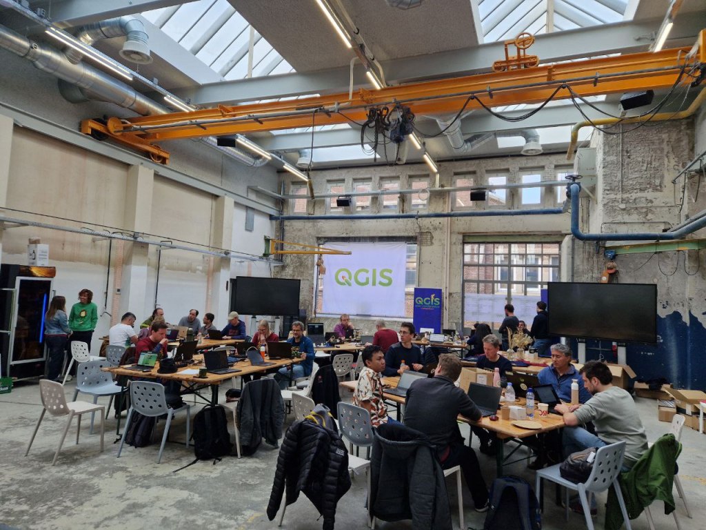
Last week, we had our 25th Contributor Meeting in ‘s-Hertogenbosch, The Netherlands. Prior to the meeting, the International QGIS User Conference, brought together 200 participants from all around the world who came to learn about QGIS and exchange ideas and best practices.

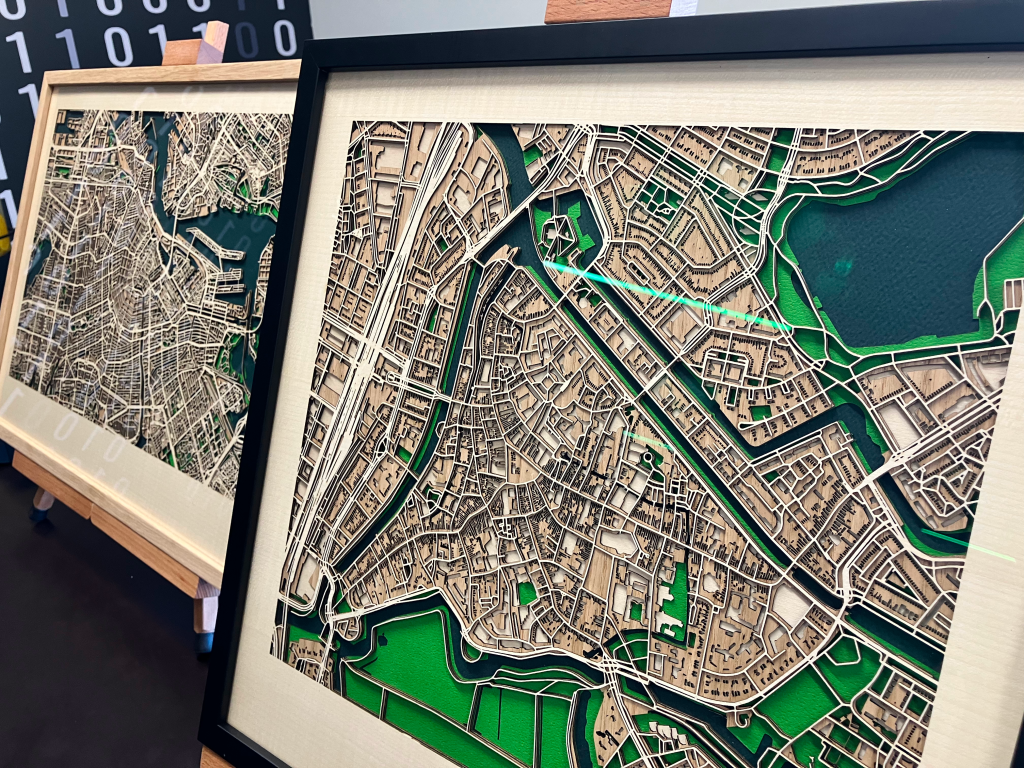
The conference programme was jam-packed with great content. Over 50 presentations were given during the conference, with the participants enjoying the Dutch atmosphere whilst building up their knowledge of QGIS and sharing their ideas. With more than 20 years of development behind us, QGIS has become a stable platform that supports geospatial decision making, analysis and decision making in all sorts of endeavours. We saw lots of talks that demonstrated this maturity, for example a presentation John Holden and Blake Esselsteyn showed how QGIS is being used to determine voting districts to support the democratic process, Angelina Savchuk showed how QGIS is being used to support the work of the Red Cross, whilst Nick Vervaal showed us how QGIS is used to make high tech artistic laser cut maps from wood.

We were honoured to be joined by Lucho Ferrer who came all the way from Peru! Ujaval Gandhi travelled all the way from India and wowed the audience with his workshop on QGIS Actions.

There are two mobile offerings for QGIS users who want to take their work out to the field. Both QField and MerginMaps had a strong presence at the User Conference, causing a lot of excitement and buzz in the audience.

Contributor Meeting

As is traditional, the contributor meeting (which was held directly after the two day user conference) was full of workshops, sessions, and spontaneous get-togethers to facilitate the exchange between community members, including sessions on:

  • Onboarding Day
  • Plans for the certification programme
  • Getting around in the QGIS community
  • Translating QGIS 
  • Documentation system and process
  • Editing the documentation online on GitHub
  • Building documentation on your local machine and using Git to make a pull request (submission)
  • Compiling QGIS
  • Making your first pull request to QGIS
  • Create QGIS issues and feature requests
  • OGC API in QGIS
  • QGIS vision
  • QGIS website update
Everyone worked hard to advance the project, the open plan space facilitating lots of ad hoc conversations which are hard to match in an online environment.
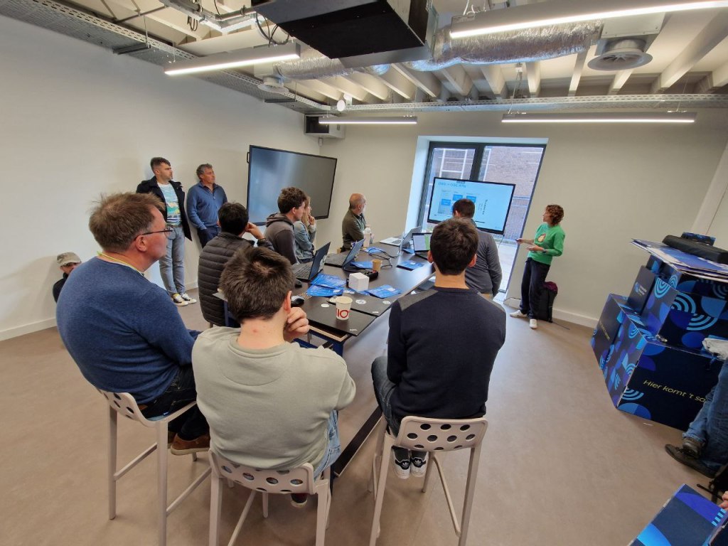
OGC API in QGIS: current support and proposed developments, hosted by Joana Simoes

From the QGIS community we would like to extend a huge ‘thank you!’ to the local organising team who hosted a flawless event and worked so hard to make sure everyone had the best experience possible. Thank you and see you next year!

Getting ready for our user conference and contributor meeting in ‘s-Hertogenbosch

In a few weeks, our 25th Contributor Meeting and International QGIS User Conference uc2023.qgis.nl will take off on 18 April.

Register or become a speaker yourself. For details on all the exciting opportunities to get involved, check out the introduction by our awesome organizing team:

Save the date: QGIS user conference and contributor meeting in ‘s-Hertogenbosch

We are happy to announce that our 25th Contributor Meeting will be held in ‘s-Hertogenbosch, The Netherlands from 20 to 23 April 2023.

uc2023.qgis.nl

Leading up to the contributor meeting, we will also have a two-day International QGIS User Conference, on 18 & 19 April.

QGIS Contributors Meetings are volunteer-driven events where contributors to the QGIS project from around the world get together in a common space – usually a university campus. During these events, contributors to the QGIS project take the opportunity to plan their work, hold face-to-face discussions and present new improvements to the QGIS project that they have been working on. Everybody attending the event donates their time to the project for the days of the event. As a project that is built primarily through online collaboration, these meetings provide a crucial ingredient to the future development of the QGIS project. The event is planned largely as an ‘unconference’ with minimal structured programme planning. We do this to allow attendees the freedom to meet dynamically with those they encounter at the event. Those sessions that are planned are advertised on the event web page and we try to enable remote participation through video conferencing software. Although our hosts are not funded and donate the working space to us, we show our appreciation by making one of our software release’s splash screens in honour of that host, which is a great way to gain exposure of your institution and country to the hundreds of thousands of users that make use of QGIS.

For more details and to sign up, please visit the corresponding wiki page.

Save the date: QGIS contributor meeting in Firenze

After a long hiatus, we are happy to announce that there will be a another international QGIS Contributor Meeting in conjunction with this year’s FOSS4G in Firenze, Italy from 18 to 22 August 2022.

QGIS Contributors Meetings are volunteer-driven events where contributors to the QGIS project from around the world get together in a common space – usually a university campus. The event is normally three days in duration and we hold two such events each year. During these events, contributors to the QGIS project take the opportunity to plan their work, hold face-to-face discussions and present new improvements to the QGIS project that they have been working on. Everybody attending the event donates their time to the project for the days of the event. As a project that is built primarily through online collaboration, these meetings provide a crucial ingredient to the future development of the QGIS project. The event is planned largely as an ‘unconference’ with minimal structured programme planning. We do this to allow attendees the freedom to meet dynamically with those they encounter at the event. Those sessions that are planned are advertised on the event web page and we try to enable remote participation through video conferencing software. Although our hosts are not funded and donate the working space to us, we show our appreciation by making one of our software release’s splash screens in honour of that host, which is a great way to gain exposure of your institution and country to the hundreds of thousands of users that make use of QGIS.

For more details and to sign up, please visit the corresponding wiki page.

QGIS Open Day – 26 Feb 2021

On Friday, 26 February 2021 we will be holding our monthly QGIS Open Day! What is a QGIS Open Day you may be wondering to yourself? It is an initiative to replace the wonderful community meetups we used to hold every six months when times were different. Like our in-person meetings, the event is organised on a principle of self-organisation and community participation.

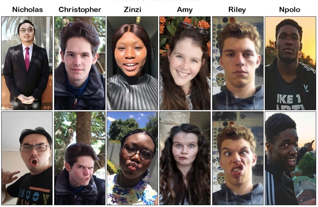
This open day will have the theme of “QGIS Plugged In!” and will be hosted, organised, focussed on and presented by young GIS practitioners from around the world!

Where to watch

Please see the event wiki page for all the details of times and links for participation.

Many of the events may be recorded and made available to users who couldn’t make the live events. YouTube live streams should be automatically available for catchup viewing. Be sure to check back on the wiki page (link above) for updates!

Being a good open source citizen

Participants are kindly reminded to please read and observe our QGIS Code of Conduct and Diversity Statement to make these events a great experience for everyone!

Contact

Please contact Zinziswa Xakayi by email ([email protected]) or via the QGIS Open Day Telegram User Group (https://t.me/joinchat/Aq2V5RPoxYYhXqUPoxRWPQ user @zinzixakayi) if you have any queries or need help setting up events.

We look forward to seeing you there!

Regards the QGIS Open Day Organising Team!

A Coruña contributors meeting: another step forward for the QGIS.ORG project!

IMG_20190310_101428_486~2

On behalf of QGIS.ORG and the whole community, I’m would like to extend our thanks and congratulations to all the local volunteers who helped to make the event happen, with special thanks to Luigi “Ginetto” Pirelli, who spearheaded the effort. The event, which included a full week of workshops, a user conference, and contributor meeting, marked another milestone in the history of QGIS.

It was possibly the largest meeting we have had to date. It especially gratifying seeing more diversity and new faces. Our inclusive and welcoming community has always been a point of pride and it was amazing seeing how newcomers easily and pleasantly integrating in the community, producing good and tangible results within just a few days.

Many decisions were made, many discussions were fruitfully concluded, many tortillas were eaten, plans were laid out. These events are critical for preparing the way for the future of the QGIS.ORG project.

Our heartfelt thanks to all who donated their time and intellect, and to the many donors and sponsors to make all this possible.

See you in Bucharest next August, for the 23rd QGIS meeting!

QGIS.ORG

Report back on the 20th QGIS Hackfest in Zanzibar


This post summarizes personal reports of community members who attended the 20th Hackfest in Stone Town, Zanzibar the week before the FOSS4G in Dar Es Salaam.

Report from Matteo Ghetta

QGIS developers spent 3 days in the beautiful island of Zanzibar were they worked on bug fixing, improvement of new features and documentation enhancements. It is extremely important for developers to meet together and spend some days working side by side given that the geographical distribution is very wide.

Thanks to the (local government & Yves Barthelemy) we had the chance to visit the Land Mapping Commission in Stone Town: It has been an amazing experience for both developers and local council. Moreover developers visited the SUZA (University of Zanzibar) and saw the local infrastructure and GIS related workflow.

  • I have merged many PR of the documentation
  • Many old and not old issues have been closed or the author has been pinged
  • Many new additions to the documentation both small corrections and new sections from scratch
  • A new version of DataPlotly released
  • A small presentation of DataPlotly to the QGIS crew

Report from Mario Baranzini

I spent one day of the Hackfest contributing to the SLYR project, improving the conversion of LAB colors. SLYR (https://github.com/nyalldawson/slyr) is a project started and almost entirely developed by Nyall (which was not present to the Hackfest) which aims to provide tools to extract and convert symbols from ESRI .lyr and .style files and use them in QGIS. Nyall has recently worked hard on the project and perhaps soon sponsorship will allow further development.

Around this theme there is a keen interest. Even during the FOSS4G there has been discussion of the conversion of ESRI symbols and there was also a presentation of how the conversion in Israel is currently managed.

During the rest of the hackfest, I worked on the implementation of the new QField file selector.

Report from Denis Rouzaud

Report from Tim Sutton

Firstly let me thank the QGIS project for contributing to my travel and accommodation costs – I am most grateful for the support! This hackfest was special for me because it is the first hackfest in an African country. As an African born person living in the interface between “first world” and “third world”, I have always had a particular social agenda with QGIS: To bring spatial tools to support responsible and sustainable management of our world. There is a huge technological and skills divide between Europe and less developed societies where QGIS can be a valuable social enabler in helping to advance the standard of living and quality of life. Hosting a hackfest in an environment where we don’t have tree cadastres, street furniture cadastres and every aspect of civilian life mapped and systematised is an important way to build empathy and understanding in our QGIS core community members for a broader cross-section of our user base. Having the opportunity to meet with users from ZMI (the Zanzibar Mapping Initiative) and students from the local university was a really uplifting experience. ZMI are building the national cadastre from the ground up using QGIS, PostGIS and UAV mapping. We were privileged to have a number of Zanzibar residents join us on the hackfest and get to experience just how appreciative they are, first hand.

There were a number of interesting topics that arose during the hackfest which I will try to summarise here:

Certification:

We held an extended meeting on the QGIS Certification Programme, mainly detailing how we should go about the review process for onboarding new organisations.

Mac OS Build:

I spent quite a bit of time struggling with my MacOS build on QGIS. It’s definitely an area of the project that needs more work as the process can be non-trivial and the brew based formulas quickly become outdated.

QField Show and Tell:

Matthias showed off the latest version of QField and all the hard work they have been putting into the QGIS mobile client. This Android based version of QGIS for mobile data gathering is a really great project and is getting more and more useful with each release. There was also a translation sprint for QField during which I translated it to Afrikaans.

QField Autobuilds:

Denis and Matthias showed off the work they have done to automate the .apk builds for QField. Their system combines Travis and some git hooks to automatically build .APK’s whenever a pull request os made or a tag is made. See the QField travis for details: https://github.com/opengisch/QField/blob/master/.travis.yml

Plotly plugin:

Matteo Ghetta showed off the latest capabilities of the Data Plotly plugin for QGIS 3. The plugin supports the creation of a wide assortment of charts from your layer’s attribute data. See the plugin homepage here for examples and more detail: https://github.com/ghtmtt/DataPlotly 

Governance:

I took the opportunity to sign off the statute changes from 2017 general meeting. This was my last official act as outgoing project Chair. I was also extremely humbled to be awarded an Honorary PSC membership during the FOSS4G2018 conference.
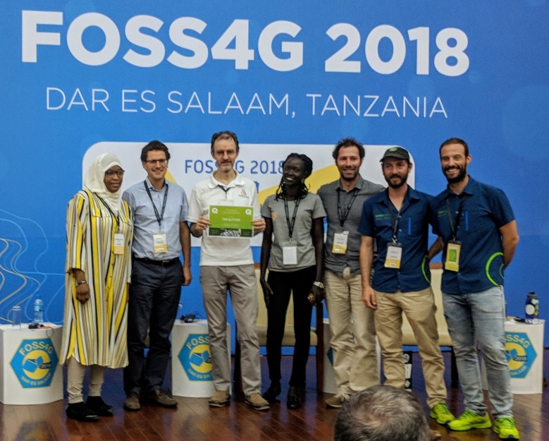
TimRecievesHonoraryPSCMembership
Easter Eggs:

I contributed a couple of new easter eggs to QGIS. While easter eggs are fun, the data behind these hidden tools provide an important history of the project. I took the opportunity of having many long-time QGIS community members around the dinner table to collate all the previous QGIS meet-up dates. You can view this as a map here: https://github.com/qgis/QGIS/blob/master/resources/data/qgis-hackfests.json 

The spatial clustering of these events shows that going to Zanzibar and getting out of our geographical comfort zone is a really useful endeavour.

Report from Paolo Cavallini

During the HF in Zanzibar I mainly worked on:

  • Plugins: I cleaned up the queue of unapproved plugins, contacting all individual authors, fixing what was possible and deprecating the worst cases; we also solved a long standing issue with a contentious plugin
  • Issues: I examined many tickets, especially those waiting for feedback
  • Training certification: through a very productive meeting we defined clear rules for accepting certifying organizations, with the main aim of driving people to actively support the project:
    • in the application process, the proponent should explain what are his contribution to QGIS project
    • following an initial review, the application will be sent to local QGIS groups for their opinion, which should take place in less than one monthly; where there is no user group, the responsibility will fall entirely on PSC shoulders
    • the training material for each course should be released with a free license, and a review will be done; if the material is not of adequate quality, this is a cause for refusal
    • then PSC will take a decision and publish the contributions as stated by the proponent, for transparency
  • Other meetings helped focusing on our mission, defining the relationship between volunteer and paid work, and other
  • I visited the Land Mapping Commission and the University, soliciting a tighter cooperation with QGIS project.

Report from Admire Nyakudya

During the heck fest in Zanzibar, I mainly worked on porting some common plugin we use to QGIS 3. The plugins I mainly worked on were Cogo Parcel plugin and Sg Diagram downloader. We visited the Zanzibar mapping agency and interacted with the people who were working on capturing cadastral data using QGIS and explained them about the COGO Parcel plugin which streamlines capturing cadastral boundaries in QGIS and storing the results in a PostgreSQL database. To summarise the work I was working on during the heck fest.

  • Port Cogo Plugin from QGIS 2 to make it compatible with QGIS 3. This has been achieved and now awaiting one of my team members to approve the pull request.
  • Expand functionality being offered by the COGO Parcel plugin to include the new reporting framework in QGIS 3.
  • Investigate ways to generate projects on the fly after talking to Matteo and seeing the work he has done with QGIS project generator.

I also went to the Zanzibar university to see ways in which QGIS is being used in the local university and how students are integrating drone imagery with QGIS.

Report from Matthias Kuhn

The highest value of hackfests is actually to meet and greet and discuss ideas and bigger plans. There is a lot of communication on a high bandwidth channel (also known as face-to-face) that strengthens the community. This helps to quickly overcome technical problems sometimes. Or to give someone some tips and tricks you normally wouldn’t come to (e.g. optimizing a git workflow) that results in a long-term gain because of sustainable productivity improvements. I tend to walk around once in a while and just randomly bump into people where I – more or less successfully – try to help them solve their issues or discuss approaches. In the same area, there is the possibility to informally discuss plans about organization, workflows and strategies. The concept of an LTR was to a big degree discussed and built at a hackfest in Essen some years ago. This year there was a very interesting discussion about the topic LTR. For how much time the “long” in the term “long term release” should stand, about the life cycle of releases and of long-term releases. One of the important things when it comes to this question is what organisations think and do – because, in the end, it is mostly for organisations that the LTR exists – and how development resources can be assigned to the task of keeping a high quality of an LTR during its whole lifetime. There are no conclusions yet, but synchronizing on these ideas is often the seed for tomorrow’s exciting changes.

We were also visited by a group of students from the local university. It was really refreshing to talk to them about open source and QGIS and how we work and what the challenges of spatial data and GIS infrastructure are on an island like Zanzibar.

Feature-wise, the main thing I worked on feature wise was a new snap to grid functionality that is available for digitizing tools. It allows configuring a precision for vector layers. Whenever a new node is added or an existing one is edited on this vector layer, it will be automatically placed on this grid. Normally this is used to force the objects on a layer to something like cm or mm resolution.

And then, of course, I did my daily bunch of (mostly volunteer) pull request reviewing, some code cleanup and some bugfixes.

Report from Marco Bernasocchi

https://photos.app.goo.gl/seX2kSJ9vKxKBZt58

The Zanzibar hackfest was a special one for me, my first hackfest as QGIS.org co-chair. My main goal was definitely to get as much information out of Tim as possible so that I wouldn’t have to keep on bugging him all time 🙂

Beside that, multiple meetings where planned to which I took part, as Paolo already explained, we had very good meetings about:

  • Certifications meeting
  • Trademark discussion
  • Creating a membership system that allows entities that are not allowed to budget sponsoring money to instead become paying members.
  • Other meetings helped focusing on our mission, defining the relationship between volunteer and paid work, and other

On the first two days, we were joined by a largish group of local students to whom I explained how the structure of QGIS.org works and where they could help. I also helped them choosing a task to work and mentored them.

As I mentioned before, I spent a lot of time asking a lot of questions to Tim to get the biggest possible knowledge transfer about running QGIS.org and some time choosing and booking restaurants for our evening “meetings”

On the technical side, I worked with Mario on a new implementation of the QField File selector.

After everybody left, the OPENGIS.ch team stayed one day longer and introduced Mario to the real Brighton-style hackfest with take-away pizza 😉


Do you want to host a QGIS developer meeting?

Each year the QGIS.ORG community holds two developer meetings. These events are an important part of  our project – they provide an invaluable opportunity for us all to meet face to face and share ideas, discuss issues and plan the future of QGIS.

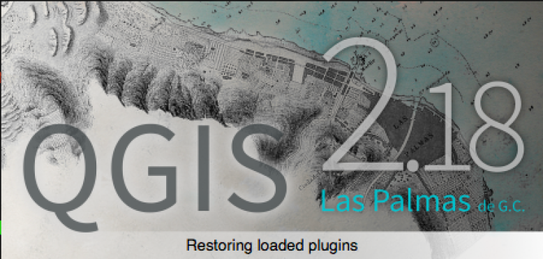
The host of the developer meeting gets a special bonus for hosting the meeting: One of our releases will be named after the town / village / city etc. where the event was held – like this:

Screen Shot 2017-09-02 at 11.11.31 PM.png

We want to have a better idea of which venues we will be using for future events to help with out planning. So I am putting out a call for venue proposals:

If you would like to host a QGIS developer meeting (estimated 50 people per event) or a QGIS Conference (estimated 100-150 people per event) please contact us!

Please don’t submit proposals unless you have the authority to make such a proposal and are willing to act as the local organiser for the event. To make a proposal, fill out this form and tell us about your great venue!


Plotting the future of QGIS

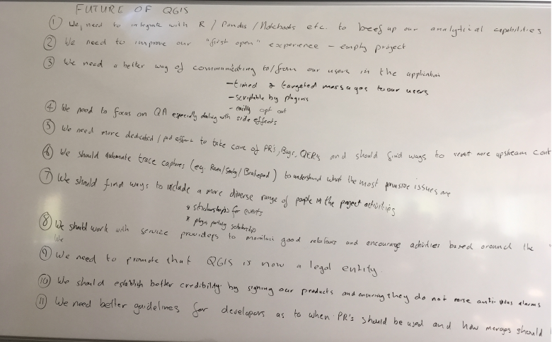
During the developer hackfest at our recent QGIS Conference in Nødebo, the developers present had a discussion session about the future (post 3.0) road map for QGIS. Note that the ideas laid out here do no necessarily represent a consensus between all the QGIS developers and community members since those present at the hackfest were only a subset of the great QGIS community. However the discussion probably provides a good idea of the kind of things on our minds as we move forward to QGIS 3.0 and beyond. Just a note before you get too excited reading the article below: This was a future looking session of great ideas that will take QGIS forward, but there may not be anybody actively working on these ideas (if you are looking for something to fund it would be a great start!). Here are twelve ideas that were raised (in no particular order)…

1. We need to beef up the analytical capabilities in QGIS

There was a general feeling that we should have stronger analytical capabilities in QGIS. Somewhere along the line we lost ManageR (the R integration with QGIS) and we have missed the boat in having something like Pandas / Jupyter Notebooks, embedded into QGIS (with iface available to the console). Whilst many data scientists are using R, going the python route with Pandas and Jupyter Notebooks might be a better fit in terms of being harmonious with the other work that has been done to provide python bindings for QGIS. But hey, why not provide both a Jupyter Notebook that supports both Python and R out of the box? Technically curious may want to look here for some hints on how we might go about integrating Jupyter into the QGIS application…

2. We need to improve our ‘first open’ experience

Especially for new users and novice GIS users, starting a QGIS project with a blank white canvas and many buttons and menus can be quite intimidating. We want to provide some basic projects (e.g. based on OpenStreetmap tiles) that can appear as a default layer when you open the QGIS application so that you can immediately get a sense of place and space – much like you would get in Google maps or any web mapping application. Naturally we will provide the option to disable this for those who are not interested in this functionality, but we would make it a default behaviour for new users…

3. We need a better way of communicating with our users

We do not even know simple things like how many users we have (I estimate broadly between 500 000 and 1 000 000 users based on downloads). Most users are silent users – they never communicate with the upstream project via our mailing lists or other communication mechanisms. Not knowing stuff about our users makes it hard to build a better product for them, and not having a communication channel with our users makes it hard for us to let them know about important updates, bug fixes, events etc. and it is a bit silly to be in this situation because every time a user opens QGIS, we have an opportunity to share this kind of information with them. So in the future it would be nice to have a way to provide timed and targeted messages to our users (for example letting them know when we have made a new blog post on the official QGIS blog). It would be nice to have the notification system scriptable by plugin. Of course it should be easy to opt out of or filter the messages by category (e.g. don’t show me event announcements) we share with our users. Imagine on the projects list view you see when you first open QGIS that we have a panel to the right of the projects list which just lists the headlines of the latest announcements. Perhaps there are other ways we can communicate with our users, but we should really make it a priority to get to know our users and this seems like a good start. By seeing how many times a given article gets read after it as been posted in the QGIS announcement area, we might get a better indication of how many users we have. Another example – when a new LTR bug fix comes out, we can publicise it better to make sure users are aware of the important fixes.

4. We need to focus on Quality Assurance (QA)

Especially as relates to reducing the incidence of side effects, QA is going to be critical as the project grows and gains a user base that uses it for critical functions. Side effects happen when e.g. a developer implements one feature that (probably unbeknownst to him) breaks another feature. Side effects are bad because they are hard to test for and hard to trace back to the root cause. The development of QGIS happens in a largely ad hoc manner – developers get contracts to build features their clients need, there is no top-down approach to how we roll out new features. This makes it difficult for us to ensure that side effects do not happen. We are not only concerned with side effects, but QA in general and would like to have the time and resources to spend on really taking the work that has already been put in place (automated testing on Travis for example) to the next level.

5. We need more dedicated (paid) effort to take care of the project

QGIS has become too big of a project to rely entirely on volunteers to take care of all aspects of the project. Many of us still contribute many hours of unpaid volunteer time to the project and will continue to do so. It has long been my vision that we eventually recruited a corps of professional (i.e. paid) contributors to work on QGIS, especially to take care of things that contract work will never cover. For example triaging the pull request queue (which is extremely time consuming), managing the issues in the issue tracker, expanding our test suite coverage, writing documentation, fixing bugs and building ‘cross cutting functionality that typically would not be funded by client work but that everyone will derive benefit from. Our project revenue (from sponsorships and donations) has been steadily growing (thank you to all of those that have contributed!) and if we can increase the revenue a little more we will reach the point where we can start to recruit some of our community members to work for QGIS.org on a professional basis – maybe on a part time basis in the beginning, but eventually building a corps of full time paid staff. This has long been a vision of mine for QGIS and if it is the one thing we achieve while I am project chair, I will be a happy chappie!

6. We need to automate trace captures

This relates somewhat to 3. above – when a user experiences a crash in QGIS, we have no automated way to get that crash information (and no Apple / Microsoft do not pass along the tracebacks to us when they offer to let you post them to their domain 🙂 ). Services like Sentry can aggregate crash data and help us understand the impact of different issues – and thus how to prioritise fixes.

7. We need to find ways to include a more diverse range of people in the project

In this particular brain storming session, we had one lady (hi Sophie!) in a room full of maybe 40 men.

We also have little representation from Africa, Asia, Latin America. A few years ago we added a diversity statement and a code of conduct to our web site, but  we need to ‘get out there’ and be more active about ensuring that people of all ages, genders, races, religions and cultures feel welcomed into our project and start actively participating as ‘makers’ not just consumers. We are a friendly and welcoming project and we should take the effort to let everyone know they are welcome in our community. Some ideas were aired about e.g. having scholarships to fund people from developing nations who would like to attend our conferences and hackfests, and scholarships to fund new developers to port plugins to QGIS 3.0 or similar more entry level tasks. It would be great to have users out there in the commercial world reach out to us to help make this happen (e.g. by offering to fund the travel and expenses of a developer who would normally not be able to attend due to costs).

8. We need to work on maintaining good relations with providers

QGIS sports a growing list of independent commercial support providers – some with very large user bases. I’ve written before here on the blog about some things providers should do to be ‘QGIS friendly’. We really want to encourage providers to use the QGIS LTR’s (Long Term Releases) as the basis for their support services, upstream their fixes to the QGIS project and avoid providing forked copies of QGIS to their clients. Why? It will improve the quality of the LTR QGIS packages and clients of every support provider will benefit. We would also really like to appeal to our commercial support providers to refer to QGIS upstream LTR builds as the ‘Official’ QGIS releases and not some lesser adjective like the ‘Community’ QGIS Release. There was the sentiment in the meeting that  calling it a community release implies that the vendor’s packaged copy is the ‘good one’ and the QGIS.org is the ‘not so good one’ and we would like to reverse that perception. It may seem like splitting hairs to some but we would like to see that there is not fragmentation in the user base of QGIS so we think that it is important to set the right tone from the get-go.

9. We need to promote that QGIS is now a legal entity

It has taken a lot of work, planning and hoop jumping, but QGIS.org is now a legal entity – a Swiss Association / Verein. We are VAT registered, have our own bank account and can now hold our own trademarks and IP instead of working through a proxy. We hope this will open a new chapter in the future growth of QGIS – in particular in our ability to attract much more substantial funding and to make formal agreements with entities where needed. A huge thank you to Andreas Neumann (QGIS PSC Member and project treasurer) for making the whole process happen!

10. We should establish credibility by code signing our products

There was some discussion about the fact that QGIS installers don’t always get recognised by operating systems as a ‘good’ application – virus checkers might flag it or system preferences my reject applications that are not code signed. The good news is that since the meeting Jürgen Fischer has added code signing for the Windows binaries (if that makes you happy please buy him a beer or something :-)) and there is work in progress by Larry Shaffer (who might also be motivated by beer :-)) to have code signed MacOS installers. Of course Linux users are probably scoffing here since they have a nice package distribution mechanism in place and they are already signed.

11. We need a smoother path to integration of code contributions

There was an extended discussion in our meeting about how we should manage contributions to QGIS as we move forward. Some were in favour of forcing everyone to use Pull Requests (PR’s) with a peer review. Others were in favour of also being able to push directly to the code base. Various other permutations were discussed. For now we are going to continue on with our current approach more or less which is to not prevent direct pushes to the code tree, but to discourage it – and of course non-core users will be required to use PR’s since they don’t have direct push rights to the official repo. Suffice to say we are aware of the fact that we have a large backlog of PR’s that are not merged and that it can sometimes be difficult to get your work merged. Hopefully in the future the ideas outlined in point 5. above will help to alleviate this situation….

12. Intergalactic domination

This was a late addition to our meeting notes, but still a worthwhile cause. Martin Dobias  felt strongly that we should include in our roadmap (thus not pictured below), plans for intergalactic domination and hey, if we are going to do something like that, we will need a good GIS to help us find our way around right? 🙂

Thanks to Nyall Dawson for prompting the discussion, it was great to once again experience how convivial and constructive our community discussions are, even when the topics can sometimes get difficult or technically involved!

Screen Shot 2017-08-25 at 12.20.05 PM


3rd QGIS User Conference

This year, we are looking forward to the 3rd installment of our annual QGIS conference and it will be the biggest one yet!

The QGIS community, developers and users are meeting from August 2–11, 2017 in Nødebo at University of Copenhagen’s Forest and Landscape College.

1st user conference in Nødebo 2015

The program consists of the main conference, as well as a developer meeting and multiple workshops, including:

  • QGIS Expressions
  • Plugin development in Python
  • QGIS Server and Web Client
  • QField
  • QGIS cartography

The program is already online. So register and make sure to get a spot in your favorite workshops!

Let’s meet and make QGIS even better!

Call for presentations and workshop proposals: QGIS Conference 2017

NOTE: Deadline for proposals is May 15 2017

We are going back to Nødebo! Each year we combine one of our QGIS Developer Meetings with a User Conference. The User Conference is a great opportunity for QGIS users to meet developers and share their experiences – both with developers and with other users. Our first ever User Conference was held in Nødebo, Denmark in 2015 and we are thrilled to be going back to the beautiful venue at the University of Denmark’s Forest and Landscape College.

1k0a4924

The user conference will be combined with the QGIS Developer Meeting and a summer school event, with the first week being focussed on the User Conference, the intermediate weekend on the QGIS Hackfest and the second week on the Summer School. The event will run from the 2nd of August through to the 11th of August 2017.

We would like to invite those who are interested in presenting a talk to apply now (NOTE: Deadline for proposals is May 15 2017). There are four kinds of contributions you can make (see the conference website for full details):

  • 20 minute ‘lightning’ talks
  • 1-2 hour short workshops
  • half and full day workshops
  • posters (which should be presented in the form of a map)

We have identified a number of themes for the User Conference:

  • QGIS Software Development
  • New Technology
  • Business
  • Government/Municipality
  • Science
  • Education

Presenters of full day workshops are eligible for a EUR 1000 reimbursement to offset their costs. You can find out more details at the conference web page (as well as registering your talk / presentation):

https://qgis2017.wordpress.com/presentations/

We are looking forward to seeing a great programme come together for the conference!


Announcing the QGIS hackfests 2016

Dear QGIS developers

This year, just like in the previous years, we will have two developer-centric hackfests, where we invite coders, documenters, testers, graphic artists, translators, and anyone else who is interested in improving QGIS for the benefit of all our users:

May 27th-29th in Girona, Spain

… right after the 2nd International QGIS User and Developer Conference and the Jornadas SIG Libre, and

August 21st-23rd & 27th-28th in Bonn, Germany

… together with the FOSS4G 2016 Code Sprint before and after the conference

The QGIS hackfests are an important aspect of the project, playing a key role in facilitating collaboration and planning within the community of developers and contributors who combine their efforts to put out three releases of QGIS each year. We rely on the goodwill and sponsorship of our grateful users and their host organisations to financially sustain the QGIS project. If you are in a position of influence, we ask you to please consider sponsoring QGIS to support this hackfest and other project related activities.

We look forward to seeing you all there!

The QGIS Team


Back to Top

Sustaining Members