QGIS Planet

New PyQGIS documentation

We are proud to announce our new dedicated documentation of the QGIS Python API (also called PyQGIS) which is now available at https://qgis.org/pyqgis:

While the QGIS API has long been documented, Python developers in the past had to work with the general C++ documentation that wasn’t always straightforward to use. The new PyQGIS documentation presents the API in an accessible pythonic manner.

Of course, creating a good API documentation from source code in an automated way, is not trivial. A key challenge was to automatically create Python bindings files (or SIP files). A custom Perl script known as “sipify” now enables us to automatically integrate the C++ documentation into the Python bindings and keep them up to date. Another challenge was to create the documentation itself using Sphinx. Two detailed reports containing all the technical details of the first and second generation of the documentation are available if you want to learn more about the underlying architecture.

This has been a really important infrastructure project for QGIS that has been made possible by support from our donors and sponsors, as well as the generous in-kind contributions of our community members.

Reports from the winning grant proposals 2017

While we are waiting for this year’s grant proposals to come in, it is time to look back at last year’s winning proposals and their results. These are the reports on the work that has been done within the individual projects:

QGIS 3D – Martin Dobias

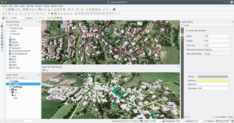
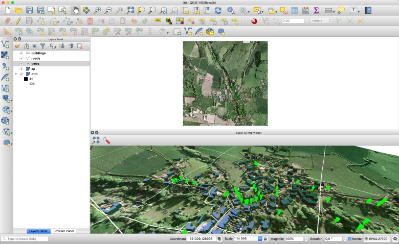
Results are included in the QGIS 3.0 release. As proposed in the grant, a new 3D map view has been added together with GUI for easy configuration of 3D rendering. The 3D view displays terrain (either from a DEM raster layer or a simple flat area) with 2D map rendered on top of the terrain. In addition to that, vector layers can be rendered as true 3D entities: points may be visualized as simple geometric shapes or as 3D models (loaded from a file), polygons and linestrings are tessellated into 3D geometries. 2D polygons can be turned into 3D objects using extrusion, possibly with data-defined height – an easy way how to display buildings, for example. Data with 3D coordinates have the Z values in geometries respected. Although the 3D view is still in its early stages, it is already usable for many use cases. Hopefully this functionality will help to attract even more users to QGIS!

More details: https://github.com/qgis/QGIS-Enhancement-Proposals/issues/105

Improvements to relations – Régis Haubourg

Various improvements for deep relations with PostgreSQL were successfully added in QGIS 3.0:

Add consistency to UI controls – Nyall Dawson

We’ve unified all the various opacity, rotation and scale controls to use the same terminology and numeric scales. We’ve also updated ALL methods for setting opacity, rotation and scale within the PyQGIS API to use consistent naming and arguments, making the API more predictable and easy to use. Lastly, we’ve also added a new reusable opacity widget (QgsOpacityWidget) to the GUI library so that future code can (and 3rd party scripts and plugins) can follow the new UI conventions for opacity handling.

Extend unit test coverage for geometry classes – Nyall Dawson

We’ve extended the unit testing coverage for all the underlying geometry primitive classes (points, lines, polygons, curves, collections, etc) so that all these classes have as close to 100% unit test coverage as possible. In the process, we identified and fixed dozens of bugs in the geometry library, and naturally added additional unit tests to avoid regressions in future releases. As a result QGIS’ core geometry engine is much more stable. Furthermore, we utilised the additional test coverage to allow us to safely refactor some of the slower geometry operations, meaning that many geometry heavy operations will perform much faster in QGIS 3.0.

Processing algorithm documentation – Matteo Ghetta & Alexander Bruy

The new Help system is landed and already available: when opening a Processing algorithm and clicking on the Help button, the guide of the algorithm will be showed in the default browser.

Many of the QGIS Processing algorithm guides have been enhanced with pictures and new or enhanced descriptions. A consistency number of Pull Requests have been already merged and many others are in review. Just a few descriptions need to be still enhanced.

Currently all the QGIS algorithms have been described and all the PR in the doc repository have been merged (kudos to Harrissou for all the reviews!).

Right now the Help button of each Processing dialog will open the related page of the algorithm, BUT:

  • if the name of the algorithm is made by only ONE word (e.g. clip, intersection…), the help button will open the browser to also the correct section (that is, the user will see directly the description of the related algorithm)
  • if the name of the algorithm has >1 words (e.g. split polygon with lines, lines to polygon, ecc.) the Help button will open the correct page (so the algorithm GROUP) but is not able to go to the correct algorithm anchor. This is because sphinx converts “split with lines” in “split-with-lines” while QGIS system will always cast the words “split-with-lines” in “splitwithlines”. Not a big deal, but IMHO a pity.
    We are really too close to the solution.

So Processing Help system right now consists of:

  • QGIS algs -> documented
  • GDAL algs -> documented
  • GRASS -> documented (own docs)
  • Orfeo -> documented (own docs)
  • SAGA -> nothing documented

Thanks to QGIS Grants to provide this chance to give a big improvement to the Processing framework even if not in a coding way!


Last but not least, we had another project that was not part of the grant programme but was also funded by QGIS.ORG in 2017:

Python API documentation – Denis Rouzaud

QGIS Python API Documentation is created using Sphinx and this work is available on Github. The repo is a fork of QGIS’ one and has been merged in the meantime. The docs are available at qgis.org/pyqgis. It uses a new theme (sphinx_rtd_theme aka ReadTheDocs theme). Some improvements were brought in (not exhaustive):

  • QGIS theming with colors and icon
  • Foldable toctree
  • Summary of methods and attributes for classes
  • Module index (not available before)
  • Correct display of overloaded methods

Full Python signature in Docstring

In former SIP versions, it was not possible to use the auto generated signature if a Docstring already existed. This means any documented method could not have a signature created. Unfortunately for this project, the vast majority of methods in QGIS API are documented!

The source code of SIP was modified and theses changes got merged upstream. See rev 1788 to 1793 in SIP changelog. It will be released in upcoming 4.19.7 version. QGIS source code was modified accordingly to prepend auto generated Python signatures to existing Docstrings. Using a CMake configuration file for each module (core.sip.in, gui.sip.in, etc.) was required to avoid syntax errors when using former version of SIP (since bumping minimum version is not realistic).

Sipify adjustments

Many things were fixed in sipify script :

  • Creation of links to classes, methods
  • Handling/fixing of Doxygen annotations \see, \note, \param
  • Handling of code snippets: c++ vs Python. Only Python are shown.

Thank you to everyone who participated and made this round of grants a great success and thank you to all our sponsor and donors who make this initiative possible!

Anita

Preparing for the next LTR

Dear QGIS users,

As you know, QGIS 3 has recently been published. This version introduced big changes in  the code structure that, in addition to the new functionalities already exposed, makes our code base more modern and easier to expand and improve on in the future.

As a normal by-product of such a huge overhaul, these changes also triggered a series of new issues, that you, our users are helping to discover and document. Our objective is to eliminate the most important of these issues in time for what will be our next Long Term Release (LTR) – version 3.4. This release is scheduled for October 2018. The resources available from QGIS.ORG funds are limited, and we have already invested in QGIS 3.0 far more than we have done for any previous version.

Now is a great time for users, and particularly for power users, larger institutions and enterprises, to invest in QGIS bugfixing. You have a number of different options: donating your developers’ time or hiring a developer directly to resolve the bugs that annoy you most, sponsoring our foundation, or donating to QGIS.ORG.

Our targets are:

  • 20k€ within 2018-05-18 (for 3.2)
  • 40k€ within 2018-09-14 (for 3.4)

If you would like to help, feel free to contact us (preferably through the qgis-users or qgis-developers mailing list, or directly to info@qgis.org) for further details!

signature_qgis_cert

QGIS Grants #3: Call for Grant Proposals 2018

Dear QGIS Community

Our first two rounds of Grant Proposals were a great success. If you are an early adopter using QGIS 3.0, you can already try out some of the new capabilities that have arrived in QGIS thanks to these grants.

We are very pleased to announce the third round of grants is now available to QGIS contributors. The deadline for this round is Sunday, 13 May 2018. All the details for the grants are described in the application form, and for more context we encourage you to also read these articles:

We look forward to seeing all your great ideas about how to improve QGIS!

Anita Graser

QGIS PSC

QGIS Annual General Meeting – 2018

Dear QGIS Community


We recently held our 2018 QGIS Annual General Meeting. The minutes of this meeting are available for all to view. As I have previously announced, I have decided to step down as chair of the PSC this year, so this post is my last official act as QGIS Chair. Thank you all for the kind words and deeds of support you gave me during my time as project chair.

I would like to welcome our new QGIS Board Chair: Paolo Cavallini, and our new QGIS Board Vice-Chair and QGIS PSC Member, Marco Bernasocchi. In case you are not familiar with Paolo and Marco, you can find short introductions to them below. I am pleased also to say that the project governance is in good hands with Richard Duivenvoorde, Jürgen Fischer, Andreas Neumann and Anita Graser kindly making themselves available to serve on the PSC for another two years. It is also great to know that our project founder, Gary Sherman, continues to serve on the PSC as honorary PSC member. Gary set the standard for our great project culture and it is great to have his continued presence.

QGIS has been growing from strength to strength, backed by a really amazing community of kind and collaborative users, developers, contributors and funders. I am looking forward to seeing how it continues to grow and flourish and I am excited and confident it will do so with Paolo acting as the project chair and representative. Rock on QGIS!


Paolo Cavallini

Paolo

I got involved in QGIS long ago, first as a user, then more and more deeply in various activities, initiating and supporting various plugins and core functions (e.g. GDAL Tools, DB Manager), opening and managing bugs, taking care of GRASS modules, handling the trademark registration, etc. I acted as Finance and Marketing Advisor for several years. Currently, I manage the plugin approval process. Motivation: It’s such a pleasure building up, in a truly cooperative and democratic way, together with truly intelligent people, a tool that enables people to freely do their job or pursue their interests, that I cannot resist helping as much as I can.

Marco Bernasocchi (http://berna.io @mbernasocchi)

20180214_112925.jpg

I am an open source advocate, consultant, teacher and developer. My background is in geography with a specialization in geographic information science. I live in Switzerland in a small Romansh speaking mountain village where I love scrambling around the mountains to enjoy the feeling of freedom it gives me. I’m a very communicative person, I fluently speak Italian, German, French English and Spanish and love travelling. I work as director of OPENGIS.ch which I founded in 2011. Since 2015 I share the company ownership with Matthias Kuhn. At OPENGIS.ch LLC we (4 superstar devs and myself) develop, train and consult our client on any aspect related to QGIS. My first QGIS (to be correct for that time QuantumGIS) ever was “Simon (0.6)” during my BSc when the University of Zurich was teaching us proprietary products and I started looking around for Open Source alternatives. In 2008, when starting my MSc, I made the definitive switch to Ubuntu and I started working more and more with QGIS Metis (0.11) and ended developing some plugins and part of Globe as my Masters thesis. Since three years the University of Zurich invites me to hold two seminars on Entrepreneurship and Open Source. In November 2011 I attended my first Hackfest in Zürich where I started porting all QGIS dependencies and developing QGIS for Android under a Google Summer of Code. A couple of years and a lot of work later QField was born. Since then I’ve always tried to attend at least to one Hackfest per year to be able to feel first hand the strong bonds within our very welcoming community. In 2013 I was lucky enough to have a release named after a suggestion I saved you all from having QGIS 2.0 – Hönggerberg and giving you instead QGIS 2.0 – Dufour Beside my long story with QGIS as user and passionate advocate I have a long story as QGIS service provider where we are fully committed to its stability, feature richness and sustainable development. Furthermore, as WorldBank consultant, I am lucky enough to be sent now and then to spread the QGIS goodness in less fortunate countries. Motivation: One of my main motivation to be part of the PSC is to help QGIS keep this incredible growth rate by being even more attractive to new community members, sponsors and large/corporate users. To achieve this, the key is maintaining the right balance between sustainable processes (that guarantee the great quality QGIS has been known for) and an interesting and motivating grassroots project where community members can bloom and enjoy contributing in their most creative ways.


Regards

timsutton

Tim Sutton (outgoing Chair)

QGIS 3.0 Girona is released!

We are pleased to announce the release of QGIS 3.0 ‘Girona’. The city of Girona was the location of our 15th developer meeting.

This is the first release in the 3.x series. It comes with tons of new features (see our visual changelog) and under-the-hood updates. As such, we do not expect it to be as reliable as the 2.18 LTR just yet.

From now on, 2.18 is the only Long Term Release (LTR) and 2.14 is retired.

Once the release is done, our packagers will start preparing packages for different operating systems. We’ll keep you updated when different packages and installers become available.

We would like to thank the developers, documenters, testers and all the many folks out there who volunteer their time and effort (or fund people to do so). From the QGIS community we hope you enjoy this release! If you wish to donate time, money or otherwise get involved in making QGIS more awesome, please wander along to qgis.org and lend a hand!

QGIS is supported by donors and sponsors. A current list of donors who have made financial contributions large and small to the project can be seen on our donors list. If you would like to become and official project sponsor, please visit our sponsorship page for details. Sponsoring QGIS helps us to fund our six monthly developer meetings, maintain project infrastructure and fund bug fixing efforts. A complete list of current sponsors is provided below – our very great thank you to all of our sponsors!

QGIS is Free software and you are under no obligation to pay anything to use it – in fact we want to encourage people far and wide to use it regardless of what your financial or social status is – we believe empowering people with spatial decision making tools will result in a better society for all of humanity.


Documentation for QGIS 3.0 – call for contributions!

Dear QGIS users, enthusiasts and fine people out there. QGIS 3.0 is coming very soon….we are in a ‘soft freeze’ state at the moment while we wait for some critical last pieces of code to get finalised. Then we go into hard freeze and prepare to roll out our next major release. Those of you that have been playing with the ‘2.99’ builds will surely have noticed that QGIS 3.0 is going to feature a huge number of improvements and new features – both in the user interface and in the API and code internals.

Screen Shot 2017-12-03 at 23.05.34

But we have a BIG problem:
we need your help to document and describe all those fine new features!

Yes fine reader now is the time to break out of the ‘passive user of QGIS’ mould you might find yourself in and lend a hand. We have an issue tracker with an issue for each of the new features that has landed in QGIS 3.0. Even if you do not know how to use our Sphinx based documentation system, you can help tremendously by preparing the prose that should be used to describe new features and attaching it to the issue list linked to above. If you do that, the documentation team can do more editorial work and less  ‘writing from scratch’ work.

Writing documentation is a brilliant way to enhance your own knowledge of QGIS and learn the new features that are coming in the next release. For those starting out with documentation there are issue reports that are tagged “easy” to lower the barrier for beginners. If you are an existing documentation team member it would be great if you could review the list and check whether there are more issues that can be tagged as “easy”.

The issue list is automatically created whenever a developer commits a change to QGIS with the word ‘FEATURE’ in their change notes. In some cases the change may not be something that an end user will be able to see – so it will be great for volunteers to also review the automatically added issues and close off any that are not relevant for documentation.

Other features are quite complex and in some cases could benefit from interaction with the original developer to make sure that the nuances of the new features are properly described. We need documentation writers to follow these thread and present the new functionality in a clear and concise way.

There are some very helpful resources for people just getting started with QGIS documentation. You can read the documentation for contributors. You can also contact the team via the community mailing list for specific help if the contributor docs don’t provide the information you need.

If you want to see the QGIS Documentation up-to-date for the version 3.0 release, please do get involved and help Yves Jacolin and the documentation team!

Lastly if you are not able to directly contribute to the documentation, consider funding QGIS – we have a budget for documentation improvements.

We look forward to your support and contributions!


Tim Sutton (QGIS Project Chairman)


QGIS Server refactoring is done!

As you may know, QGIS is jumping to a new major version. (Yes!) Doing so was made necessary because of the need to switch to Python 3, Qt5, but also because we needed to break the QGIS API in several places.

A year ago there was an appeal on the QGIS developer mailing list about the strong need for love that the QGIS server code base required. Indeed, the API was locked by some old methods of QGIS server. In short, QGIS server was reparsing the .qgs project file in its own way, and created dependencies to parts of QGIS we needed to drop.

As outsourcing the server code base was not an option, so we had to refactor it. The involved parties decided to get engaged in a code sprint in the city of Lyon , France dedicated to sharing their vision, planning the work and finally making all the following happen:

Higher level refactoring

All services (WMS GetMap, WFS GetFeature, GetLegendGraphics, WCS, GetPrint etc..) have been rewritten. Some like WMS were entirely rewritten. Kudos to the devs!

New features

Deep, complex and unrewarding tasks

  • Remove all singleton calls
  • Cut all the dependencies to the old QGIS project file parser
  • Minimize dependencies to GUI library. Since fonts are necessary to render maps, totally removing them was not feasible.

Infrastructure tasks

Additionally, some of these new developments have already been presented at FOSS4G-EU in July.

Congratulations to the developers who worked hard on this!

Now this deserves to be well tested, please report back any issues!

Do you want to host a QGIS developer meeting?

Each year the QGIS.ORG community holds two developer meetings. These events are an important part of  our project – they provide an invaluable opportunity for us all to meet face to face and share ideas, discuss issues and plan the future of QGIS.

The host of the developer meeting gets a special bonus for hosting the meeting: One of our releases will be named after the town / village / city etc. where the event was held – like this:

Screen Shot 2017-09-02 at 11.11.31 PM.png

We want to have a better idea of which venues we will be using for future events to help with out planning. So I am putting out a call for venue proposals:

If you would like to host a QGIS developer meeting (estimated 50 people per event) or a QGIS Conference (estimated 100-150 people per event) please contact us!

Please don’t submit proposals unless you have the authority to make such a proposal and are willing to act as the local organiser for the event. To make a proposal, fill out this form and tell us about your great venue!


Plotting the future of QGIS

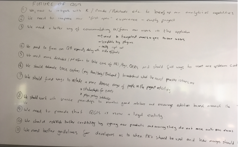
During the developer hackfest at our recent QGIS Conference in Nødebo, the developers present had a discussion session about the future (post 3.0) road map for QGIS. Note that the ideas laid out here do no necessarily represent a consensus between all the QGIS developers and community members since those present at the hackfest were only a subset of the great QGIS community. However the discussion probably provides a good idea of the kind of things on our minds as we move forward to QGIS 3.0 and beyond. Just a note before you get too excited reading the article below: This was a future looking session of great ideas that will take QGIS forward, but there may not be anybody actively working on these ideas (if you are looking for something to fund it would be a great start!). Here are twelve ideas that were raised (in no particular order)…

1. We need to beef up the analytical capabilities in QGIS

There was a general feeling that we should have stronger analytical capabilities in QGIS. Somewhere along the line we lost ManageR (the R integration with QGIS) and we have missed the boat in having something like Pandas / Jupyter Notebooks, embedded into QGIS (with iface available to the console). Whilst many data scientists are using R, going the python route with Pandas and Jupyter Notebooks might be a better fit in terms of being harmonious with the other work that has been done to provide python bindings for QGIS. But hey, why not provide both a Jupyter Notebook that supports both Python and R out of the box? Technically curious may want to look here for some hints on how we might go about integrating Jupyter into the QGIS application…

2. We need to improve our ‘first open’ experience

Especially for new users and novice GIS users, starting a QGIS project with a blank white canvas and many buttons and menus can be quite intimidating. We want to provide some basic projects (e.g. based on OpenStreetmap tiles) that can appear as a default layer when you open the QGIS application so that you can immediately get a sense of place and space – much like you would get in Google maps or any web mapping application. Naturally we will provide the option to disable this for those who are not interested in this functionality, but we would make it a default behaviour for new users…

3. We need a better way of communicating with our users

We do not even know simple things like how many users we have (I estimate broadly between 500 000 and 1 000 000 users based on downloads). Most users are silent users – they never communicate with the upstream project via our mailing lists or other communication mechanisms. Not knowing stuff about our users makes it hard to build a better product for them, and not having a communication channel with our users makes it hard for us to let them know about important updates, bug fixes, events etc. and it is a bit silly to be in this situation because every time a user opens QGIS, we have an opportunity to share this kind of information with them. So in the future it would be nice to have a way to provide timed and targeted messages to our users (for example letting them know when we have made a new blog post on the official QGIS blog). It would be nice to have the notification system scriptable by plugin. Of course it should be easy to opt out of or filter the messages by category (e.g. don’t show me event announcements) we share with our users. Imagine on the projects list view you see when you first open QGIS that we have a panel to the right of the projects list which just lists the headlines of the latest announcements. Perhaps there are other ways we can communicate with our users, but we should really make it a priority to get to know our users and this seems like a good start. By seeing how many times a given article gets read after it as been posted in the QGIS announcement area, we might get a better indication of how many users we have. Another example – when a new LTR bug fix comes out, we can publicise it better to make sure users are aware of the important fixes.

4. We need to focus on Quality Assurance (QA)

Especially as relates to reducing the incidence of side effects, QA is going to be critical as the project grows and gains a user base that uses it for critical functions. Side effects happen when e.g. a developer implements one feature that (probably unbeknownst to him) breaks another feature. Side effects are bad because they are hard to test for and hard to trace back to the root cause. The development of QGIS happens in a largely ad hoc manner – developers get contracts to build features their clients need, there is no top-down approach to how we roll out new features. This makes it difficult for us to ensure that side effects do not happen. We are not only concerned with side effects, but QA in general and would like to have the time and resources to spend on really taking the work that has already been put in place (automated testing on Travis for example) to the next level.

5. We need more dedicated (paid) effort to take care of the project

QGIS has become too big of a project to rely entirely on volunteers to take care of all aspects of the project. Many of us still contribute many hours of unpaid volunteer time to the project and will continue to do so. It has long been my vision that we eventually recruited a corps of professional (i.e. paid) contributors to work on QGIS, especially to take care of things that contract work will never cover. For example triaging the pull request queue (which is extremely time consuming), managing the issues in the issue tracker, expanding our test suite coverage, writing documentation, fixing bugs and building ‘cross cutting functionality that typically would not be funded by client work but that everyone will derive benefit from. Our project revenue (from sponsorships and donations) has been steadily growing (thank you to all of those that have contributed!) and if we can increase the revenue a little more we will reach the point where we can start to recruit some of our community members to work for QGIS.org on a professional basis – maybe on a part time basis in the beginning, but eventually building a corps of full time paid staff. This has long been a vision of mine for QGIS and if it is the one thing we achieve while I am project chair, I will be a happy chappie!

6. We need to automate trace captures

This relates somewhat to 3. above – when a user experiences a crash in QGIS, we have no automated way to get that crash information (and no Apple / Microsoft do not pass along the tracebacks to us when they offer to let you post them to their domain 🙂 ). Services like Sentry can aggregate crash data and help us understand the impact of different issues – and thus how to prioritise fixes.

7. We need to find ways to include a more diverse range of people in the project

In this particular brain storming session, we had one lady (hi Sophie!) in a room full of maybe 40 men.

We also have little representation from Africa, Asia, Latin America. A few years ago we added a diversity statement and a code of conduct to our web site, but  we need to ‘get out there’ and be more active about ensuring that people of all ages, genders, races, religions and cultures feel welcomed into our project and start actively participating as ‘makers’ not just consumers. We are a friendly and welcoming project and we should take the effort to let everyone know they are welcome in our community. Some ideas were aired about e.g. having scholarships to fund people from developing nations who would like to attend our conferences and hackfests, and scholarships to fund new developers to port plugins to QGIS 3.0 or similar more entry level tasks. It would be great to have users out there in the commercial world reach out to us to help make this happen (e.g. by offering to fund the travel and expenses of a developer who would normally not be able to attend due to costs).

8. We need to work on maintaining good relations with providers

QGIS sports a growing list of independent commercial support providers – some with very large user bases. I’ve written before here on the blog about some things providers should do to be ‘QGIS friendly’. We really want to encourage providers to use the QGIS LTR’s (Long Term Releases) as the basis for their support services, upstream their fixes to the QGIS project and avoid providing forked copies of QGIS to their clients. Why? It will improve the quality of the LTR QGIS packages and clients of every support provider will benefit. We would also really like to appeal to our commercial support providers to refer to QGIS upstream LTR builds as the ‘Official’ QGIS releases and not some lesser adjective like the ‘Community’ QGIS Release. There was the sentiment in the meeting that  calling it a community release implies that the vendor’s packaged copy is the ‘good one’ and the QGIS.org is the ‘not so good one’ and we would like to reverse that perception. It may seem like splitting hairs to some but we would like to see that there is not fragmentation in the user base of QGIS so we think that it is important to set the right tone from the get-go.

9. We need to promote that QGIS is now a legal entity

It has taken a lot of work, planning and hoop jumping, but QGIS.org is now a legal entity – a Swiss Association / Verein. We are VAT registered, have our own bank account and can now hold our own trademarks and IP instead of working through a proxy. We hope this will open a new chapter in the future growth of QGIS – in particular in our ability to attract much more substantial funding and to make formal agreements with entities where needed. A huge thank you to Andreas Neumann (QGIS PSC Member and project treasurer) for making the whole process happen!

10. We should establish credibility by code signing our products

There was some discussion about the fact that QGIS installers don’t always get recognised by operating systems as a ‘good’ application – virus checkers might flag it or system preferences my reject applications that are not code signed. The good news is that since the meeting Jürgen Fischer has added code signing for the Windows binaries (if that makes you happy please buy him a beer or something :-)) and there is work in progress by Larry Shaffer (who might also be motivated by beer :-)) to have code signed MacOS installers. Of course Linux users are probably scoffing here since they have a nice package distribution mechanism in place and they are already signed.

11. We need a smoother path to integration of code contributions

There was an extended discussion in our meeting about how we should manage contributions to QGIS as we move forward. Some were in favour of forcing everyone to use Pull Requests (PR’s) with a peer review. Others were in favour of also being able to push directly to the code base. Various other permutations were discussed. For now we are going to continue on with our current approach more or less which is to not prevent direct pushes to the code tree, but to discourage it – and of course non-core users will be required to use PR’s since they don’t have direct push rights to the official repo. Suffice to say we are aware of the fact that we have a large backlog of PR’s that are not merged and that it can sometimes be difficult to get your work merged. Hopefully in the future the ideas outlined in point 5. above will help to alleviate this situation….

12. Intergalactic domination

This was a late addition to our meeting notes, but still a worthwhile cause. Martin Dobias  felt strongly that we should include in our roadmap (thus not pictured below), plans for intergalactic domination and hey, if we are going to do something like that, we will need a good GIS to help us find our way around right? 🙂

Thanks to Nyall Dawson for prompting the discussion, it was great to once again experience how convivial and constructive our community discussions are, even when the topics can sometimes get difficult or technically involved!

Screen Shot 2017-08-25 at 12.20.05 PM


Report back on the 3rd QGIS Conference in Nødebo, Denmark

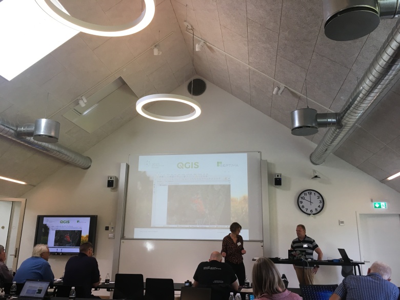
We just wrapped up the 3rd QGIS User Conference at the University of Copenhagen’s “Skovskolen” Forestry and Landscape College, just outside of Copenhagen. The conference programme was split into three parts:

  1. A general user conference of three days
  2. The a QGIS hackfest – where many developers brought their families along
  3. A week of workshops where attendees can learn in-depth topics such as expressions or the new QGIS Web Client version 2

We are extremely grateful to the event sponsors (you can find links to our sponsors at the bottom of this page):

Click to view slideshow.


Here are some of the highlights from the conference presentations:

Search – a cool unifiedsearch tool for QGIS

Klavs Pihlkjaer (from Septima) showed off the QGIS (version 2) search plugin. The plugin provides a unified search interface for datasets loaded in QGIS. You can also search external OGC services. If you are still using QGIS 2.x releases, run, don’t walk to try the search plugin. The Search Plugin also allows you to create third party plugins (via a simple python API) that integrate with it by adding new search sources to the list. If you are using QGIS 3, check out the ability to write plugins for the new locator bar! Klavs is still looking at porting his work over to work with the upcoming QGIS 3 release.

Impact Analysis plugin

Bo Victor Thomsen showed off the plugin he has built to support searching through many layers in multiple databases and database tables in a fast an efficient way. The layers do not need to be loaded in QGIS and the system uses a centralized configuration management approach so that adding new searchable sources is done once and is then immediately available for all users (e.g. in an enterprise environment) of the plugin. The plugin is currently used when searching municipal databases to see if there is any impact assessment needed or inspection needed in a given place.

Danish National Data Search

Mie Winstrup and Tom Weber showed off the national data search plugins they have developed for Denmark that allow you to easily search for local and national data. They want to be an example for other countries to show how easy it is to make national data searchable and available.

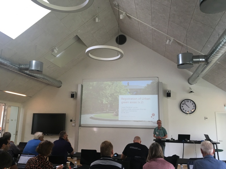
Casper Bertelsen on registering urban green areas

Casper showed the system he has developed for managing a cadaster of green spaces. The system includes versioning so that you can see changes over time. It also implements topology rules to ensure that areas do not overlap. He also provides tools for administrations to e.g. see what the maintenance cost for a given area will be.

QGIS as a digitizing platfom

Saber Razmjooei from Lutra Consulting showed off QGIS as a digitizing platform. He also showed us new digitizing coming in QGIS 3. He showed off some of the great tools coming in QGIS 3 for node editing.

QGIS Web Client – Version 2

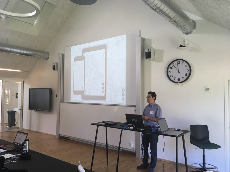
Andreas Neumann showed of the new generation of QGIS Web Client (QWC2). The new web client is really nice – responsive design and takes advantage of open layers 3 including rotating maps, permalink for any map view / set of layers, map tools for measure, draw, export etc.

Future plans include improved redlining tools including text, polygons, user authentication via LDAP or oauth, support QGIS ‘drag and drop’ forms, clip and ship and a QGIS plugin for the configuration so you do not need to edit JSON files. Also thinking about supporting vector tiles for the base maps.

I bet you didn’t know you could do this with QGIS

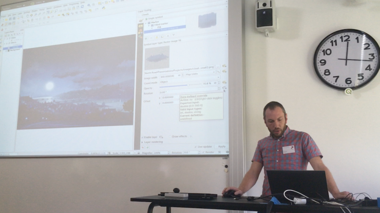
Nyall Dawson gave an awesome demo of the power and capabilities of QGIS’ labelling, symbology and expression features. His demo took us through an adventure story where each scene in the story was rendered using QGIS (based on the upcoming version 3 release). This included animated clouds floating by, lightning effects, electrical effects, smoke effects and many more cool and interesting ideas that really showed off the power and versatility of QGIS.

Screen Shot 2017-08-09 at 10.42.51 AM

QGIS 3D

Martin Dobias (Lutra Consulting) gave a presentation on the QGIS grant proposal  work he has been doing to support 3D visualizations natively in QGIS 3.  His work leverages the new Qt 3D framework provided in Qt5 (the toolkit used to develop QGIS) and allows you to use an elevation model to model a 3D terrain and use a new tab in the vector style properties dock to extrude features out from the landscape. We have had a number of 3D  tools in QGIS in the paste but none has ever been a mainstream component of QGIS, enabled and ready to use ‘out of the box’. Expect Martin’s work to change that. There were many ideas passed around about how the 3D support in QGIS could be extended but the grant proposal only supports the first-pass implementation, so please do fund Martin’s work if you would like to see him add specific features in the future.


QIGS as a cadastral management platform

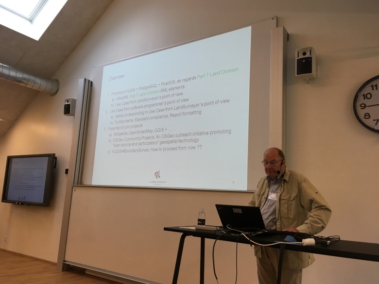
Prof. Erik Stubkjaer gave two presentations – one as a call for interest in those interested in building land parcel / cadastral management tools. He also gave an overview of the state of domain models for managing and recording property rights, including LADM (Land Administration Domain Model) and STDM (Standard Tenure Domain Model). He outlined that world aid organizations are increasingly putting an emphasis on enabling better tax revenue as a path to economic and social stability, and having a cadaster is a key element to the enablement. There are already a number of cadastral management tools out there for QGIS – it would be great to heed Prof. Stubkjaer’s clarion call and build a generic toolset for cadastral management in QGIS.

The future of coordinate reference system support in QGIS

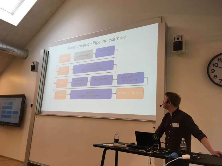
Kristian Evers from the Danish Agency for Data Supply and Efficiency spoke about the use of Coordinate Reference Systems in QGIS and the use of WGS84. He pointed out the fact that there are 6 different versions of WGS84 and they vary by up to a meter. He also highlighted the issue that e.g. ETRS89 drifts more out of sync each year. In addition the earth is dynamic with plates shifting and different regions moving with different velocities. He showed a really nice video made in Australia highlighting the issue (see here: http://www.icsm.gov.au/gda2020/ for details and the video). They use a plate fixed datum (which moves with the plates) together with a global datum (fixed to the center of the earth). This new approach is being planned / used in other places too (e.g. Iceland) and are called “dynamic datums”.  The dynamic datums will rely on a time stamp too as well as coordinates.

To address this they are introducing the concept of transformation pipelines in Proj.4 (the library used by QGIS to support projection) – there will be a new release of Project.4 which includes support for this.

InaSAFE

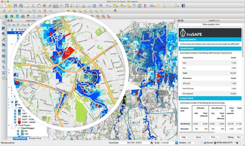
Tim Sutton (your humble blog post author) gave a presentation about InaSAFE – a plugin for QGIS that helps communities prepare for disasters.

Jonas van Schrojenstein Lantern (from Nelen & Schuurmans)

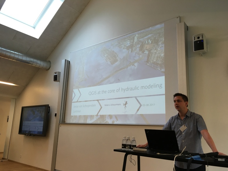
Jonas’ company built really fast and efficient models for flood models including 3D visualization. They have a really nice plugin for QGIS that lets you view a pipe model and different behaviors based on changed water levels. It requires a specific data model (d3i) in the Postgres backend and then you can visualize water levels in any pipe section. The plugin also lets you do the digitizing of the pipe network etc. The software also requires the use of som 3di services that Jonas will clarify how the licensing etc. should work.

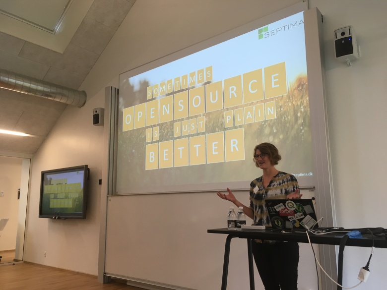
Mie Winstrup – Septima – sometimes Open Source is just plain better

Mie shared a case study about how they used Open Source to replace a tool built with ArcMap + Model Builder for flood modeling. They used malstroem  – a python command line module and also integrated with QGIS. It assumes the terrain is an impermeable surface and that water flows from one cell to another. The tool models where water will accumulate in the landscape and what the depths are at each ‘blue spot’. It also models how much water will flow from the blue spots (based on modeled precipitation amount e.g. 100mm rain). It generates an event layer which shows how many cubic meters of water will spill over to the neighboring watershed.

https://github.com/Septima/qgis-malstroem

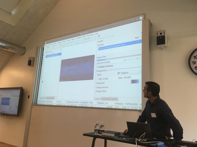
Saber Razmjooei – Lutra consulting – Crayfish plugin

Crayfish C++ plugin for QGIS adds a new renderer for gridded data. Works with HDF, NetCDF and GRIB.

What to watch out for in QGIS 3.

Nyall Dawson (core QGIS developer) gave a talk on what to expect in QGIS 3. The talk was not a feature round up but rather aimed at those concerned about the potential gotchas they will have to take care of when they migrate from QGIS 2 to QGIS 3 in their production environments. I record


Monica Balestrin Nunes & Ana Paula Maciel (National Secretariat for Housing in the Ministry of Cities, Brazil)

Monica and Ann Paula presented a talk on how the Ministry of Cities in Brazil are using QGIS and mapping to manage the roll out of housing projects to support  provision of housing for the poor “My House, My Life”. The project aims to help 4.5 million people get into housing.  They used QGIS to develop a site selection process too. They used a simple process to map urban areas, developed versus undeveloped urban areas, schools. They also used public transport as a parameters to further constrain the available areas. These data were used to produce a synthesis map which shows high, medium and low suitability of areas for housing development. They used a digital coding system to classify each area (which can be mapped back to the high, medium and low assessment ratings). They also used GeoServer, GeoKettle, PostgreSQL/PostGIS.

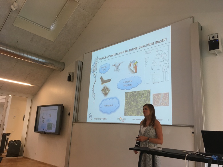
Sophie Commelinck – University of Twente

Automated cadastral mapping using UAVs. Sophie showed workflows she is building for automatic extraction of parcel boundaries from UAV imagery. She showed some interesting work in doing boundary line detection using the SLIC algorithm which creates smoothed lines along boundaries. See http://github.com/scrommelinck/boundarylinedelineation for more details.

Sophie.JPG

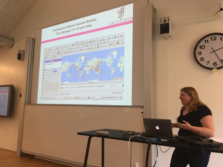
Kimberley Briscoe, Abingdon School, UK

Kimberley has been doing interesting things with high school kids learning GIS via QGIS. This work included using the time manager plugin to visualize global earthquakes and using r.lake.coordinates to do flood modeling. They also use ‘field trip gb’ mobile app to do field data collection. Many other plugins were used like EVIS, QGIS2Threejs. They also use interesting national datasets like crime etc. and data from http://data.gov.uk for their classroom work.

Kimberly.JPG

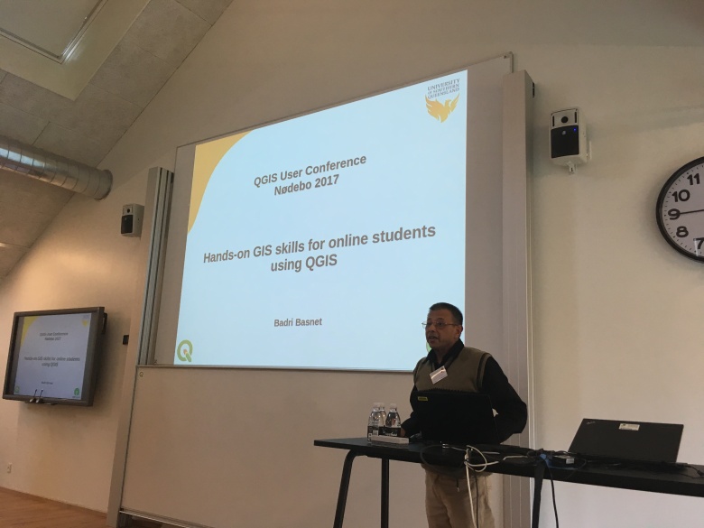
Badri Basnet – The University of Southern Queensland

Badri is a lecturer and has 90% online students in many different locations worldwide and with varying levels of internet access.  Badri has made many open content QGIS training videos and worksheets that he uses for his courses (which are based on QGIS). His videos are all on YouTube.

Badri.JPG

QField – Matthias Kuhn and Marco Bernasocchi (opengis.ch)

Matthias and Marco gave presentations on QField – an Android field data collection app based on QGIS (but with a mobile centric user interface). Matthias showed us many of the cool features QField has, whilst Marco outlined strategies for integrating field work, web publishing and desktop GIS work in a seamless workflow. I made some videos with my phone – audio and video quality is not brilliant but should be enough to follow along for those interested:

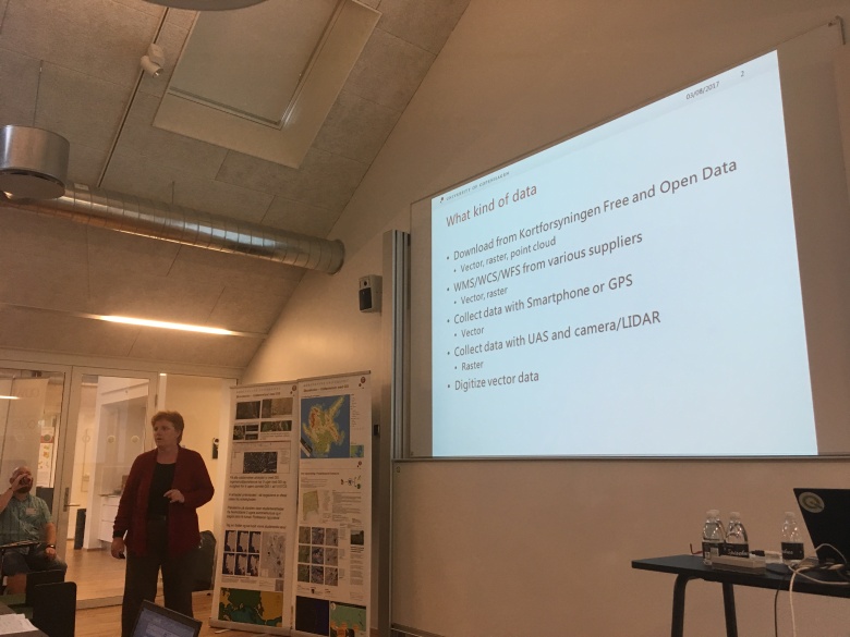
Lene Fischer (Skovskolen)

Lene (who also happens to be the event organizer – hurrah for the great job she did along with her team of volunteers!) showed how they approach teaching GIS and QGIS using ‘flipped learning’ where users first need to self study content on their own, and then use the lecturer as a consultant.

Lene.JPG

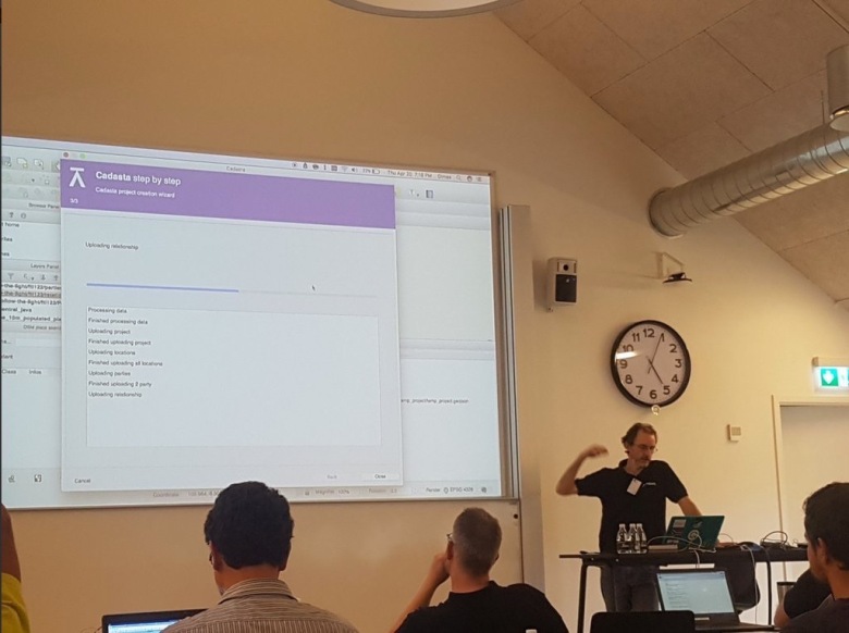
Tim Sutton – Cadasta

Your trusty author again – I presented work we have been doing to support mapping land rights of people in developing nations using the Standard Tenure Domain Model style approach where tenure is treated as a continuum rather than an absolute. You can find out more about this project at Cadasta.org

tim-cadasta

Workshops

The event was also filled with great workshops – two during the main conference, and then a week of post conference workshops. Most of the workshops were presented by developers or QGIS project members and represented a fantastic opportunity for attendees to learn straight from the experts!

Town hall meeting

At the end of the user conference, we held a town hall meeting where developers and active QGIS community members fielded a range of questions from the audience. It is always a please to hold these sessions – we get a direct channel of communication with our users and they get to speak directly to the people making the software they use and find out why we make the choices we make!

town-hall.jpg

Hackfest

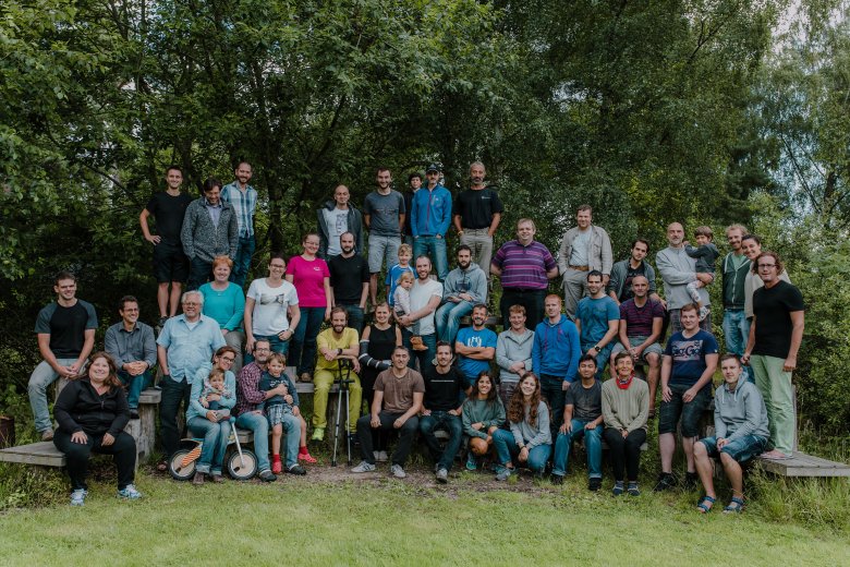
The “hackfest” (developer meeting – we use ‘hack’ in the positive sense of the word) was a chance for the QGIS community members to roll up their sleeves and work on new features, bug fixes, documentation and general polish of QGIS and related resources. It is always great to be able to work side by side for a few days – compared to our very geographically dispersed nature over the rest of the year. It was especially nice this event that many developers brought their families along to enjoy the beautiful scenery and great facilities at the Skovskolen. Here is a group photo taken by Mary Anne Lister:

IMG_2288

Thanks

On behalf of the whole QGIS community, I would like to extend our heartfelt thanks to Lene Fischer (event organizer), her team of volunteers, all the attendees who took the time to attend the conference – and of course all the developers and QGIS Community Members who attended and made it such a great event!


Event sponsor links:


3rd QGIS User Conference

This year, we are looking forward to the 3rd installment of our annual QGIS conference and it will be the biggest one yet!

The QGIS community, developers and users are meeting from August 2–11, 2017 in Nødebo at University of Copenhagen’s Forest and Landscape College.

1st user conference in Nødebo 2015

The program consists of the main conference, as well as a developer meeting and multiple workshops, including:

  • QGIS Expressions
  • Plugin development in Python
  • QGIS Server and Web Client
  • QField
  • QGIS cartography

The program is already online. So register and make sure to get a spot in your favorite workshops!

Let’s meet and make QGIS even better!

2017 QGIS Governance Update


Screen Shot 2017-05-22 at 11.33.46 PM
QGIS Developers and Community Members working on QGIS at our recent meet up in Essen, German,

Dear Voting members (and interested QGIS community members out there)

This is an open letter that was emailed to all QGIS voting members today

Just a quick note from me to thank you for participating in our ‘virtual AGM’ – I know it is a bit of an unusual system but it suits our geographically diverse nature well and we seem to have pretty good participation in the process (though I really encourage those voting members who did not participate to do so next time!).
I have done a bunch of updates on our governance section of the web site so you can find the AGM minutes, annual report, budget etc. all on the site, and I (or whoever is chair) will post them there in future years too so everything is in one place and easy to access. Here with the relevant links:
Since we have approved a new version of the statutes, I have replaced the old PSC page on the web site with the new charter:
Thank you all for the many useful hints, tips and suggestions I regularly receive on how to make things smoother within the project (keep them coming!) – hopefully we will get into a steady routine with this governance now. We have been going through a lot of ramp up trying to get templates, processes, etc in place as we switch over to QGIS.ORG legal entity etc. We appreciate your patience while we figure things out – and a very big thank you to Andreas Neumann and Anita Graser who have pitched in with a lot of administrative work behind the scenes to help get the QGIS legal entity in place!
What’s next? I will be starting the nomination process for 4 new community voting members, soon (one to match each of the incoming country user groups for Norway, Sweden, South Africa and France). At the end of that process we will have 31 voting members.
Soon QGIS.ORG will be in the Swiss Trade Registry, which means we can be VAT registered, can take ownership of the QGIS.ORG trademark (which is currently held in proxy for us) and of course present ourselves as a well governed project, hopefully attractive to large funders who recognize the global good a project like QGIS does!
Regards
timsutton
Tim Sutton
QGIS Project Steering Committee Chair

Call for presentations and workshop proposals: QGIS Conference 2017

NOTE: Deadline for proposals is May 15 2017

We are going back to Nødebo! Each year we combine one of our QGIS Developer Meetings with a User Conference. The User Conference is a great opportunity for QGIS users to meet developers and share their experiences – both with developers and with other users. Our first ever User Conference was held in Nødebo, Denmark in 2015 and we are thrilled to be going back to the beautiful venue at the University of Denmark’s Forest and Landscape College.

1k0a4924

The user conference will be combined with the QGIS Developer Meeting and a summer school event, with the first week being focussed on the User Conference, the intermediate weekend on the QGIS Hackfest and the second week on the Summer School. The event will run from the 2nd of August through to the 11th of August 2017.

We would like to invite those who are interested in presenting a talk to apply now (NOTE: Deadline for proposals is May 15 2017). There are four kinds of contributions you can make (see the conference website for full details):

  • 20 minute ‘lightning’ talks
  • 1-2 hour short workshops
  • half and full day workshops
  • posters (which should be presented in the form of a map)

We have identified a number of themes for the User Conference:

  • QGIS Software Development
  • New Technology
  • Business
  • Government/Municipality
  • Science
  • Education

Presenters of full day workshops are eligible for a EUR 1000 reimbursement to offset their costs. You can find out more details at the conference web page (as well as registering your talk / presentation):

https://qgis2017.wordpress.com/presentations/

We are looking forward to seeing a great programme come together for the conference!


QGIS Grant Programme #2 Results

We are extremely pleased to announce the winning proposals for our 2017 QGIS.ORG grant programme. Funding for the programme was sourced by you, our project donors and sponsorsNote: For more context surrounding our grant programme, please see:

Our intent with the QGIS.ORG Grant Programme is to support work from community that would typically not be funded by client/contractor agreements, and that contributes to the broadest possible swathe of our community by providing cross-cutting, foundational improvements to the QGIS Project.

Voting to select the successful projects was carried out by our QGIS Voting Membership. Each voting member was allowed to select up to 6 of the 13 submitted proposals by means of a ranked selection form. The full list of votes are available here (on the first sheet). The second sheet contains the calculations used to determine the winner (for full transparency). The table below summarizes the voting tallies for the proposals:
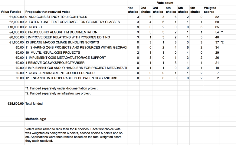
Screen Shot 2017-04-30 at 3.23.08 PM

A couple of extra notes about the voting process:

  • The PSC has an ongoing program to fund documentation so elected to fund the processing documentation work separately from the grant programme (note *1).
  • Voting was carried out based on the technical merits of the proposals and the competency of the applicants to execute on these proposals.
  • No restrictions were in place in terms of how many proposals could be submitted per person / organization, or how many proposals could be awarded to each proposing person / organization.
  • Because of the importance of having good packaging systems on each of the three major platforms, the PSC elected to additionally fund the work on MacOS bundling scripts (note *2).
  • Although the budget for the grant programme was €20,000.00, the total amount for the four winning proposals is €19,800.00, with an additional €5, 800.00 being made available to support the processing work and and MacOS packaging work.
  • Voting was ‘blind’ (voters could not see the existing votes that had been placed).

We had great participation in the voting process. Of the 27 voting members, 23 registered their votes.
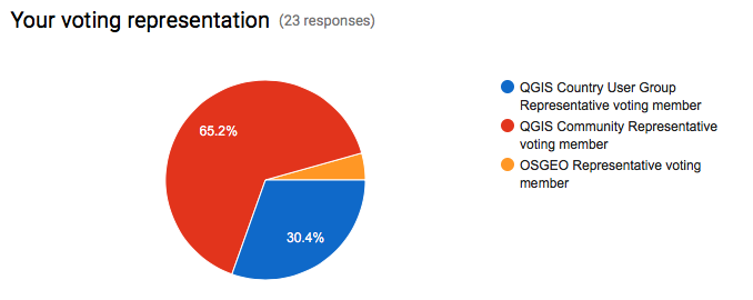
Screen Shot 2017-04-20 at 4.11.45 PM
On behalf of the QGIS.ORG project, I would really like to thank everyone who submitted proposals for this call. There were many interesting proposals that I believe would be of great benefit to QGIS and I hope others perusing the proposals list will use their initiative and funding interesting proposals independently if they can.

Below you can find the detailed proposals of the successful applications – we look forward to seeing the results of their work land in the code base soon!

Details of the approved grant proposals


9 ADD CONSISTENCY TO UI CONTROLS

Proposer: Nyall Dawson

Amount: €1800

Details: Across the QGIS UI, numerous inconsistencies exist in the way different properties like opacity and rotation are exposed to users. These inconsistencies make QGIS harder to use, as behavior from one dialog differs to the behavior in another dialog. Some examples of this include:

  • Rotation of labels is done in the opposite direction in labeling to symbology. Accordingly, an equal rotation value will result in different rotation between labels and symbols.
  • Scales are inconsistently presented, with use of both the scale numerator and denominator in different dialogs. “Minimum” and “Maximum” scales also vary between dialogs, with some dialogs using “minimum” scale as the largest scale and some using “minimum” as the smallest scale. The labeling scale based visibility controls are the biggest offenders here.
  • Controls vary between specifying “opacity”, “transparency” and “alpha”. While these all have similar results, users must adopt values to map “opacity” to “transparency” in different dialogs. This is further compounded by different ranges used for each (eg 0-100%, or 0-255).

Due to the usual API freeze, it has not been possible to fix these discrepancies. The current API break introduced with version 3.0 allow a window for addressing these issues and standardizing behavior and API.

Despite the benefits in providing a consistent UI, the work involved in standardizing is fiddly (careful attention must be paid to not breaking existing projects) and repetitive, and unlikely to be undertaken by developers on a volunteer basis.  Furthermore it is highly unlikely that a commercial organisation could justify sponsoring UI standardisation efforts. Without grant funding it is unlikely that these issues will be addressed during the 3.0 development cycle, and the inconsistencies would remain for the lifetime of QGIS 3.x.

In this proposal I will:

  • convert all “transparency” controls to “opacity” controls, and consult with the community to determine the ideal value range presented (0-100% or 0-255) before making all opacity controls use the same range.
  • Ensure that rotation always operates in the same direction.
  • Fix the labeling scale ranges to use the same scale range definitions as layer visibility
  • As much as possible, automatically upgrade existing projects so that they open in QGIS 3.0 without any loss of transparency/rotation/scale settings
  • (As much as possible without large refactoring), adapt the PyQGIS API so for consistent naming and use of opacity/rotation and scale setting/getting methods. Making the API consistent makes scripting QGIS and writing plugins easier.

This proposal relates to the issues described at:

History: No work has currently been undertaken in this regard.

Qualifications: I am currently one of the most active QGIS developers, with a long history of quality contributions to the project. I’m passionate about seeing QGIS 3.0 address these kinds of long standing UI issues which detract from QGIS’ otherwise professional image and ease of use.

Implementation Plan:  The work will be undertaken prior to the QGIS 3.0 feature freeze period.

Proposal Link:


3 EXTEND UNIT TEST COVERAGE FOR GEOMETRY CLASSES

Proposer: Nyall Dawson

Amount: €2000

Details: Since QGIS 2.8, there has been an increased focused on creation of quality automated regression (“unit”) tests designed to flag issues in code before the code is introduced to the QGIS codebase. The increase in stability of recent QGIS versions can be directly attributed to this growth in unit testing. Despite this, many areas of the QGIS codebase remain with little or no unit test coverage.

One critical area which has insufficient unit tests is the geometry classes. The geometry classes form the basis of all geometry interpretation, algorithms, and rendering within QGIS. In order to provide stable QGIS releases, it is crucial that these fundamental classes are rock-solid, efficient, and do not suffer regressions between releases.

Some years ago (shortly after the introduction of the new geometry engine, in which support for Z/M values and curved geometries was added) I added full test coverage for the Point and Linestring classes, and partial coverage for the Polygon class. Unfortunately, writing geometry tests is tricky and time consuming. There’s many corner cases with unusual or invalid geometries which need to be tested. The time commitment required prevented me from writing additional tests, and to date the remaining classes (including multi geometries and all curved geometry types) have little or no test coverage.

This proposal covers writing additional unit tests to cover all the remaining geometry classes.

It is important to note that unit tests do NOT ensure bug free software. Unit tests only protect existing logic and avoid regressions when the covered parts of the code base are changed in future releases. Despite this disclaimer, the process of creating unit tests usually stress-tests existing code and in itself CAN reveal existing bugs. This was certainly the case when the existing tests for Point and Linestring classes were added – creation of the tests alone resulted in many fixed bugs and stabler Point and Linestring geometry handling.

History: This work would continue on from work I begun a number of years ago to provide 100% unit test coverage for the base geometry classes.

Qualifications: I have a long history of quality contributions to the QGIS project, and am currently one of the most prolific committers to the QGIS codebase. I have a long history with adding unit tests to QGIS and advocating for their increased usage amongst developers.

Implementation Plan: This work would be targeted to the QGIS 3.0 release, and would be committed to the codebase prior to the feature freeze/bug fixing period leading up to the 3.0 release.

Proposal Link:


8 QGIS 3D

Proposer: Martin Dobias

Amount: €10000

Details: I would like to propose a project that introduces 3D rendering capabilities in QGIS.
To summarize the planned work, the following features can be expected:

  • 2D view of map canvas rendered on the graphics hardware (GPU) allowing smooth zooming and panning of map view
  • 3D perspective view of the map
  • generation of 3D terrain model from DEM (digital elevation model) layers
  • map layers rendered as a texture on top of the 3D terrain
  • support for true 3D rendering of vector layers rather than having just flat appearance
  • map view widget that is dockable in the main window and synchronized with the main map canvas
  • support for picking (identification) of objects in 3D view and X/Y/Z coordinate display
  • support for 3D map view in map composer

The overall target is to introduce an extensible framework for 3D map view within QGIS, so that in the future developers can add various 3D rendering techniques for map data, using custom geometries and materials (which may involve writing own vertex/fragment shaders), possibly even allowing multi-pass rendering for advanced effects (e.g. to render shadows cast by buildings with a particular sun position).
3D support in QGIS is not only about adding the extra dimension to the rendering: it is also about making it possible to use graphics hardware for rendering of map in 2D – making map browsing even more pleasant and faster at the same time. Rendering 2D maps with OpenGL also opens the door to various new graphical effects that would be otherwise very expensive

to achieve by using just CPU for map rendering.
This proposal does not assume addition of new geometry types like polyhedral surface (with read support for those) into QGIS – the aim of the work is to get 3D rendering engine running and new geometry types may be added at some point later.

State of the art

QGIS features very good 2D rendering capabilities, however its 3D support has been very limited. Prior work on 3D in QGIS includes:

  • Globe plugin – a C++ plugin developed by Matthias Kuhn and Sourcepole based on OpenSceneGraph and osgEarth libraries. OpenSceneGraph is a generic toolkit that provides higher-level abstraction on top of OpenGL, making it easier to develop 3D applications than directly using low-level OpenGL interfaces.OsgEarth project then builds on top of OpenSceneGraph and provides a toolkit for working with geographical data: it has a terrain engine that combines elevation layers into a terrain, applies textures from “image” layers and adds feature layers with true 3D objects.The plugin acts as a bridge from QGIS environment and feeds scene data into osgEarth to do the 3D rendering.
  • Qgis2threejs plugin – a Python plugin developed by Minoru Akagi. It is able to export QGIS project (with various configuration options) into a HTML page that uses three.js library to render map in 3D within web browser using WebGL.
  • Horao – developed by Oslandia. It is a standalone 3D viewer based on OpenSceneGraph that may be controlled by a QGIS plugin to display map from QGIS in 3D environment. It has explicit support for true 3D geometries in PostGIS.

While these projects solve some use cases for 3D rendering of map data, each of them have their own limitations. For example, osgEarth library used by Globe plugin has its own data access and rendering of vector features implementation, duplicating QGIS code and not having parity in their capabilities. Moreover it has been difficult over time to keep the build working on all platforms supported by QGIS. The main limitation of Qgis2threejs plugin is the fact that the 3D view is exported to web browser, so the user cannot use benefits of having 3D view tightly integrated with the rest of QGIS. The fact that Horao has a standalone viewer

application results in similar limitations as when using Qgis2threejs (although it has some degree of integration with QGIS application).

Proposed approach
Now that QGIS 3.0 is based on Qt5, we can use some of the great new functionality added recent releases of Qt5. In version 5.5, a new framework for working 3D graphics has been introduced and every major Qt5 release since has been adding more functionality, improving performance, compatibility and stability. The 3D support nicely integrates with the rest of the Qt framework, providing a familiar API and at the same time staying very generic and highly efficient.
The 3D framework provides high level abstractions just like other libraries (e.g. OpenSceneGraph, three.js). 3D scene is built with nodes (called entities) with various components (e.g. transformation, mesh, material).
The idea is to build 3D support in QGIS on top of the Qt 3D framework. From my initial tests of the framework this looks feasible and it will allow us to stick with Qt APIs without requiring extra dependencies.
The work can be divided into the following chunks of work:

  1. Rendering engine core: develop a framework that will do rendering of the map scene in 3D. The engine will have the responsibility of processing raster layers with elevation into a mesh geometry and texturing the mesh with map images rendered by the existing QGIS 2D rendering engine. The engine will support levels of detail (LOD) and tiling in order to be able to display high-resolution data in real time without having to load all the data into memory at the time of scene creation (which may be prohibitively expensive with more complex layers). 3D scene will be dynamically updated as user browses the map, keeping the amount of rendered triangles low while appropriate quality of the terrain for given zoom level.

All of the processing needs to be done in the background, so the user may freely browse the map and the scene will be continuously updated with data (changing between higher/lower detail when zooming, loading more data when moving map).

  1. Handling of user input: controller for camera that will make the camera fly on top of the map. Support for picking will be added to allow identification of objects in the map and display of coordinates at the mouse position.
  1. Integration with QGIS environment: dockable 3D map widget for the main window, synchronization with 2D map canvas, support for printing of 3D views in map compositions.
  1. Advanced 3D rendering techniques: interface that will allow adding new methods for data visualization in 3D and exploration of methods for rendering. By default map layers will be rendered into map image with the existing 2D map renderer – this interface will allow map layers to instead have 3D renderer associated which will provide entities with custom meshes and materials. As a result we will be able to achieve true 3D appearance of objects (e.g. point clouds, trees as 3D models, tesselation of polygons, buildings with extruded geometry and custom texture). Implementation of the advanced techniques is a task with nearly unlimited scope, so the idea is to develop a suitable interface and as the time will allow, implement some techniques.

History: For this proposal I have studied various sources:

  • looked into existing 3D viewer projects related to QGIS
  • explored Qt 3D framework
  • researched some academic papers regarding terrain generation and vector data display

As a proof of concept, I have created a simple prototype in C++ using Qt 3D framework. It displays aerial imagery on top of a terrain model created from a raster layer (DEM) and allows simple camera control. The code is available here: https://github.com/wonder-sk/qgis3d

Qualifications: I have been a core QGIS developer for more than 10 years and I have a very good knowledge of QGIS codebase, especially the existing 2D map rendering pipeline.
Previously when working at the university, on a project for stereo matching (creation of point cloud out of a pair of images) I worked on visualization of 3D data using OpenGL.
Implementation Plan: The plan is to work on the project between May and July 2017. As of now, the plan for QGIS releases (according to the mail from Paolo) is that QGIS 3.0 will have feature freeze in July 2017 and final release in September 2017. If nothing changes in the QGIS release schedule in meanwhile, the 3D support could be integrated into QGIS master branch before the feature freeze and thus released in QGIS 3.0.
If the project would be accepted, the first step will be to develop a prototype of the 3D rendering engine, then prepare a more detailed architecture proposal as a QEP and continue the implementation once the QEP gets accepted by the community. The work progress should be available on a branch in GitHub for anyone interested.
Proposal Link: https://github.com/wonder-sk/qgis3d


6 PROCESSING ALGORITHM DOCUMENTATION

Proposers: Matteo Ghetta, Alexander Bruy

Amount: €4000

Details: This proposal aims to improve the existing Processing algorithms documentation. With the pull request https://github.com/qgis/QGIS/pull/3911 it is possible to add external links for the documentation (both local and remotes). However the effective use of the pull request is not yet included in Processing.

With this proposal the existing code will be incorporated in Processing, allowing to have a Short Help tab (the existing one on the right of the Processing algorithm window) and a Long Help tab (next to the Log tab).

The Short Help tab will be collapsible in order to have a bigger window for the algorithm parameters, while the Long Help tab will point to the on-line existing documentation of Processing for each algorithm (http://docs.qgis.org/testing/en/docs/user_manual/processing_algs/index.html).

The default link of the on-line documentation will be added in the QGIS Settings (thanks to the pull request already merged) in order to have the standard documentation visible but to let the user the choice to overwrite it and load custom paths.

In addition to the code part, this proposal aims also to document the GDAL/OGR provider and the QGIS core algorithms. Existing documentation will be reviewed and pictures will be added when useful, while for algorithm not yet documented, the help will be written from scratch with description and additional pictures.

Currently there are:

  • 49 GDAL/OGR total algorithms, 35 to enhance with pictures, 14 to write from scratch
  • 154 QGIS algorithms, 38 to enhance, 116 to write from scratch

This means a total of 73 algorithm to enhance and 130 to write from scratch.

History: The pull request https://github.com/qgis/QGIS/pull/3911 is already merged and it is worth to make it effective to have nice, rich and translatable documentation for the Processing algorithms.

Qualifications: Matteo Ghetta: working since the release 2.0 on the documentation and made several improvements and pull request to both documentation and Processing code.

Alexander Bruy: core developer since 2010, co-maintainer of the QGIS Processing framework.

Implementation Plan: The code and the documentation will be ready for the QGIS 3 release.

Proposal Link:


5 IMPROVE DEEP RELATIONS WITH POSTGRES EDITING

Proposer: Régis Haubourg

Amount: €6000

Details: QGIS has reached a mature level and offers now a very good framework to create professional applications. One of the main reasons is that QGIS is a very strong client for spatial databases, and in particular with PostgreSQL and postGIS for which it was initially created.

Since version 2.14, QGIS offers the not-so-well-known ability to handle transaction groups, which means it can instantly evaluate triggers on database side, and refresh all layers in the same transaction. This is a big win for usability, but some drawbacks glitches remain, such as the lack of the undo/redo edit buffer, a very raw way of saving (ie quitting edition session) or having the legend cluttered by so many edit symbols (a pen symbol). Current proposal is to go a step beyond to make QGIS even better for PostgreSQL by achieving the following targets:

1 Restore an undo /redo feature by taking advantage of PostgreSQL. If possible we will try to take advantage of PostgreSQL named Savepoints.

2 Allow to have some layers not switching to edit mode in QGIS,  even if they belong to the same connection. These layers will still benefit from the instant refresh, but won’t clutter the legend with the edit pen symbol everywhere, nor risk to load QGIS snapping cache for nothing. A UI for those settings could be an evolution of the current “identify layer” list in the project properties.

3 We would like to submit a mechanism to allow converting error messages raised by the provider, like a RAISE from postgres, into custom user oriented message. Say for instance, instead of a “provider error – duplicate key for… “, QGIS project could be tuned to display first “You tried to insert a feature using the same identifier as another one”.

The error message list and regexp rules would be optionally stored in qgis project or read from a datasource table (for instance when error messages rewrites are shared by other applications). The original error message would be still avaiblable by expanding the details of the messageBar and in the general message log.

4 Cherry on cake point, we wish to have QGIS take advantage of PostgreSQL NOTIFY signals to trigger behavior in QGIS when something changes in the database (see https://www.postgresql.org/docs/9.5/static/sql-notify.html) . A first implementation proposal is to allow a map canvas refresh, but we can imagine really dynamic applications driven by the database events by converting NOTIFY messages into QGIS signals (oh yeah!).

History: In our team, we already use transaction groups for production tools and that is much appreciated. We already use some python logic to catch error message and convert them to more user oriented ones. We frequently develop applications where QGIS is linked with heavy database containing most of the intelligence. Having a really interactive edition process, speaking the same langage as average users, and being able to be triggered from database process will unleashed many possible applications.

Qualifications: Oslandia has three QGIS developers, two of them being core comiters and high  skills with Postgres and Postgis (core comiter too). We believe that developing using thick databases is a major strength of QGIS, and we have great fun getting involved in that area of the code 😉

Implementation Plan:  We currently are quite involved in QGIS 3 server refactoring and major changes such as Auxiliary Storage for project or core solutions for label connectors. We also are involved in applications build on top of QGIS for Water management like QWAT or QGEP. Such changes would benefit immediatly to those project. Our target is to provide those improvements with all necessary unit tests for 3.0 release.

Proposal Link: coming soon..


13 UPDATE MACOS CMAKE BUNDLING SCRIPTS


Proposer: Larry Shaffer


Amount: €1800


Details: Currently, the macOS bundling routines (to create a self-contained QGIS.app application) in CMake scripts where created by William Kyngsburye many years ago. Since then, CMake has added many features for bundling, e.g. BundleUtilities ( https://cmake.org/cmake/help/v3.0/module/BundleUtilities.html), that handle similar functionality to what has been arduously maintained in the CMake scripts. While the current setup does function, it is quite antiquated and adding any new QGIS dependencies to be bundled is an error-prone ordeal. I propose to fully update the bundling routines to leverage modern CMake capabilities, since building on macOS usually uses the latest CMake versions. Once completed, anyone with appropriate dependencies should be able to produce a production-ready QGIS.app bundle, including the QGIS project itself.


History: I will first build upon the existing work to ensure there is a minimal bundled QGIS.app, then completely refactor the same functionality using a modern CMake code workflow.


Qualifications: I have extensive knowledge in CMake and frequently utilize it in my work for my employer, Boundless Spatial. I have already completed a fully bundled QGIS.app distribution by my employer (similar to the first phase of the proposed work here), though Boundless now uses a different installation approach. I have been working for years on the OSGeo4Mac project in anticipation of producing better CMake bundling routines, to ensure the QGIS project can independently produce its own macOS distributions.


Implementation Plan: Basic work will follow these steps:

  • Append minimal bundling to existing CMake setup, so there is a least a functioning bundling routine, regardless of whether the proposed work is accomplished in time for the major next release.
  • Ensure the QGIS.app bundle is code-signed
  • Create a new methodology, based upon CMake’s BundlesUtilities, *in-line* next to the existing CMake routines, so both can be used, until there is a valid replacement.
  • Focus on minimal bundling, then add GRASS
  • Continue extending bundling routines to include major Processing providers, e.g. OTB, Saga, TauDEM, etc.
  • Ensure new method’s QGIS.app is properly code-signed
  • Enable bundling on Travis CI infrastructure, via Travis’ cron jobs, thereby adding the capability for the QGIS project to produce fully bundled nightlies of macOS builds.
  • Once new method represents a full replacement, old method will be removed, not just deprecated


Intended completion is in time for QGIS 3.0 release and packaging efforts.


Since the new method does not affect any existing code, as soon as useable functionality is achieved, it will be merged directly into master, then further code committed as work progresses.

Proposal Link: None at this time. Should I consider a QEP? Not many developers beyond the few existing packagers and experimenters would be involved. I would prefer to write a blog post after the work is completed, though post to the QGIS dev mailing list the intention to do the work, if this proposal is granted.

Logo Evolution – Call to User Groups

With QGIS 3.0 moving closer, it is also time to get the new QGIS logo out there.

QGIS logo evolution

We are therefore asking all our user groups to join the project redesign efforts. Please have a look at your user group logo and bring it in line with the QGIS 3.0 design.

We have compiled a Visual Style Guide which provides all logo materials, including fonts that you can use for your own user group logo. Here is an example of how the Italian user group has updated their logo:

Italian user group redesigned

We are looking forward to seeing all your creative efforts!


Update on the QGIS Grant Applications

In February this year, we put out a call for applications for the second (yay!) round of the QGIS grant programme. The intent of the programme is to leverage donor and sponsor funding in order to support community members with great ideas to improve the underlying infrastructure of the QGIS project and code base.

We have had a really great response to the call for applications (detailed list of applications is here for your reading pleasure – 231KB download).

Given that we have 13 proposals (down 7 from our last call) and only 20,000 Euros to disburse, the QGIS voting members will need to make some tough, pragmatic choices.The voting for the grant proposals ends at the mid April 2017, and we plan to announce the successful candidates soon after that. The PSC will arbitrate in the case of a dead heat or the proposal amounts of the top voted proposals not adding up to our funding target.

Although the number of proposals submitted is down from last year, the quality and utility of the proposals this year is really top notch and it is sad to know that we will not be able to fun them all through the grant programme. If you have the wherewithal to further support some of the grant proposals that did not make the cut, or the QGIS 3.0 effort in general, please get into contact with our treasurer, Andreas Neumann (finance [at] qgis.org) or head over to our sponsorship or donations page to support their work!

Lastly, I appeal to those QGIS Voting Members who have not yet cast their votes to check your email and head over to the voting form to cast your vote!


A report on QGIS Income 2016

Greetings wonderful QGIS Users, Developers and Supporters! 2016 was quite an  exciting year for QGIS – we released QGIS 2.14LTR which has been a great stable release. We also set the wheels in motion for QGIS 3.0 which we plan to release later this year. QGIS development takes a lot of time and effort – and much of the work is done by volunteers – especially the core project maintenance work which typically does not attract paid-for consulting work like new feature work does.

We are extremely lucky and grateful to have a growing band of sponsors that are helping us to slowly but surely fund more core QGIS project work too. In this post we want to say ‘thank you’ to the many sponsors that have stepped up to the plate when we asked for help and sponsored QGIS. We also want to provide some insight as to what level of funding we receive and hopefully stimulate some friendly enthusiasm to stepping up funding efforts from our users around the world.

Our project treasurer, Andreas Neumann, has been so kind as to compile a very detailed report about the sponsorships and donations received over 2016 which we would like to share with you. Before I share his actual report, let me just clarify that we have two distinct ways of contributing money to the project:

  • Donations: You simply nominate an amount you wish to contribute and pay it to the project. Donations are intended as a way for individual users to show their support for QGIS (although we welcome large donations too).
  • Sponsorships: Sponsorships are aimed at organizations. We have fixed tiers of contribution (see below) and each tier includes some benefits in terms of marketing exposure for your company or organisation.

QGIS sponsorship can be made at one of four levels:

2017-01-30 01_22_27-Projecta_ Sponsorship Levels -.png

Higher tier (silver and up) sponsors are included in the footer of our main web site, http://qgis.org e.g.:

Screen Shot 2017-02-25 at 8.50.22 AM.png

If you want to see your company listed there, why not head over to the QGIS Sponsorship page to find out how to become a sponsor?

Some interesting highlights from Andreas’ report:

Screen Shot 2017-02-25 at 9.00.07 AM.png

We had  1128 donations in 2016 amounting to a total of  €25108. We had  47 Sponsors in 2016 which raised a total income of  €67921. December is the month that attracts the highest income from donations and sponsors (though that may coincide with additional marketing we did calling for sponsors).  Looking at contributions by country, Denmark was the highest national contributor in 2016, providing a total of  €17795 to the QGIS.ORG project. If you normalize by population,  Iceland provided the largest per capita contribution to QGIS, providing  €9056 per million people.  Iceland also had the highest contribution rate when measured against GDP with  ~€154 per billion GDP.

Screen Shot 2017-02-25 at 9.04.34 AM.png

You can read Andreas’ full report in this PDF – a huge thank you to Andreas for preparing this fascinating report, and of course to everyone out there who shared their hard earned money with us – your funding has become a vital enabler for moving the project forward.

Regards

timsutton

Tim Sutton
(QGIS Project Chair)


QGIS Grants #2: Call for Grant Proposals 2017

Dear QGIS Community

Last year we held our first ever call for Grant Proposals and it was a great success. If you are an early adopter using QGIS 3.0 preview builds, you can already try out some of the new capabilities that have arrived in QGIS thanks to these grants.

We are very pleased to announce the second round of Grants is now available to QGIS Contributors. The deadline for this round is Sunday, 19 March 2017. All the details for the Grant are described in the application form, and for more context we encourage you to also read these articles:

We look forward to seeing all your great ideas about how to improve QGIS!

Tim Sutton

QGIS Project Chair


Minutes of the Inaugural QGIS General Meeting (2016)

Dear QGIS community members

At the end of December 2016, we held our inaugural Annual General Meeting (AGM). It should be noted that QGIS AGM’s will be ‘virtual’ meetings conducted as a questionnaire (for voting / raising motions) and then a report such as the one below, with optional follow up email discussion if deemed necessary. The reason for this is that our community is spread far and wide and any attempt at an in-person (physical or virtual) meeting will prove very difficult given the number of different time zones the participants live in. Thus this, and future, AGM reports will be a reflection / summary of the various online activities that constitute the ‘AGM’ and the reports should be read with this understanding in mind.  It should also be kept in mind that because we are bootstrapping the QGIS Board, the 2016/ 2017 meetings follow a reduced agenda – the 2018 meeting will commence with the full AGM agenda since we will have a year of financial reporting / board activity etc. behind us. Here follow the minutes:


Minutes of the Inaugural General Assembly (AGM) 2016 – Concluded 22 December 2016

Dear QGIS.ORG voting members,

In December 2016 we held a special Inaugural AGM event in order to bootstrap the new governance structures for QGIS.ORG. The following items were tabled during our special AGM to cater for the needed transition from the old organisation to the new:

Election of incoming board and PSC member replacements

Under our statutes, existing board / PSC members are automatically put forward for re-election during our PSC elections. A call for nominations was held and closed on 15 December 2016. All voting members were elegible to put forward their nominations. The following valid nominations were received (i.e. for candidates who were not already PSC members):

  1. Régis Haubourg

Subsequent to the call for nominations, an election was held via online vote. Response rate was 20 out of 27 eligible voters. Under our statutes this is considered a quorum. Election results were as follows:

Position Name Votes Received Max Votes
Chair: QGIS Board Tim Sutton 19 20
Vice-Chair: QGIS Board Paolo Cavallini 12 20
Treasurer: QGIS Board Andreas Neumann 20 20
PSC Member Richard Duivenvoorde 17 20
PSC Member Anita Graser 16 20
PSC Member Jϋrgen Fischer 14 20
Honorary PSC Member Gary Sherman

Note that each voting member was allowed 6 votes, but was not allowed to vote for the same person more than once. For the Board Member positions, which were specifically named, the candidate with the greatest number of votes for each role assigned that role. The PSC member positions were calculated based on the total number of votes each candidate received (including those allocated to named board roles). In accordance with our statutes, Gary Sherman remains on the PSC on a permanent basis as Honorary PSC member.

Election of the board chair

Election of the board chair was carried out as part of the general voting process. The successful candidate was Tim Sutton.

Matters brought forward by voting members

There were no matters brought forward by voting members.

Annual AGM for 2017

Now that the special AGM has been held and the Board and PSC constituted, we will hold our first AGM in the first quarter of 2017 (and then each year thereafter will be held in the first quarter). The 2017 AGM will be a reduced format since we will have just elected the PSC and Board,

Agenda for 2017 AGM:

  1. Approval of the annual report (2016) by the chair
  2. Approval of the annual financial report (2016)
  3. Approval of the 2017 budget
  4. Election of two financial auditors for the upcoming year
  5. Deal with matters brought forward by voting members


Given the outcomes of the end-2016 AGM, the QGIS Governance now looks like this (click for larger version):

qgisoperationalstructure

If you have any queries about the QGIS Governance processes, please do not hesitate to ask!

Regards

timsutton

Tim Sutton (QGIS Project Chair)


Back to Top

Sustaining Members