QGIS Planet

Dissolver polígonos em Postgres\Postgis

Trata-se de um cenário muito recorrente em análise espacial. Tendo uma camada\tabela composta por diversos polígonos, queremos “juntá-los” de acordo com valores distintos de um ou mais atributos (exemplo: de uma camada com os limites de freguesias, queremos obter os concelhos, ou, da COS ao 3º nível, obter o 2º ou o 1º)

Este artigo tem como objectivo mostrar como fazê-lo em Postgres\Postgis.

Tabela de exemplo

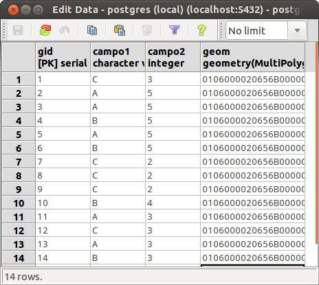
Como exemplo vou usar uma tabela como o seguinte formato:

CREATE TABLE tabela_1
    (gid serial PRIMARY KEY,
     campo1 character varying(128),
     campo2 integer,
     geom geometry(MultiPolygon,27493);

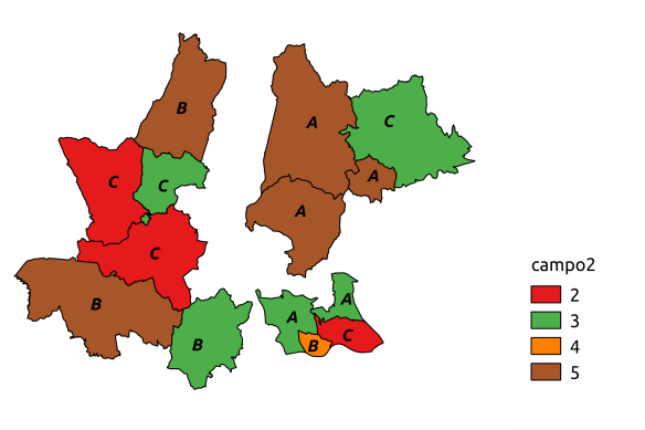
tabela1_original_tabela

tabela1_original

Dissolver todos os polígonos

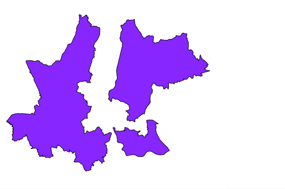
Em primeiro lugar podemos simplesmente agregar todos os elementos num multi-polígono único. Para tal usamos a função ST_Union().

SELECT
    ST_Union(t.geom) as geom
FROM
    tabela_1 as t;

tabela1_union

Separar polígonos que não sejam contíguos

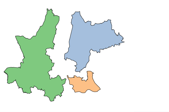
Se por outro lado não quisermos que o resultado apresente multi-polígonos usamos a função ST_Dump() recolhendo o campo da geometria.

SELECT
    (ST_Dump(ST_Union(t.geom))).geom as geom
FROM
    tabela_1 as t;

tabela1_union_dump

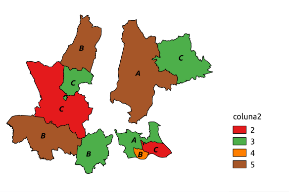
Dissolver polígonos com base em valores dos campos

Se quisermos dissolver os polígonos que tenham valores iguais num ou mais campos, basta incluí-los na cláusula GROUP BY. Se quisermos que esses campos apareçam no resultado (geralmente queremos) há que referi-los no início do SELECT.

SELECT
    campo1,
    campo2,
    (ST_Dump(ST_Union(t.geom))).geom as geom
FROM
    tabela_1 as t
GROUP BY
    campo1,
    campo2;

tabela1_union_by_value

Nota 1: Para quem prefere usar interfaces gráficos, preencher formulários e clicar em botões, o uso de SQL para fazer este tipo de operações pode parecer demasiado complicado e até um pouco retrógrado. Mas uma coisa garanto, com alguma prática as dificuldades iniciais são ultrapassadas e os benefícios que se retiram deste tipo de abordagem são muito recompensadores.

Nota 2: Visualizar o resultado deste tipos consultas de agregação (que usam a cláusula GROUP BY) no QGIS pode ser desafiante, este artigo explica como ultrapassar essa dificuldade.


Old map in QGIS

EN | PT

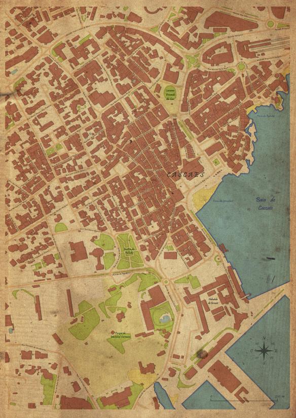
Inspired in a post by Anita Graser, I’ve tried to use QGIS to create a Cascais‘s old looking map, as if it have been drawn by hand in a methodical way.

Defining the styles

I have started by defining the styles for each elements to represent.

Buildings

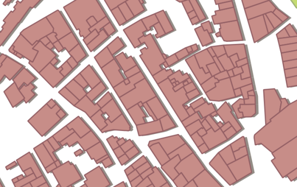
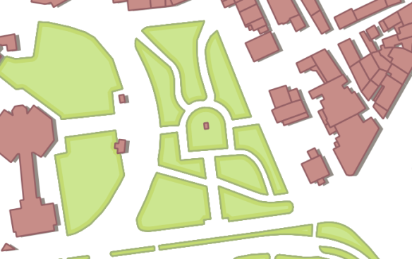
To fill the buildings, I have tried to use a color that reminds me the portuguese roofs, similar to the color commonly used in old maps of cities, with a slightly darker outline of the same color.

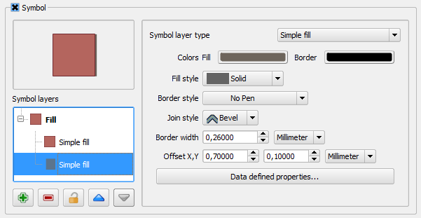
To give a bit of dimension, a shadow was created beneath, using a “simple fill” with dark colors and using a Offset X,Y. The values were chosen assuming the predominant direction of building’s facades, so that the effect could be seen all over the map area.

Capturar_4Capturar_6

Green spaces

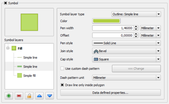
For the green spaces, 3 symbol layers were used. One with a green “simple fill”. A second one with a thick outline (outline: simple line) in a darker green, and using the new 2.2 functionality that allows one to show outlines only in the polygons inside.

Capturar_5The last symbol layer is just a tin line of a green even darker than the other two.

Capturar_7

The Sea

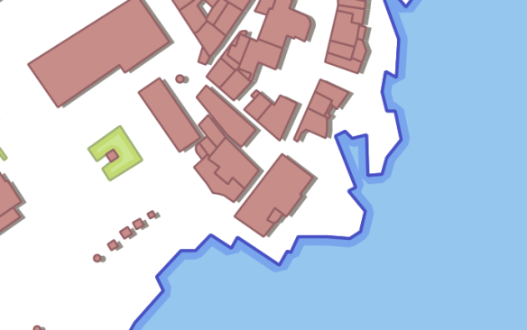
For the sea, the same effect as the green spaces was used, but in blues and with the middle outline even thicker.
Capturar_8

Roads

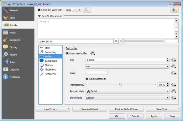
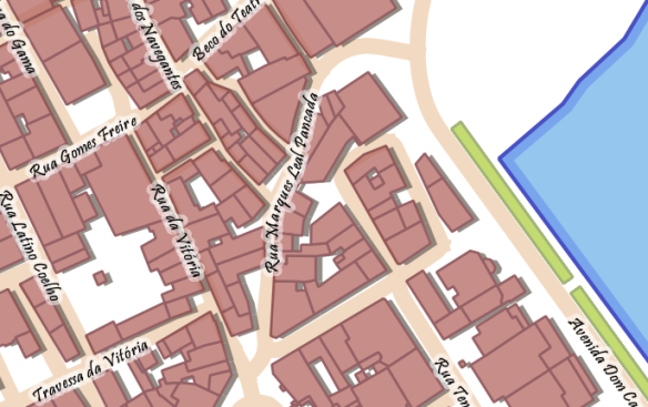
In the road, it was used a thick line with a orange pastel color. Some street names labels were created on top of the line using a script font (in have used Pristina Bold). To improve the label readability, a small white buffer with 50% transparency was added.
Captura de tela 2014-04-11 17.55.04Capturar_9

Beach

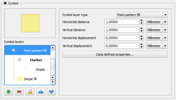
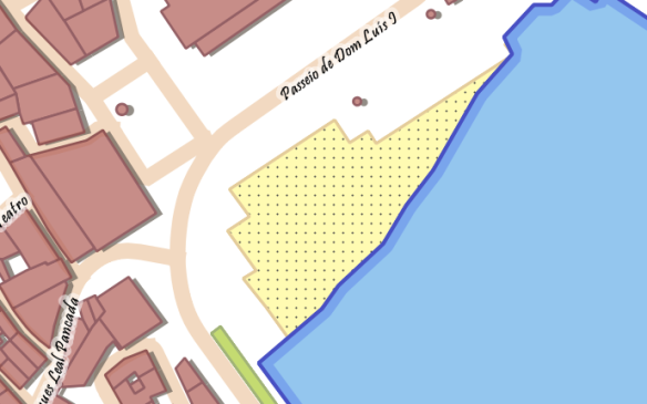
In the beaches, besides a simple fill as background, a point patern fill was used with a very small dot.
Capturar_11Capturar_10

Map composing

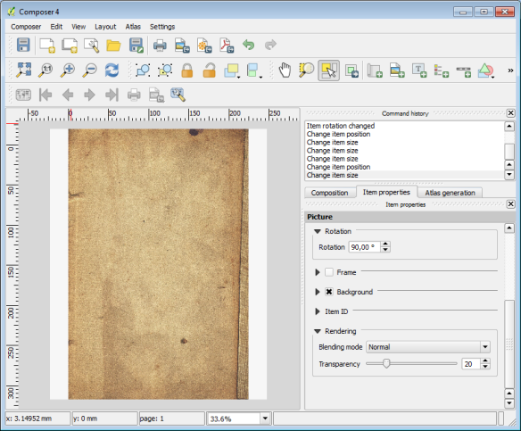
Though the map is looking almost done, it’s in the print composer that the final touches are given. First, the map sheet is totally covered with an image of an old papel (the same used by Anita). A bit of transparency is added (20%), so that the effect is not too strong.

Captura de tela 2014-04-14 11.24.53

Alterwards, the actual map is added, and in the map item properties, the rendering mode is changed from “normal” (by default) to “multiply”. This way it looks like if the map was draw directly on the old paper.

Captura de tela 2014-04-14 11.30.07

After this, it’s all about adding a few more labels (the beach and places names), a north arrow and the graphic scale (always using “multiply” rendering mode), and… Voilá, we have a map!

mapa_antigo


New QGIS plugin – “Walking time”

EN | PT

I have finally “finished” my new plugin. I uses some quotation marks, since I believe that there is still space for a few improvement. This plugin arised with the need to calculate the travel time for the Cascais oficial pedestrian routes, and started as a simple python script. I have then decided to create a graphic interface and publish it as a plugin in the hope that someone else finds it useful.

icon_largeWalking time is a QGIS python plugin that uses Tobbler’s hiking function to estimate the travel time along a line depending on the slope.

The input data required are a vector layer with lines and a raster layer with elevation values ​​(1). One can adjust the base velocity (on flat terrain) according to the type of walking or walker. By default, the value used is 5 km h (2). The plugin update or create fields with estimated time in minutes in forward and in reverse direction (3). One can run the plugin for all elements of the vector layer, or only on selected routes (4).

The plugin can also been used to prepare a network (graph) to perform network analysis when the use of travel walking time as cost is intended.

Captura de tela 2014-03-24 12.12.17-01

QGIS repository: http://plugins.qgis.org/plugins/walkingtime/

Code: https://github.com/SrNetoChan/WalkingTime

Bug report: https://github.com/SrNetoChan/WalkingTime/issues


Back to Top

Sustaining Members