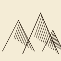
Raisz-style Relief
Presentation-quality relief rendering from a DEM in the style of Erwin Raisz hand-drawn physiographic maps: two algorithms (hybrid landform and classic oblique hachures) with a shared decoration layer - hypsometric or thematic draped fill, overlay layers for waters, roads, settlements, land cover textures, sheet decoration (frames, graticule ticks, scale bar, compass rose) and old-print emulation.
The plugin builds presentation-quality physiographic relief graphics from a DEM (Alpha & Winter 1971; Raisz 1931; oblique view with proportional displacement - Ridd 1963). Contour levels are made invisible; each relief point is shifted north proportionally to its height, so the higher the mountain, the taller its profile; fall lines with light-dependent density and hidden-surface removal by a floating horizon form the correct oblique view. Two algorithms: "Landform map" (a hybrid of Mower-style morphometry and hachures at working resolution with variable plains density) and "Classic physiographic" (full resolution, uniform hachuring, memory control with optional strip tiling). A shared decoration layer (all optional): monochrome sepia paper, hypsometric fill from elevation (Patterson, Bartholomew, Peucker, Imhof palettes) or thematic fill colored from the QGIS layer style; the fill is draped over the displaced relief; separate water layers (rivers, lakes, seas, marshes) drawn in ink on paper presets and in blue on colored fills; roads; settlements with labels; land cover textures; large-form shading (flat shadow or anaglyptography engraving); sheet decoration (frames including a checkered map border, graticule tick labels in D°MM', old-style scale bar, compass rose) and old-print emulation (dot screen, paper grain, color misregistration). Vector layers are reprojected and clipped to the DEM extent automatically. Both algorithms open in the plugin's own tabbed window (toolbar and Raster menu) and are also available in the Processing Toolbox. The interface follows the QGIS language: English and Russian. Output - PNG, SVG or PDF. Requires numpy, scipy, matplotlib, rasterio, shapely (>=2.0), pyproj and affine -- all bundled with QGIS/OSGeo4W.