Most Downloaded Plugins
List of approved plugins sorted by the number of downloads.
4435 records found

Draw, measure and organize field geometries with a simple, satellite-imagery-style workflow and automatic GeoPackage storage
2026-11-09T23:10:16.844615+00:00

Find addresses and display driving routes as QGIS vector layers.
2026-10-18T21:55:00.474348+00:00
Explore and export Swedish geodata from GeoNod in QGIS.
2026-10-27T15:34:58.104501+00:00

Network routing and isochrone generation powered by OSMnx
2026-10-25T18:30:10.927562+00:00
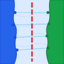
Maritime Boundary Delimitation: Equidistance Median Line and Weighted Boundaries per TALOS (IHO S-51) and UNCLOS 1982 standards.
2026-10-31T07:06:03.748558+00:00

This plugin converts CSV files containing grid data or ground data (ID, X, Y, Z) acquired via airborne laser scanning …
2026-11-07T08:26:03.104652+00:00

Audits technical SEO and Schema.org geocoordinates, mapping SEO health scores onto QGIS layers.
2026-10-23T13:22:35.777157+00:00

Automatically selects the newest suitable CBERS-4A/WPM scene for a chosen area using spatial coverage and potential cloudiness thresholds.
2026-11-02T21:09:21.788010+00:00
Export selected point features as printable Arabic or English location cards with Google Maps links.
2026-10-27T12:13:14.363367+00:00

Shows the Milan planning rules (PGT/PTC) and constraints that apply at a clicked point.
2026-11-11T16:38:35.294848+00:00
Makes terrain maps of an area from local or downloaded DEMs, saves each analysis as a portable ZIP, and exports …
2026-11-13T13:14:18.623383+00:00

Distance-aware LTE PCI and RSI planning
2026-10-28T03:50:53.545449+00:00
Parcel and attribute editing toolkit: explode multipart, repair invalid geometry, copy/fill attributes, find and replace, copy coordinates, area calculation (ha/m²), …
2026-11-02T07:44:46.053739+00:00
Fetch vascular plant observations from Artportalen (SLU Artdatabanken) as a temporary, year-coloured point layer.
2026-11-05T13:47:24.319354+00:00

Download TOPODATA (INPE, Brazil) terrain products for the 1° × 1.5° tiles that intersect a rectangle drawn on the map.
2026-10-30T19:08:03.597078+00:00

10x super-resolution of Sentinel-2 images with the Gamma Earth S2DR3 service (API key and paid credits required)
2026-11-04T08:21:22.525217+00:00

Local map styling history and recovery for stable QGIS 3.44 and 4.0/4.2.
2026-11-02T22:24:09.843210+00:00

Wtyczka służąca do pobierania warstw obszarów chronionych z serwera WFS GDOŚ. EN: Download layers of protected areas in Poland from …
2026-11-12T18:33:19.890463+00:00

Trace a steepest-downhill path across a selected DEM using an eight-neighbour raster method.
2026-11-09T07:06:04.152922+00:00
Assign sequential numbers to existing polygon features by clicking them on the map
2026-10-17T07:18:34.698826+00:00
| Name | Author | Latest Version | Created On | ||||
|---|---|---|---|---|---|---|---|

|
GeoSketch | 69 | Gabriel Alberto | 2026-11-09T23:10:16.844615+00:00 | 2026-11-02T23:52:15.672219+00:00 | 1.0.0 | 0.22.0 |

|
OSRMRoute | 68 | OSRMRoute | 2026-10-18T21:55:00.474348+00:00 | 2026-10-18T21:52:08.269618+00:00 | — | 0.1.1 |

|
Svenska geodata – Export | 68 | segl-segl | 2026-10-27T15:34:58.104501+00:00 | 2026-10-27T15:34:56.317464+00:00 | 1.0.0 | — |

|
OSMnx Routing & Isochrones | 67 | Marcello Benigno Borges de Barros Filho | 2026-10-25T18:30:10.927562+00:00 | 2026-10-25T18:20:40.287159+00:00 | — | 0.1.1 |
|
Maritime Delimitation (TALOS & UNCLOS) | 67 | Arif Rahman | 2026-10-31T07:06:03.748558+00:00 | 2026-10-31T06:37:35.541135+00:00 | 1.1.1 | — |

|
kk_txt2dem | 66 | kouichi kita | 2026-11-07T08:26:03.104652+00:00 | 2026-11-07T08:18:02.545582+00:00 | 0.9.2 | — |

|
SEOWebChecker GeoSEO | 65 | SEOWebChecker | 2026-10-23T13:22:35.777157+00:00 | 2026-10-23T12:02:25.350135+00:00 | 1.0.1 | — |

|
CBERS AutoSelect | 65 | Rodrigo Barbosa Lima | 2026-11-02T21:09:21.788010+00:00 | 2026-11-02T21:09:19.953469+00:00 | — | 0.1.0 |

|
Idraaak Location Cards | 64 | Nedal Sh. | 2026-10-27T12:13:14.363367+00:00 | 2026-10-27T12:13:12.567599+00:00 | — | 0.1.1 |

|
Norme Milano | 64 | Saeed Sabzeh | 2026-11-11T16:38:35.294848+00:00 | 2026-11-05T05:19:43.148972+00:00 | 0.1.4 | 0.1.3 |

|
Quick Landscape Analysis Explorer | 64 | Hideharu Masai | 2026-11-13T13:14:18.623383+00:00 | 2026-11-13T11:54:35.880358+00:00 | 0.1.0 | — |

|
LTE PCI and RSI Planning | 62 | EasyCalculator.org | 2026-10-28T03:50:53.545449+00:00 | 2026-10-28T03:50:51.804680+00:00 | — | 1.1.0 |

|
Rimba Edit | 62 | Alfian (Ian) | 2026-11-02T07:44:46.053739+00:00 | 2026-11-02T03:36:37.055865+00:00 | — | 0.9.4 |

|
Species Data (SLU Artdatabanken) | 62 | Mats Elfström | 2026-11-05T13:47:24.319354+00:00 | 2026-11-05T12:58:35.608859+00:00 | 1.0.1 | — |

|
TOPODATA Downloader | 61 | Marcello Benigno Borges de Barros Filho | 2026-10-30T19:08:03.597078+00:00 | 2026-10-26T20:53:09.674162+00:00 | — | 0.2.0 |

|
Gamma Earth S2DR3 | 61 | Gamma Earth | 2026-11-04T08:21:22.525217+00:00 | 2026-11-02T13:15:05.304735+00:00 | 1.1.3 | — |

|
Checkpoint | 59 | Alen Alimzhanov | 2026-11-02T22:24:09.843210+00:00 | 2026-11-02T22:24:08.039508+00:00 | — | 0.2.3 |

|
Obszary Chronione | 58 | Jakub Jankiewicz | 2026-11-12T18:33:19.890463+00:00 | 2026-11-06T18:13:57.725378+00:00 | — | 0.2 |

|
Water Drop | 57 | Mayuresh Padalkar | 2026-11-09T07:06:04.152922+00:00 | 2026-11-09T07:06:02.363038+00:00 | 1.0.0 | — |

|
MJ-Auto-Polygon-Number | 56 | MJNETWORK | 2026-10-17T07:18:34.698826+00:00 | 2026-10-17T07:18:32.788049+00:00 | 1.0.0 | — |