Analisi DUSAF 7 Comune Lombardo
Automated DUSAF 7 land-use analysis for Lombardy municipalities via Regione Lombardia REST services. QC-4 audit, GeoPackage + CSV export. (Plugin regionale italiano.)
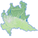
English - QGIS plugin for automated land-use analysis in the municipalities of Lombardy (Italy), based on the DUSAF 7.0 dataset of Regione Lombardia and the official administrative boundaries.
Unlike traditional plugins it does NOT require manual pre-loading of layers: data is fetched on-the-fly from the Regione Lombardia ArcGIS REST services, with automatic caching in the QGIS profile. Optionally, ISTAT 2026 boundaries can be enabled as the authoritative source.
Workflow: Comune validation, geometry fix, EPSG:32632 reprojection, DUSAF clipping on the municipal perimeter, slivers handling, dissolve by land-use class, area calculation (m^2, hectares, percentages), and a QC-4 audit with area-conservation check.
Output: multilayer GeoPackage with applied QML styles + CSV summary per class. A memory-only mode is available for quick analyses without writing files.
Compatibility: QGIS 3.34 -> 4.99, Qt5 and Qt6.
Data attribution: DUSAF 7.0 and Ambiti Amministrativi (c) Regione Lombardia (CC BY 4.0); ISTAT 2026 boundaries (c) ISTAT (CC BY 4.0). Plugin code: AGPL-3.0.
---
Italiano - Plugin QGIS per l'analisi automatica dell'uso del suolo nei Comuni lombardi, basato sul dataset DUSAF 7.0 di Regione Lombardia e sui confini amministrativi ufficiali.
A differenza dei plugin tradizionali NON richiede il pre-caricamento manuale dei layer: i dati vengono scaricati al volo dai servizi REST ufficiali di Regione Lombardia (ArcGIS Server), con cache automatica nel profilo QGIS. Opzionalmente e' possibile attivare i confini ISTAT 2026 come fonte autoritativa.
Flusso di lavoro: validazione del Comune, fix geometrie, riproiezione EPSG:32632, clip DUSAF sul perimetro, gestione slivers, dissolve per classe, calcolo superfici (m^2, ettari, percentuali) e audit QC-4 con controllo conservazione delle aree.
Output: GeoPackage multilayer con stili QML applicati + CSV riepilogativo per classe. Modalita memoria disponibile per analisi rapide senza scrivere file.
Compatibilita: QGIS 3.34 -> 4.99, Qt5 e Qt6. Pensato per istruttorie urbanistiche e analisi PGT.
Attribuzione dati: DUSAF 7.0 e Ambiti Amministrativi (c) Regione Lombardia (CC BY 4.0); confini ISTAT 2026 (c) ISTAT (CC BY 4.0). Codice plugin: AGPL-3.0.