QGIS Planet

ArcGIS REST API Connector Plugin for QGIS

ArcGIS REST Connector Plugin

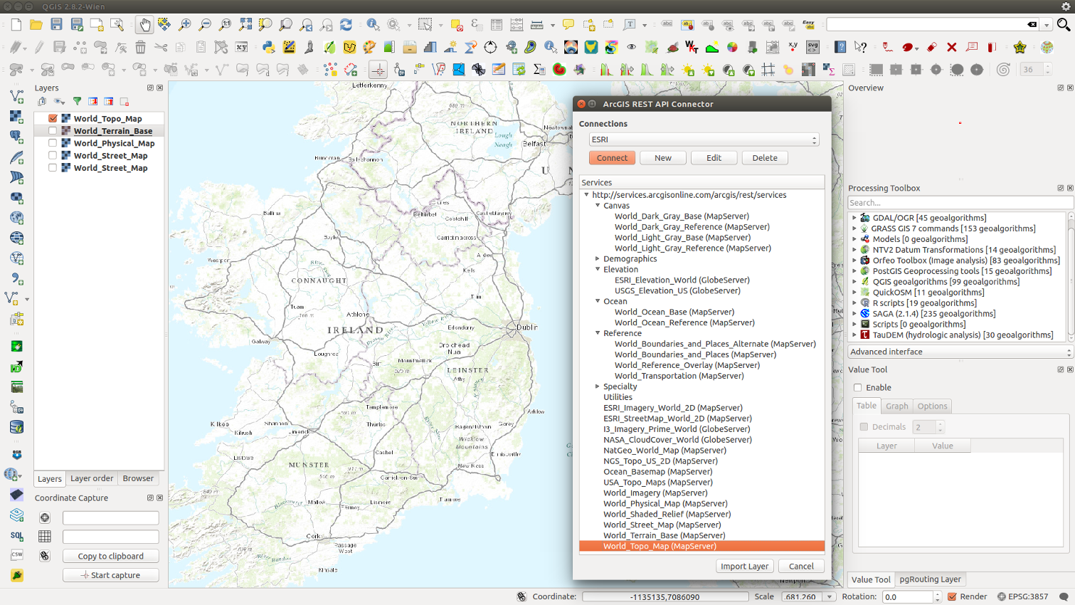
Last year we described a command line method that adds ESRI REST layers in QGIS. Well, a team at the Geometa Lab in the University of Applied Sciences Rapperswil (HSR) Switzerland, have released a plugin for QGIS that adds ESRI REST layers via a GUI (Github page). The plugin is experimental so you will need to tick the box “Show also experimental plugins” in the settings panel of the “Plugins – Manage and Install Plugins” dialogue in order to add the plugin to QGIS. The following URLs lists numerous REST layers in the plugin’s GUI:

http://services.arcgisonline.com/arcgis/rest/services

http://basemap.nationalmap.gov/arcgis/rest/services

http://services.nationalmap.gov/arcgis/rest/services

Reference:

REST API Connector Plug-in Wiki Page

The 10th annual FOSS4G conference

The 10th annual FOSS4G conference was held from 8th-13th September in Portland, Oregon, USA. FOSS4G is the world’s premier global gathering of developers, users and key decision-makers involved in open source geospatial software. With over 180 talks presented covering topics from 3D printing maps with Grass GIS 7 to QGIS Map Server and beyond, FOSS4G 2014 was a resounding success. Don’t be disappointed if you could not attend, all the talks given at FOSS4G 2014 are now viewable on Vimeo, including 8 one hour invited presentations from staff at Amazon, MapZen, Boundless, Mapbox etc. These talks are well worth watching if you want to keep up to date with the latest developments in open source geospatial software.

FOSS4G 2014 General Sessions – Talks and Invited Presentations

Oceancolor Data Downloader v1.0 for QGIS

Aqua Modis SST 2015-01-13

Sea Surface Temperature data downloaded by Oceancolor Data Downloader.

The Oceancolor Data Downloader is a new plugin for QGIS from the Mapping and Geographic Information Centre of the British Antarctic Survey that downloads Oceancolor and Sea Surface Temperature data from NASA’s Oceancolor website. The plugin currently downloads three datasets:

  • MODIS AQUA chlorophyll concentration
  • SeaWiFS chlorophyll concentration
  • MODIS AQUA night time Sea Surface Temperatures

The data accessed includes daily, 8 day, monthly and yearly composites, all of which can be saved to disk while downloading. Future plans for the plugin include additional access to other datasets such as ocean Net Primary Production, selection by bounding box, the ability to save in other formats, a progress bar etc.

I used the plugin to download global Sea Surface Temperatures for the 13th Jan 2015. I then used shapefiles from Natural Earth to create a simple basemap. I finally chose the IBCAO Polar Stereographic projection (EPSG: 3996) to create a map centred on the North Pole.

If you use the plugin to produce published research, please cite:

10.5281/zenodo.15018

Back to Top

Sustaining Members