QGIS Planet

[Case Study] Innovating road research and construction

Discover how BRRC revolutionized their field survey workflows with Mergin Maps, enhancing productivity and data accuracy. Learn how their partnership with Lutra Consulting enabled tailored solutions for seamless integration, transforming road research and construction projects.

[Case Study] Designing surveys for fibre optics rollout

Jacops was starting a new project for the fiber rollout and needed the tools to organise a national survey. Previously they had used tools provided by a partner and needed to find a solution that allowed them to manage the full scope of the project.

[Blog] Hello from Mergin Maps!

Mergin Maps is a QGIS-powered field survey tool designed to collect data from the field. It is developed by Lutra Consulting, a longstanding contributor, developer, supporter and trainer within the QGIS community.

[Changelog] Enhanced feature identification speed

In our latest update, we've turbocharged the speed of feature identification on the map! Enjoy a faster and more responsive experience as you navigate and identify features with efficiency.

[Changelog] Easier way to prepare offline projects - download vector tile layers

Introducing an easier way to prepare offline projects!

Now, you can download vector tile layers seamlessly by simply right-clicking on the layer and selecting 'Make available offline...' - making offline project preparation a breeze.

For a step-by-step guide, check out our documentation here. Enhance your offline mapping experience today!

[Changelog] Configure DB Sync right from your QGIS

QGIS Plugin now allows you to generate configuration file for DB Sync based on your PostgreSQL connections. Simply navigate to “Plugins → Mergin Maps → Configure DB Sync“ and follow the guide.

Resulting configuration file can be saved and used for synchronising our GPKG data with PostgreSQL. Read more about DB Sync here: https://merginmaps.com/docs/dev/dbsync/

[Changelog] Enhanced synchronization performance and stability

The mobile app 2.5.0 contains multiple synchronization fixes and enhancements. Enjoy faster and more reliable file transfers!

[Blog] Mergin Maps 2023: our year in review

This year was another successful year for Mergin Maps, as we are growing to a feature-rich and scalable enterprise geodata collection solution.

[Case Study] Improving wildfire prevention and firefighting readiness

David Galloway works as a volunteer with the Wallcliffe Volunteer Fire Brigade in Western Australia. Volunteer brigades are the front line of firefighting and prevention across the State.

[Changelog] Reset local changes from QGIS

With Mergin Maps QGIS Plugin 2024.1 you can now revert local changes of your QGIS project. Click on synchronise button in the toolbar and in the “Project status” dialog you will see new button to “Reset Changes”

Read the full changelog of the release: https://github.com/MerginMaps/qgis-plugin/releases/tag/2024.1

[Changelog] Position tracking is now available

I am pleased to announce that position tracking 📡 has been released today as part of Mobile version 2.3.0 and Plugin version 2023.3.

You can learn more about the tracking feature and how to set it up by visiting: https://merginmaps.com/docs/field/tracking/

Enjoy the tracking, and please let us know your thoughts! If you encounter any issues, please don’t hesitate to contact us.

[Changelog] Stake out mode now supports multiple distance units

Users now have the flexibility to utilize a variety of distance units in the stake out mode, moving beyond the conventional meters. This enhancement allows for a more customized and user-friendly experience, catering to diverse geographic contexts and preferences.

To configure these distance units, navigate to QGIS project settings and change “distance units“ to your preferred units.

For detailed instructions on how to set up and leverage alternative distance units in stakeout mode, refer to our documentation https://merginmaps.com/docs/field/stake-out/#changing-stake-out-distance-units-in-qgis.

[Blog] View and track changes in QGIS

With the recent changes to the Mergin Maps plugin for QGIS, you can visualise the local changes before synchronising your data. Read more in our blog post!

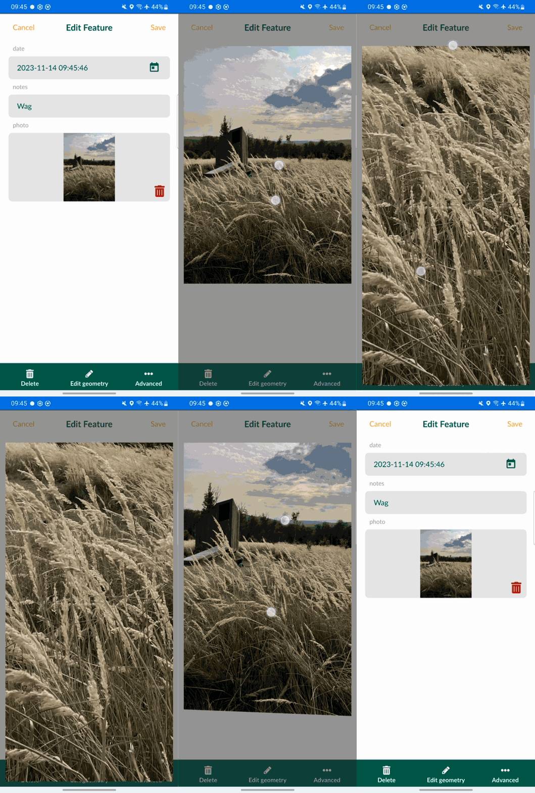
[Changelog] Enhanced viewing: zoom feature now available in the mobile app

In our latest mobile app update, we've added an enhanced viewing feature that allows users to smoothly zoom in and out of images. This new functionality provides a more detailed and flexible viewing experience, letting you focus on intricate details or take in the big picture with ease. Navigate your visual data with precision and control!

[Changelog] Added support for text, spacer and HTML widgets

In our most recent update, we're thrilled to announce the addition of support for QGIS's spacer, text, and HTML widgets in our forms! This enhancement brings greater flexibility and customization to your data entry process. Easily incorporate spacers, add informative text, and use HTML elements to create dynamic and engaging forms tailored to your specific needs.

[Case Study] Mapping ground points in Senegal for imagery stereo-preparation

Valentin was overseeing a large-scale stereo-preparation project in Senegal in order to adjust aerial imagery and LiDAR with recognizable ground control points

[Changelog] Ability to set custom name for photos taken in Mergin Maps mobile

Mergin Maps QGIS plugin is now capable of setting a custom QGIS expression that will be used as a name for the photos taken in the Mergin Maps mobile app. It is possible to combine field values, variables (even Mergin Maps variables) and other QGIS expression elements to create your custom photo name format (subfolders supported). You can find this configuration in the QGIS project settings > Mergin Maps.

Available since Mergin Maps QGIS plugin 2023.2 and Mergin Maps mobile 2.2

Read more about this in our documentation here: https://merginmaps.com/docs/gis/photo-names/

Back to Top

Sustaining Members