
Walk Potential
Plugin ID: 4337
A plugin to analyze pedestrian demand for urban planning
(0) votes
Download latest
This plugin has an experimental version available!
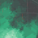
This plugin generates a heatmap showing the degree to which locations
have pedestrian access to shops, parks, restaurants, and other services
nearby. It is not a "walkability" metric because comfort is not considered. Instead it's a useful planning tool to combine
with other metrics of sidewalk presence like condition to determine where to prioritize funding pedestrian facilities.
By default, it uses a free isochrone service to calculate travel times which may be slow or have usage limits. Alternately, you can
supply your own service URL. OpenStreetMap is queried to determine nearby amenities.
A default set of amenities is provided, but you can provide your own. See README.md for more details.


