Stable Plugins
List of approved plugins with at least one stable version.
1803 records found
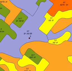
Wtyczka do wizualizacji mapy glebowo rolniczej
2024-12-23T07:04:19.557273+00:00
This plugin lets you get alert from MapBiomas Project(http://alerta.mapbiomas.org/).
2022-04-11T19:33:36.926818+00:00
This plugin lets you get alert from MapBiomas Project(http://alerta.mapbiomas.org/).
2023-01-20T18:42:16.712517+00:00
This plugin lets you add the anual land use and land cover maps from the MapBiomas Project (http://mapbiomas.org/) as a …
2021-11-19T17:29:26.841242+00:00
This plugin enables the acquisition of land's use and coverage maps from MapBiomas Project (http://mapbiomas.org/) as a WMS layer.
2024-05-28T19:40:29.683499+00:00
QGIS plugin for saving map canvas coordinates into a text file.
2020-05-11T17:50:48.822533+00:00
Find the topographical chart that covers a defined area or a selected feature.
2018-01-24T13:16:15.503938+00:00
Extract real-world objects from satellite imagery with Mapflow by Geoalert. Mapflow provides AI mapping pipelines for building footprints, roads, fields, …
2025-01-01T22:25:14.988430+00:00
A map library which makes it easy to add much used maps to your project.
2023-07-07T10:17:16.369750+00:00
Share your maps online (raster and shape) as a profissional. Easily make your QGIS maps online 24/7 (for free, no …
2024-11-04T18:29:22.365578+00:00
a tool to facilitate data processing for Bayesian spatial modeling
2024-08-14T19:25:14.774776+00:00
safeguard datasets using masking, encryption and notarisation
2025-01-14T00:47:51.643839+00:00
Uses machine learning to segment a map into ares of interest.
2024-11-19T20:56:36.454932+00:00
Export several print layouts to pdf, svg or image file (jpg, tif, png...) format in one click, from the current …
2025-02-14T06:11:06.248613+00:00
Download georeferenced parts of tile map services
2024-09-03T21:58:43.207073+00:00
| Name | Author | Latest Version | Created On | Stars (votes) | ||||
|---|---|---|---|---|---|---|---|---|
|
|
manageR | 12,724 | Carson J. Q. Farmer | 2012-10-11T11:39:17.298466+00:00 | 2012-10-11T11:39:15.060738+00:00 |
(8)
|
1.1 | — |
|
|
Mapa Glebowo-Rolnicza | 730 | GUGiK | 2024-12-23T07:04:19.557273+00:00 | 2024-12-22T20:44:42.704373+00:00 |
(2)
|
1.0.2 | — |
|
|
MapBiomas Alert | 9,554 | Luiz Motta | 2022-04-11T19:33:36.926818+00:00 | 2019-10-03T19:51:41.858127+00:00 |
(2)
|
1.3 | 0.3 |
|
|
MapBiomas Alert Oficial Plugin | 11,715 | Luiz Motta, Luiz Cortinhas | 2023-01-20T18:42:16.712517+00:00 | 2022-05-02T16:04:53.668511+00:00 |
(2)
|
1.2.2 | — |
|
|
MapBiomas API | 12,494 | Sandro Klippel | 2021-08-13T22:37:28.332386+00:00 | 2021-03-17T03:56:39.581800+00:00 |
(6)
|
0.3.1 | — |
|
|
MapBiomas Collection | 67,597 | Luiz Motta and Luiz Cortinhas | 2021-11-19T17:29:26.841242+00:00 | 2019-09-05T14:25:12.388266+00:00 |
(23)
|
1.4 | 0.3 |
|
|
MapBiomas Collection Official | 16,630 | Luiz Motta, Luiz Cortinhas and Mário Hermes | 2024-05-28T19:40:29.683499+00:00 | 2022-10-26T01:46:51.758117+00:00 |
(17)
|
1.6.1 | 1.5.1 |
|
|
Map Corners Coordinates | 12,866 | CTU GeoForAll Lab (Kala, Kulovana, Landa) and OpenGeoLabs s.r.o | 2020-05-11T17:50:48.822533+00:00 | 2018-08-16T20:30:03.314482+00:00 |
(5)
|
2.0.0 | — |
|
|
MapFinder Brasil | 5,256 | Diego Benincasa | 2018-01-24T13:16:15.503938+00:00 | 2018-01-09T13:41:57.331466+00:00 |
(8)
|
1.3 | — |
|
|
Mapflow | 129,525 | Geoalert | 2025-01-01T22:25:14.988430+00:00 | 2021-07-09T15:15:42.595345+00:00 |
(105)
|
3.0.1 | — |
|
|
Map Library | 118,910 | Marco Duiker - MD-kwadraat | 2023-07-07T10:17:16.369750+00:00 | 2019-02-26T11:54:16.215563+00:00 |
(27)
|
1.3 | — |
|
|
Mapmaker | 7,291 | R. | 2022-04-15T09:39:25.072693+00:00 | 2022-04-15T09:39:24.732695+00:00 |
(3)
|
1 | — |
|
|
Mappia Publisher | 51,604 | Danilo da Silveira Figueira, Rubia Souza | 2024-11-04T18:29:22.365578+00:00 | 2020-02-05T20:46:28.955100+00:00 |
(34)
|
2.11.0 | — |
|
|
maps2WinBUGS | 11,987 | Norbert Solymosi | 2024-08-14T19:25:14.774776+00:00 | 2015-07-31T18:44:35.624348+00:00 |
(2)
|
3.0 | — |
|
|
MapSafe | 1,511 | Pankajeshwara Sharma | 2025-01-14T00:47:51.643839+00:00 | 2024-07-12T02:50:12.426412+00:00 |
(4)
|
1.3 | — |
|
|
Map Segmenter | 8,984 | Quant Civil | 2024-11-19T20:56:36.454932+00:00 | 2023-06-16T05:54:20.498604+00:00 |
(14)
|
2.1.3 | — |
|
|
Maps Printer | 120,241 | Harrissou Sant-anna (Conseil d'Architecture, d'Urbanisme et de l'Environnement du Maine-et-Loire) | 2025-02-14T06:11:06.248613+00:00 | 2014-07-30T18:27:38.236127+00:00 |
(66)
|
1.0 | 0.4 |
|
|
Mapstack visualisation | 3,427 | Leon | 2014-07-17T10:28:35.900704+00:00 | 2014-07-03T12:28:14.404217+00:00 |
(3)
|
0.2 | — |
|
|
MapSwipe Tool | 169,651 | Hirofumi Hayashi and Luiz Motta | 2024-05-31T15:41:22.640960+00:00 | 2015-10-14T14:12:33.243259+00:00 |
(85)
|
1.3 | 1.1 |
|
|
MapTileLoader | 19,603 | Pavel Pereverzev | 2024-09-03T21:58:43.207073+00:00 | 2022-05-14T14:45:10.187990+00:00 |
(12)
|
0.2.0 | 0.1 |

