
Sidewalk Priority Toolkit
Plugin ID: 4501
Algorithms for prioritizing locations, particularly with sidewalks in mind.
(0) votes
Download latest
This plugin has an experimental version available!
Toolkit of algorithms useful to generates a location prioritization heatmap. It was designed
with sidewalk funding in mind, but most algorithms are suitable generic to work for other cases.
Including algorithms cover:
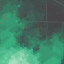
- Generating a hex grid map within a boundary, like a city.
- Calculating pedestrian demand ("walk potential") a cross a city.
- Creating a missing sidewalk map, using existing street centerlines and existing sidewalk layer
- Creating metrics for the heatmap that can cover a range of cases with point, line and isochrone
data, allowing for example to factor in proximity to features, crash or traffic calming data,
street attributes like speed or width, and census/demographic data for the area.
All metrics are scored in a consistent way, allowing all metrics to be combined with weighed
percentages you choose into into a final priority score.
An algorithm with a sample heatmap styling is provided as well.
See README.md for more details.
This plugin provides an interface for QGIS Server.


