All Plugins
List of all approved plugins.
2356 records found
Measure magnetic bearing and distance between two points
2025-02-06T21:36:50.797458+00:00
Calculates the magnetic heading from a true geographic heading and vice versa.
2023-12-04T10:32:26.250644+00:00
Maps with a Magnifying Glass Tool "Concept" for Qgis.
2016-05-20T10:07:40.892602+00:00
Plugin to create sector, circle radius, and spidergraph delimited and vector layer
2024-08-09T00:46:58.884626+00:00
Managing Forest Areas Under The Power Lines Network
2020-08-06T01:16:36.100715+00:00
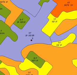
Wtyczka do wizualizacji mapy glebowo rolniczej
2024-12-23T07:04:19.557273+00:00
This plugin lets you get alert from MapBiomas Project(http://alerta.mapbiomas.org/).
2022-04-11T19:33:36.926818+00:00
This plugin lets you get alert from MapBiomas Project(http://alerta.mapbiomas.org/).
2023-01-20T18:42:16.712517+00:00
This plugin lets you add the anual land use and land cover maps from the MapBiomas Project (http://mapbiomas.org/) as a …
2021-11-19T17:29:26.841242+00:00
This plugin enables the acquisition of land's use and coverage maps from MapBiomas Project (http://mapbiomas.org/) as a WMS layer.
2024-05-28T19:40:29.683499+00:00
QGIS plugin for saving map canvas coordinates into a text file.
2020-05-11T17:50:48.822533+00:00
Select a Print Layout, export a PDF, JPG and metadata, zip up the files.
2020-04-18T12:59:50.478517+00:00
Find the topographical chart that covers a defined area or a selected feature.
2018-01-24T13:16:15.503938+00:00
Extract real-world objects from satellite imagery with Mapflow by Geoalert. Mapflow provides AI mapping pipelines for building footprints, roads, fields, …
2025-01-01T22:25:14.988430+00:00
A map library which makes it easy to add much used maps to your project.
2023-07-07T10:17:16.369750+00:00
| Name | Author | Latest Version | Created On | Stars (votes) | ||||
|---|---|---|---|---|---|---|---|---|
|
|
MagicWand | 10,055 | Gianluca Silvestri | 2017-02-24T13:39:43.013253+00:00 | 2017-02-12T20:04:47.269437+00:00 |
(14)
|
1.7.0 | 1.5.0 |
|
|
Magnetic Bearing Measurement Map Tool | 7,182 | Aaltronav s.r.o. | 2025-02-06T21:36:50.797458+00:00 | 2022-01-05T18:39:44.000002+00:00 |
(9)
|
0.6 | 0.2 |
|
|
Magnetic Declination | 39,611 | Aldo Scorza | 2023-12-04T10:32:26.250644+00:00 | 2015-05-02T14:15:40.393366+00:00 |
(119)
|
2.4.4 | — |
|
|
Magnifying Glass | 7,075 | Francisco Raga | 2016-05-20T10:07:40.892602+00:00 | 2016-05-19T15:08:42.454255+00:00 |
(25)
|
0.1 | — |
|
|
Mahalanobis Distance | 3,727 | Damian Michal Harasymczuk | 2016-07-12T17:42:43.011635+00:00 | 2016-07-12T17:42:41.938056+00:00 |
(5)
|
1.0 | — |
|
|
MAJIC | 3,462 | JB Desbas - Quartier libre | 2018-07-01T09:58:36.485077+00:00 | 2018-06-26T07:45:11.519215+00:00 |
(2)
|
— | 0.3 |
|
|
Make Sector | 2,122 | Imam Sibro Muhlisi | 2024-08-09T00:46:58.884626+00:00 | 2024-07-21T12:44:23.767931+00:00 |
(7)
|
1.1 | — |
|
|
manageR | 12,725 | Carson J. Q. Farmer | 2012-10-11T11:39:17.298466+00:00 | 2012-10-11T11:39:15.060738+00:00 |
(8)
|
1.1 | — |
|
|
Manejo | 1,014 | Carvalho Neto, R.M. and Sustembio Environmental Services | 2020-08-06T01:16:36.100715+00:00 | 2020-08-06T01:16:33.963518+00:00 |
(1)
|
— | 0.2 |
|
|
Mapa Glebowo-Rolnicza | 741 | GUGiK | 2024-12-23T07:04:19.557273+00:00 | 2024-12-22T20:44:42.704373+00:00 |
(2)
|
1.0.2 | — |
|
|
MapBiomas Alert | 9,559 | Luiz Motta | 2022-04-11T19:33:36.926818+00:00 | 2019-10-03T19:51:41.858127+00:00 |
(2)
|
1.3 | 0.3 |
|
|
MapBiomas Alert Oficial Plugin | 11,732 | Luiz Motta, Luiz Cortinhas | 2023-01-20T18:42:16.712517+00:00 | 2022-05-02T16:04:53.668511+00:00 |
(2)
|
1.2.2 | — |
|
|
MapBiomas API | 12,500 | Sandro Klippel | 2021-08-13T22:37:28.332386+00:00 | 2021-03-17T03:56:39.581800+00:00 |
(6)
|
0.3.1 | — |
|
|
MapBiomas Collection | 67,637 | Luiz Motta and Luiz Cortinhas | 2021-11-19T17:29:26.841242+00:00 | 2019-09-05T14:25:12.388266+00:00 |
(23)
|
1.4 | 0.3 |
|
|
MapBiomas Collection Official | 16,681 | Luiz Motta, Luiz Cortinhas and Mário Hermes | 2024-05-28T19:40:29.683499+00:00 | 2022-10-26T01:46:51.758117+00:00 |
(17)
|
1.6.1 | 1.5.1 |
|
|
Map Corners Coordinates | 12,875 | CTU GeoForAll Lab (Kala, Kulovana, Landa) and OpenGeoLabs s.r.o | 2020-05-11T17:50:48.822533+00:00 | 2018-08-16T20:30:03.314482+00:00 |
(5)
|
2.0.0 | — |
|
|
Map Export | 5,044 | Ant Scott (MapAction.org) | 2020-04-18T12:59:50.478517+00:00 | 2020-02-22T12:44:41.818336+00:00 |
(0)
|
— | 1.0.2 |
|
|
MapFinder Brasil | 5,257 | Diego Benincasa | 2018-01-24T13:16:15.503938+00:00 | 2018-01-09T13:41:57.331466+00:00 |
(8)
|
1.3 | — |
|
|
Mapflow | 129,668 | Geoalert | 2025-01-01T22:25:14.988430+00:00 | 2021-07-09T15:15:42.595345+00:00 |
(105)
|
3.0.1 | — |
|
|
Map Library | 118,967 | Marco Duiker - MD-kwadraat | 2023-07-07T10:17:16.369750+00:00 | 2019-02-26T11:54:16.215563+00:00 |
(27)
|
1.3 | — |


