Urban Green SARCA
Plugin for analysis of radioactive contamination of vegetation cover
in (mostly) urban environment
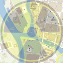
The Urban Green SARCA (USG) module is a GIS tool created for the
purpose of estimating the deposition of radionuclides on the surface
of vegetation and soil, or in areas without vegetation in the early
phase of a radiation accident. The module makes it possible to
estimate the radioactive contamination of the vegetation cover by
means of satellite images, total radioactivity deposition data and
precipitation amount data during the radiation accident. USG provides
a “first sight” on spatial information of a radioactive contamination
of vegetation and soils within large areas in a very simple way and
thus it is a usable tool for decision makers and authorities in case
of radiation accident. The usage of module is suitable mostly for
areas where the vegetation cover and amount of biomass is not very
well documented, e.g. urban areas.
Outputs:
- Amount of biomass (t/ha)
- Interception factor
- Biomass contamination (Bq/m2)
- Soil contamination (Bq/m2)
- Mass contamination (Bq/kg)
- Mask of hygienic limit exceeding
- Mask of reference levels
QGIS module Urban Green SARCA development was supported by project of
Ministry of the Interior of the Czech Republic No. VH20172020015