
Near Shore Bathymetry Estimator
Plugin ID: 1600
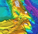
Bathymetry determination using Multi Spectral Satellite imageries.
(47) votes
Download latest
This plugin has an experimental version available!
This plugin is used to estimate approx depth between 2m to 20m using multispectral satellite images.
It can estimate the actual depth provided actual depth of some field points are given as a shape file.
Without the actual data, it can estimate only the relative water depth.


