QGIS Style
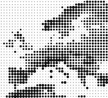
Halftone Elevation Points

- Name
- Halftone Elevation Points
- Description
This style generates points in the form of buffer dots, where the size is based on the value sampled from a raster layer (normally 1-band elevation data).
The most important settings can be changed in the beginning of the script with variables.
The style is tested with temporary scratch layers with a single polygon feature. Multiple features will trigger the style to generate multiple times (slower).
Try to be consistent regarding layer coordinate systems...
CRS: Vector layer = Raster layer = Project
- Uploaded Date
- 10 October 2021
- Approved Date
- 10 October 2021
- Modified Date
- 30 May 2024
- Creator
- Klas Karlsson
- Type
- Fill
- Style File

This Style is made available under the CC-0 license.
