QGIS Model
Stream delineation
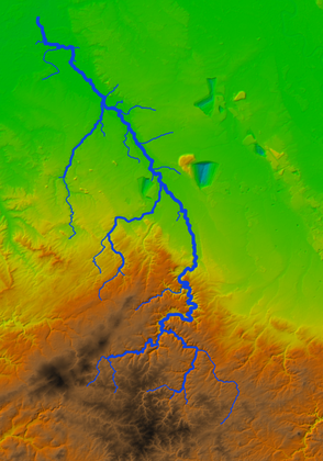
- Name
- Stream delineation
- Description
Creates a filled DEM from DEM tiles, clipped and reprojected to the bounding box polygon. Delineates streams from the filled DEM using the Strahler order method and snaps a defined outlet to the delineated stream. The results can be used in the catchment delineation model.
- Uploaded Date
- 20 July 2021
- Approved Date
- 27 July 2021
- Modified Date
- 27 May 2024
- Creator
- Hans Kwast
- Model File

This Model is made available under the CC-0 license.
Sustaining Members
