QGIS Model
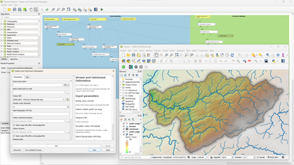
Stream and catchment delineation

- Name
- Stream and catchment delineation
- Description
Calculate streams and catchment boundary for a given extent and outlet. The model will automatically download the DEM for the extent and follow all the processing steps to derive the streams and catchment.
- Dependencies
- PCRaster Tools plugin, OpenTopography DEM Downloader plugin
- Uploaded Date
- 01 December 2024
- Approved Date
- 03 December 2024
- Modified Date
- 03 December 2024
- Creator
- Hans Kwast
- Model File

This Model is made available under the CC-0 license.
