QGIS Model
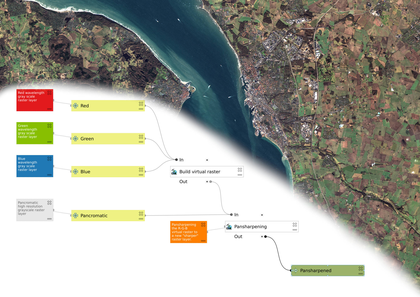
Simple Pansharpen Tool

- Name
- Simple Pansharpen Tool
- Description
This model takes all the steps required to create a sharp RGB image from multi spectral satellite raster bands, and puts it all in one simple to use tool.
Requires Red, Green, Blue and Pancromatic raster layers.
- Uploaded Date
- 13 February 2022
- Approved Date
- 13 February 2022
- Modified Date
- 28 May 2024
- Creator
- Klas Karlsson
- Model File

This Model is made available under the CC-0 license.
